Garden City, Missouri
| Garden City, Missouri | |
|---|---|
| City | |
| Motto: A piece of heaven on highway seven. | |
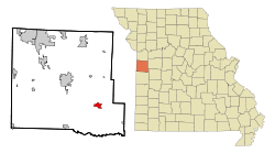 Location of Garden City, Missouri | |
| Coordinates: 38°33′31″N 94°11′21″W / 38.55861°N 94.18917°WCoordinates: 38°33′31″N 94°11′21″W / 38.55861°N 94.18917°W | |
| Country | United States |
| State | Missouri |
| County | Cass |
| Area[1] | |
| • Total | 2.51 sq mi (6.50 km2) |
| • Land | 2.47 sq mi (6.40 km2) |
| • Water | 0.04 sq mi (0.10 km2) |
| Elevation | 922 ft (281 m) |
| Population (2010)[2] | |
| • Total | 1,642 |
| • Estimate (2012[3]) | 1,639 |
| • Density | 664.8/sq mi (256.7/km2) |
| Time zone | Central (CST) (UTC-6) |
| • Summer (DST) | CDT (UTC-5) |
| ZIP code | 64747 |
| Area code(s) | 816 |
| FIPS code | 29-26434[4] |
| GNIS feature ID | 0718333[5] |
Garden City is a city in Cass County, Missouri, United States. The population was 1,642 at the 2010 census.
History
Garden City was platted in 1885, and so named on account of the fertile soil near the town site.[6] A post office called Garden City has been in operation since 1875.[7]
The O'Bannon Homestead was listed on the National Register of Historic Places in 1979.[8]
Geography
Garden City is located at 38°33′31″N 94°11′21″W / 38.55861°N 94.18917°W (38.558731, -94.189231).[9]
According to the United States Census Bureau, the city has a total area of 2.51 square miles (6.50 km2), of which, 2.47 square miles (6.40 km2) is land and 0.04 square miles (0.10 km2) is water.[1]
Demographics
| Historical population | |||
|---|---|---|---|
| Census | Pop. | %± | |
| 1890 | 227 | — | |
| 1900 | 574 | 152.9% | |
| 1910 | 713 | 24.2% | |
| 1920 | 711 | −0.3% | |
| 1930 | 632 | −11.1% | |
| 1940 | 599 | −5.2% | |
| 1950 | 590 | −1.5% | |
| 1960 | 600 | 1.7% | |
| 1970 | 633 | 5.5% | |
| 1980 | 1,021 | 61.3% | |
| 1990 | 1,225 | 20.0% | |
| 2000 | 1,500 | 22.4% | |
| 2010 | 1,642 | 9.5% | |
| Est. 2015 | 1,625 | [10] | −1.0% |
2010 census
As of the census[2] of 2010, there were 1,642 people, 650 households, and 436 families residing in the city. The population density was 664.8 inhabitants per square mile (256.7/km2). There were 721 housing units at an average density of 291.9 per square mile (112.7/km2). The racial makeup of the city was 97.4% White, 0.2% African American, 0.9% Native American, 0.2% Asian, 0.4% from other races, and 0.9% from two or more races. Hispanic or Latino of any race were 1.7% of the population.
There were 650 households of which 38.6% had children under the age of 18 living with them, 48.8% were married couples living together, 12.5% had a female householder with no husband present, 5.8% had a male householder with no wife present, and 32.9% were non-families. 27.4% of all households were made up of individuals and 8.8% had someone living alone who was 65 years of age or older. The average household size was 2.53 and the average family size was 3.06.
The median age in the city was 33.1 years. 29.2% of residents were under the age of 18; 8.3% were between the ages of 18 and 24; 27.5% were from 25 to 44; 23.9% were from 45 to 64; and 11.2% were 65 years of age or older. The gender makeup of the city was 49.3% male and 50.7% female.
2000 census
As of the census[4] of 2000, there were 1,500 people, 595 households, and 399 families residing in the city. The population density was 869.0 people per square mile (334.8/km²). There were 630 housing units at an average density of 365.0 per square mile (140.6/km²). The racial makeup of the city was 97.73% White, 0.20% African American, 0.47% Native American, 0.33% from other races, and 1.27% from two or more races. Hispanic or Latino of any race were 1.47% of the population.
There were 595 households out of which 35.5% had children under the age of 18 living with them, 53.3% were married couples living together, 10.3% had a female householder with no husband present, and 32.8% were non-families. 27.7% of all households were made up of individuals and 13.4% had someone living alone who was 65 years of age or older. The average household size was 2.52 and the average family size was 3.11.
In the city the population was spread out with 29.1% under the age of 18, 10.1% from 18 to 24, 30.3% from 25 to 44, 18.5% from 45 to 64, and 11.9% who were 65 years of age or older. The median age was 32 years. For every 100 females there were 93.1 males. For every 100 females age 18 and over, there were 86.8 males.
The median income for a household in the city was $37,461, and the median income for a family was $43,125. Males had a median income of $31,848 versus $20,486 for females. The per capita income for the city was $19,695. About 7.7% of families and 8.0% of the population were below the poverty line, including 7.7% of those under age 18 and 7.1% of those age 65 or over.
Notable people
- Tyler Farr - Country music singer-songwriter
- Ewing Kauffman - Businessman who founded Marion Laboratories and the first owner of the Kansas City Royals
References
- 1 2 "US Gazetteer files 2010". United States Census Bureau. Retrieved 2012-07-08.
- 1 2 "American FactFinder". United States Census Bureau. Retrieved 2012-07-08.
- ↑ "Population Estimates". United States Census Bureau. Retrieved 2013-05-30.
- 1 2 "American FactFinder". United States Census Bureau. Retrieved 2008-01-31.
- ↑ "US Board on Geographic Names". United States Geological Survey. 2007-10-25. Retrieved 2008-01-31.
- ↑ "Cass County Place Names, 1928–1945 (archived)". The State Historical Society of Missouri. Retrieved 17 September 2016.
- ↑ "Post Offices". Jim Forte Postal History. Retrieved 17 September 2016.
- ↑ National Park Service (2010-07-09). "National Register Information System". National Register of Historic Places. National Park Service.
- ↑ "US Gazetteer files: 2010, 2000, and 1990". United States Census Bureau. 2011-02-12. Retrieved 2011-04-23.
- ↑ "Annual Estimates of the Resident Population for Incorporated Places: April 1, 2010 to July 1, 2015". Retrieved July 2, 2016.
- ↑ "Census of Population and Housing". Census.gov. Retrieved June 4, 2015.
External links
- Historic maps of Garden City in the Sanborn Maps of Missouri Collection at the University of Missouri
- Garden City, Missouri Official Website
Municipalities and communities of Cass County, Missouri, United States | ||
|---|---|---|
| Cities | 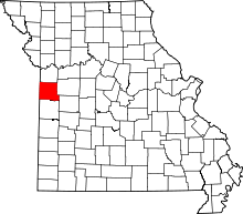 | |
| Villages | ||
| Townships | ||
| Unincorporated communities | ||
| Ghost towns | ||
| Footnotes | ‡This populated place also has portions in an adjacent county or counties | |