Frey-Haverstick Site
|
Frey-Haverstick Site (36LA6) | |
|
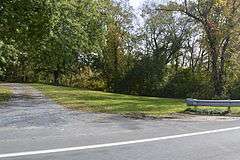
Land along the stream | |
  | |
| Location | Eastern side of the Susquehanna River, north of Staman's Run, Washington Boro, Manor Township, Pennsylvania |
|---|---|
| Coordinates | 39°59′42″N 76°28′13.8″W / 39.99500°N 76.470500°WCoordinates: 39°59′42″N 76°28′13.8″W / 39.99500°N 76.470500°W |
| Area | 10.3 acres (4.2 ha) |
| NRHP Reference # | 86000819[1] |
| Added to NRHP | January 15, 1986 |
The Frey-Haverstick Site (36LA6) is a prehistoric and historic archaeological site located in Manor Township, Lancaster County, Pennsylvania. The site was excavated in 1931, 1971, and 1975 by the Pennsylvania Historical and Museum Commission. Artifacts on the site were discovered as early as 1873, and included a helmet of Swedish origin dated to the reign of King Gustavus II Adolphus (1611–1632). The site features a Susquehannock cemetery, a Middle Woodland habitation site, and a Shenks Ferry village. Various artifact date activities on the site between 3500 BC. and 1650 AD.[2]
It was listed on the National Register of Historic Places in 1986.[1]
References
- 1 2 National Park Service (2010-07-09). "National Register Information System". National Register of Historic Places. National Park Service.
- ↑ "National Historic Landmarks & National Register of Historic Places in Pennsylvania" (Searchable database). CRGIS: Cultural Resources Geographic Information System. Note: This includes Ira C. Beckerman (1980). "National Register of Historic Places Inventory Nomination Form: Frey-Haverstick Site (36LA6)" (PDF). Retrieved 2012-02-18.
| Topics |   | |
|---|---|---|
| Lists by county |
| |
| Lists by city | ||
| Other lists | ||
| ||
This article is issued from Wikipedia - version of the 11/29/2016. The text is available under the Creative Commons Attribution/Share Alike but additional terms may apply for the media files.