Farm to Market Road 400
| ||||
|---|---|---|---|---|
| Route information | ||||
| Maintained by TxDOT | ||||
| Length: | 85.417 mi[1][nb 1] (137.465 km) | |||
| Existed: | 1945 – present | |||
| Major junctions | ||||
| South end: |
| |||
|
| ||||
| North end: |
| |||
| Location | ||||
| Counties: | Lynn, Lubbock, Hale, Swisher | |||
| Highway system | ||||
| ||||

Farm to Market Road 400 (FM 400) is a farm to market road located in Lynn, Lubbock, Hale, and Swisher counties in the Llano Estacado of Texas.[1]
Route description
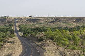
The southern terminus of FM 400 is at an interchange with US 87 north of the Tahoka city limits.[2] The route travels to the northeast through rural areas of Lynn County, passing to the west of Tahoka Lake and through Wilson along that city's 10th Street before entering Lubbock County.[3] In Slaton, FM 400 turns to the north and crosses US 84 near the southern city limits before entering that city's downtown, where it is concurrent with Bus. US 84 along 9th Street for 2.4 miles (3.9 km). The route leaves Slaton and continues north along Vetch Avenue, passing to the east of Slaton Airport, then descending into and climbing out of Yellow House Canyon, to the east of the community of Ransom Canyon.[4] The next major intersection is just east of Idalou, with US 62 / US 82 / SH 114.[5] Continuing north, FM 400 crosses into Hale County, approximately 9.0 miles (14.5 km) east of Abernathy.[6] It has a concurrency of about 2.0 miles (3.2 km) with FM 37 and passes through the farming community of Happy Union before entering Plainview, where it is known as Date Street.[7] The highway crosses US 70 and then briefly turns to the east along 24th Street before resuming its northward journey.[8] FM 400 has a brief concurrency with FM 788 in northern Hale County; after the two routes separate, FM 400 enters Swisher County, and reaches its northern terminus at FM 145 east of Kress.[9]
History
FM 400 was originally designated on June 25, 1945; its original routing was exclusively in Lubbock County, from Idalou northward to the Hale County line.[1] On July 9 of that same year saw an extension northward, into Hale County and to a junction with FM 54 west of Petersburg. The road was lengthened, this time to the south, on December 16, 1948, from Idalou to a county road just north of the Slaton Airport. On March 19, 1949, a southern section of FM 400 was designated, replacing FM 1074. This southern section was in Lynn County, and ran southward from the Lubbock County line through Wilson to US 87. This created a gap in the routing of FM 400 in and around Slaton; this gap would be closed on May 23, 1951, when the two sections of FM 400 were both extended to connect with US 84 at two different points in Slaton. The route was extended northward to Plainview on January 27, 1950. It was extended north to the Swisher County line on December 17, 1952, replacing the section of FM 788 from US 70 north to the junction of FM 788 and FM 400. On October 29, 1953, it extended north to FM 145; this created the concurrency with FM 788, which TxDOT officially considers a gap in that route's mileage.[10] The route designation was amended in 1965 after the US 84 freeway bypass south of Slaton was constructed; the old location of US 84 was renumbered Loop 251, which would eventually be redesignated as Business US 84 in 1991.[11][12]
Major intersections
| County | Location | mi[13][nb 1] | km | Destinations | Notes |
|---|---|---|---|---|---|
| Lynn | | 0.0 | 0.0 | Southern terminus | |
| Wilson | 9.6 | 15.4 | |||
| Lubbock | Slaton | 18.3 | 29.5 | ||
| 18.6 | 29.9 | South end of US 84 Bus. concurrency | |||
| 19.4 | 31.2 | ||||
| 21.0 | 33.8 | North end of US 84 Bus. concurrency | |||
| | 27.4 | 44.1 | |||
| | 30.7 | 49.4 | |||
| | 35.9 | 57.8 | |||
| | 46.0 | 74.0 | |||
| Hale | | 50.7 | 81.6 | ||
| | 55.7 | 89.6 | South end of FM 37 concurrency | ||
| | 57.7 | 92.9 | North end of FM 37 concurrency | ||
| Happy Union | 60.7 | 97.7 | |||
| | 63.7 | 102.5 | |||
| | 65.7 | 105.7 | |||
| Plainview | 71.4 | 114.9 | |||
| 72.0 | 115.9 | ||||
| 72.9 | 117.3 | ||||
| | 75.8 | 122.0 | |||
| | 77.8 | 125.2 | |||
| | 78.3 | 126.0 | South end of FM 788 concurrency | ||
| Swisher | | 79.9 | 128.6 | North end of FM 788 concurrency | |
| | 87.7 | 141.1 | Northern terminus | ||
| 1.000 mi = 1.609 km; 1.000 km = 0.621 mi | |||||
Notes
See also
References
- 1 2 3 Transportation Planning and Programming Division (n.d.). "Farm to Market Road No. 400". Highway Designation Files. Texas Department of Transportation. Retrieved 2011-01-18.
- ↑ Transportation Planning and Programming Division (2012). Texas County Map Book (PDF) (Map) (2012 ed.). 1:120,000. Texas Department of Transportation. p. 191. OCLC 867856197. Retrieved 2011-01-18.
- ↑ Transportation Planning and Programming Division (2012). Texas County Map Book (PDF) (Map) (2012 ed.). 1:120,000. Texas Department of Transportation. p. 217. OCLC 867856197. Retrieved 2011-01-18.
- ↑ Transportation Planning and Programming Division (2012). Texas County Map Book (PDF) (Map) (2012 ed.). 1:120,000. Texas Department of Transportation. p. 216. OCLC 867856197. Retrieved 2011-01-18.
- ↑ Transportation Planning and Programming Division (2012). Texas County Map Book (PDF) (Map) (2012 ed.). 1:120,000. Texas Department of Transportation. p. 190. OCLC 867856197. Retrieved 2011-01-18.
- ↑ Transportation Planning and Programming Division (2012). Texas County Map Book (PDF) (Map) (2012 ed.). 1:120,000. Texas Department of Transportation. p. 189. OCLC 867856197. Retrieved 2011-01-18.
- ↑ Transportation Planning and Programming Division (2012). Texas County Map Book (PDF) (Map) (2012 ed.). 1:120,000. Texas Department of Transportation. p. 188. OCLC 867856197. Retrieved 2011-01-18.
- ↑ Transportation Planning and Programming Division (2012). Texas County Map Book (PDF) (Map) (2012 ed.). 1:120,000. Texas Department of Transportation. p. 214. OCLC 867856197. Retrieved 2011-01-18.
- ↑ Transportation Planning and Programming Division (2012). Texas County Map Book (PDF) (Map) (2012 ed.). 1:120,000. Texas Department of Transportation. p. 213. OCLC 867856197. Retrieved 2011-01-18.
- ↑ Transportation Planning and Programming Division (n.d.). "Farm to Market Road No. 788". Highway Designation Files. Texas Department of Transportation. Retrieved 2011-01-18.
- ↑ Transportation Planning and Programming Division (n.d.). "State Highway Loop No. 251". Highway Designation Files. Texas Department of Transportation. Retrieved 2011-01-18.
- ↑ Transportation Planning and Programming Division (n.d.). "Business U.S. Highway No. 84-E". Highway Designation Files. Texas Department of Transportation. Retrieved 2011-01-18.
- ↑ Google (2011-01-18). "Overview map of Farm to Market Road 400 Distances Between Interchanges" (Map). Google Maps. Google. Retrieved 2011-01-18.