Yellow House Canyon
| Yellow House Canyon | |
| West Texas | |
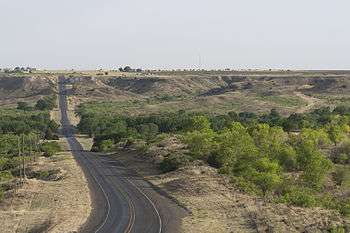 Farm to Market Road 400 passing through Yellow House Canyon | |
| Country | |
|---|---|
| State | |
| River | North Fork Double Mountain Fork Brazos River |
| Source | Confluence of Yellow House Draw and Blackwater Draw |
| - location | Mackenzie Park, Lubbock, Texas |
| - elevation | 959 m (3,146 ft) |
| - coordinates | 33°35′34″N 101°50′02″W / 33.59278°N 101.83389°W [1] |
| Mouth | 10 km east of Slaton, Texas |
| - location | Crosby County, Texas |
| - elevation | 847 m (2,779 ft) |
| - coordinates | 33°27′20″N 101°32′11″W / 33.45556°N 101.53639°WCoordinates: 33°27′20″N 101°32′11″W / 33.45556°N 101.53639°W [2] |
| Length | 32 km (20 mi) |
| Website: Handbook of Texas Online | |
Yellow House Canyon is about 32 km (20 mi) long, heading in Lubbock, Texas, at the junction of Blackwater Draw and Yellow House Draw, and trending generally southeastward to the edge of the Llano Estacado about 10 km (6.2 mi) east of Slaton, Texas; it forms one of three major canyons along the east side of the Llano Estacado and carries the waters of the North Fork Double Mountain Fork Brazos River.[2]
Within the city limits of Lubbock, Yellow House Canyon remains a narrow and shallow channel with a typical width of less than 0.5 km (0.31 mi) and a typical depth of not more than 20 m (66 ft). Here, the city of Lubbock has constructed a series of small dams that form a series of narrow lakes, collectively known as Canyon Lakes. The Canyon Lakes park offers conservation areas and recreational opportunities on the water and in the narrow park along the water's edge.
As Yellow House Canyon extends outside the city limits of Lubbock, the canyon gradually widens and deepens. Around 15 km (9.3 mi) to the east-southeast of Lubbock, a dam was constructed to form Buffalo Springs Lake, a recreational lake that now inundates the site of the main springs, though the springs continue to flow beneath the waters of the lake.[3] Immediately downstream of Buffalo Springs Lake is a much smaller dam that forms another recreational lake named Lake Ransom Canyon, where numerous single-family homes surround the lake to form the community of Ransom Canyon, Texas.
Downstream of Ransom Canyon, the North Fork is finally allowed to flow freely across sparsely populated ranchland as the canyon continues to deepen and widen. Where the North Fork crosses Texas Farm to Market Road 400, the canyon is nearly 3 km (1.9 mi) wide and 60 m (200 ft) deep. Further downstream, near the confluence of Plum Creek and the North Fork, the walls of the canyon begin to curve sharply outward as the North Fork Double Mountain Fork Brazos River flows out of the canyon and onto the rolling plains of West Texas.
 Robert Bruno's steel house, standing on the rim of Yellow House Canyon
 North Fork Double Mountain Fork Brazos River flowing through Yellow House Canyon
 Erosional remnants of the Llano Estacado in Yellow House Canyon
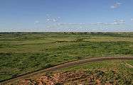 Yellow House Canyon near Slaton, Texas
See also
References
- ↑ U.S. Geological Survey Geographic Names Information System: North Fork Double Mountain Fork Brazos River
- 1 2 United States Board on Geographical Names. 1964. Decisions on Geographical Names in the United States, Decision list no. 6402, United States Department of the Interior, Washington DC, p. 51-52.
- ↑ Lively, Jeanne F. "Buffalo Springs Lake". Handbook of Texas Online. Retrieved 2010-01-26.
External links
| Wikimedia Commons has media related to Double Mountain Fork Brazos River. |
- Mackenzie State Recreation Area
- U.S. Geological Survey Geographic Names Information System: North Fork Double Mountain Fork Brazos River
- Robert Bruno Steel House
- Public domain photos of West Texas and Llano Estacado
