Fargues, Gironde
| Fargues | |
|---|---|
|
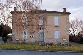
Town hall | |
 Fargues | |
|
Location within Nouvelle-Aquitaine region  Fargues | |
| Coordinates: 44°32′12″N 0°17′44″W / 44.5367°N 0.2956°WCoordinates: 44°32′12″N 0°17′44″W / 44.5367°N 0.2956°W | |
| Country | France |
| Region | Nouvelle-Aquitaine |
| Department | Gironde |
| Arrondissement | Langon |
| Canton | Canton of Langon |
| Intercommunality | Pays de Langon |
| Government | |
| • Mayor (2008–2014) | Pierre Augey |
| Area1 | 15.41 km2 (5.95 sq mi) |
| Population (2008)2 | 1,617 |
| • Density | 100/km2 (270/sq mi) |
| Time zone | CET (UTC+1) |
| • Summer (DST) | CEST (UTC+2) |
| INSEE/Postal code | 33164 / 33210 |
| Elevation |
18–88 m (59–289 ft) (avg. 40 m or 130 ft) |
|
1 French Land Register data, which excludes lakes, ponds, glaciers > 1 km² (0.386 sq mi or 247 acres) and river estuaries. 2 Population without double counting: residents of multiple communes (e.g., students and military personnel) only counted once. | |
Fargues is a commune in the Gironde department in Nouvelle-Aquitaine in southwestern France.
Fargues is located in the Sauternes wine appellation of Bordeaux.
Population
| Historical population | ||
|---|---|---|
| Year | Pop. | ±% |
| 1962 | 643 | — |
| 1968 | 652 | +1.4% |
| 1975 | 769 | +17.9% |
| 1982 | 1,078 | +40.2% |
| 1990 | 1,185 | +9.9% |
| 1999 | 1,215 | +2.5% |
| 2008 | 1,617 | +33.1% |
See also
References
| Wikimedia Commons has media related to Fargues (Gironde). |
This article is issued from Wikipedia - version of the 11/9/2016. The text is available under the Creative Commons Attribution/Share Alike but additional terms may apply for the media files.