Saint-Genis-du-Bois
| Saint-Genis-du-Bois | |
|---|---|
|
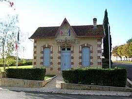
Town hall | |
 Saint-Genis-du-Bois | |
|
Location within Nouvelle-Aquitaine region  Saint-Genis-du-Bois | |
| Coordinates: 44°42′10″N 0°10′26″W / 44.7028°N 0.1739°WCoordinates: 44°42′10″N 0°10′26″W / 44.7028°N 0.1739°W | |
| Country | France |
| Region | Nouvelle-Aquitaine |
| Department | Gironde |
| Arrondissement | Langon |
| Canton | Targon |
| Intercommunality | Targonnais |
| Government | |
| • Mayor (2008–2014) | Michel Villeneuve |
| Area1 | 2.34 km2 (0.90 sq mi) |
| Population (2008)2 | 95 |
| • Density | 41/km2 (110/sq mi) |
| Time zone | CET (UTC+1) |
| • Summer (DST) | CEST (UTC+2) |
| INSEE/Postal code | 33409 / 33760 |
| Elevation |
42–85 m (138–279 ft) (avg. 50 m or 160 ft) |
|
1 French Land Register data, which excludes lakes, ponds, glaciers > 1 km² (0.386 sq mi or 247 acres) and river estuaries. 2 Population without double counting: residents of multiple communes (e.g., students and military personnel) only counted once. | |
Saint-Genis-du-Bois is a commune in the Gironde department in Nouvelle-Aquitaine in southwestern France.
Population
| Historical population | ||
|---|---|---|
| Year | Pop. | ±% |
| 1962 | 54 | — |
| 1968 | 65 | +20.4% |
| 1975 | 60 | −7.7% |
| 1982 | 70 | +16.7% |
| 1990 | 83 | +18.6% |
| 1999 | 75 | −9.6% |
| 2008 | 95 | +26.7% |
See also
References
| Wikimedia Commons has media related to Saint-Genis-du-Bois. |
This article is issued from Wikipedia - version of the 11/9/2016. The text is available under the Creative Commons Attribution/Share Alike but additional terms may apply for the media files.