Fairfield (community), Wisconsin
| Fairfield, Wisconsin | |
|---|---|
| Unincorporated community | |
|
Motto: Latitude and Longitude: Latitude: 42.6333469Longitude: -88.7728836 - See more at: http://www.placekeeper.com/Wisconsin/Fairfield_Cemetery-2002803.html#sthash.blBl43pO.dpuf | |
 Fairfield, Wisconsin  Fairfield, Wisconsin | |
| Coordinates: 42°37′59″N 88°46′35″W / 42.63306°N 88.77639°WCoordinates: 42°37′59″N 88°46′35″W / 42.63306°N 88.77639°W | |
| Country | United States |
| State | Wisconsin |
| County | Walworth |
| Elevation | 915 ft (279 m) |
| Time zone | Central (CST) (UTC-6) |
| • Summer (DST) | CDT (UTC-5) |
| Area code(s) | 262 |
| GNIS feature ID | 1564806[1] |
Fairfield is an unincorporated community located in the towns of Bradford in Rock County and Darien in Walworth County, Wisconsin, United States.[1]
History
The earliest reference to Fairfield is a description from John W. Hunt's 1853 Wisconsin Gazetteer: "FAIRFIELD, P. O., (Maxson's Mtill), in town of Bradford, county of Rock, on section 13, town 2 N., of range 15 E. It is 11 miles southeast from county seat, and 50 miles east of south from Madison. Population 100, 12 dwellings, 2 stores, 1 grist mill, and Presbyterian and Baptist denominations. It is on Turtle Creek, 16 miles from Beloit, and on the county line between Rock and Walworth, 9 miles from the state line. The first settler was Joseph Maxson."
Fairfield also has a cemetery, Fairfield/Pioneer Cemetery, located on east side of County Highway C, Sec 1. It is an active cemetery with 72 burials.[2]
Notes
Sources
- Source: U.S. Geographic Names Information Server
- Source: Hunt, John W. Wisconsin Gazetteer (Madison, 1853)
Municipalities and communities of Rock County, Wisconsin, United States | ||
|---|---|---|
| Cities | 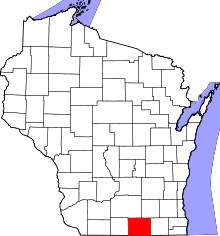 | |
| Villages | ||
| Towns | ||
| CDP | ||
| Unincorporated communities |
| |
| Ghost towns | ||
| Footnotes | ‡This populated place also has portions in an adjacent county or counties | |
Municipalities and communities of Walworth County, Wisconsin, United States | ||
|---|---|---|
| Cities | 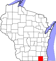 | |
| Villages | ||
| Towns | ||
| CDPs | ||
| Unincorporated communities |
| |
| Ghost towns | ||
| Footnotes | ‡This populated place also has portions in an adjacent county or counties | |