Troy, Walworth County, Wisconsin
| Troy, Wisconsin | |
|---|---|
| Town | |
 Location of Troy, Wisconsin | |
| Coordinates: 42°48′14″N 88°28′45″W / 42.80389°N 88.47917°W | |
| Country | United States |
| State | Wisconsin |
| County | Walworth |
| Area | |
| • Total | 35.4 sq mi (91.8 km2) |
| • Land | 34.7 sq mi (90.0 km2) |
| • Water | 0.7 sq mi (1.8 km2) |
| Elevation[1] | 915 ft (279 m) |
| Population (2000) | |
| • Total | 2,328 |
| • Density | 67.0/sq mi (25.9/km2) |
| Time zone | Central (CST) (UTC-6) |
| • Summer (DST) | CDT (UTC-5) |
| Area code(s) | 262 |
| FIPS code | 55-80875[2] |
| GNIS feature ID | 1584299[1] |
| Website |
townoftroy |
Troy is a town in Walworth County, Wisconsin, United States. The population was 2,328 at the 2000 census. The census-designated place of Potter Lake is located in the town. The unincorporated communities of Adams, Little Prairie, Troy, and Troy Center are also located in the town. The ghost town of Mayhews was also located in the town.
Geography
According to the United States Census Bureau, the town has a total area of 35.4 square miles (91.8 km²), of which, 34.7 square miles (90.0 km²) of it is land and 0.7 square miles (1.8 km²) of it (1.95%) is water.
Demographics
As of the census[2] of 2000, there were 2,328 people, 837 households, and 660 families residing in the town. The population density was 67.0 people per square mile (25.9/km²). There were 904 housing units at an average density of 26.0 per square mile (10.0/km²). The racial makeup of the town was 98.58% White, 0.13% African American, 0.34% Native American, 0.43% Asian, 0.39% from other races, and 0.13% from two or more races. Hispanic or Latino of any race were 1.46% of the population.
There were 837 households out of which 34.4% had children under the age of 18 living with them, 70.8% were married couples living together, 5.4% had a female householder with no husband present, and 21.1% were non-families. 16.0% of all households were made up of individuals and 6.1% had someone living alone who was 65 years of age or older. The average household size was 2.75 and the average family size was 3.09.
In the town the population was spread out with 25.8% under the age of 18, 7.1% from 18 to 24, 27.4% from 25 to 44, 28.9% from 45 to 64, and 10.8% who were 65 years of age or older. The median age was 39 years. For every 100 females there were 103.3 males. For every 100 females age 18 and over, there were 104.9 males.
The median income for a household in the town was $57,604, and the median income for a family was $59,167. Males had a median income of $41,467 versus $26,969 for females. The per capita income for the town was $24,200. About 2.4% of families and 4.6% of the population were below the poverty line, including 5.1% of those under age 18 and 12.3% of those age 65 or over.
Notable people
- Doc Adkins, baseball player.
- Joseph D. Bryant, physician, was born in the town.[3]
- Nathaniel M. Bunker, politician.
References
- 1 2 "US Board on Geographic Names". United States Geological Survey. 2007-10-25. Retrieved 2008-01-31.
- 1 2 "American FactFinder". United States Census Bureau. Retrieved 2008-01-31.
- ↑ 'Dr. Joseph D. Bryant Dies Age of 69,' New York Sun, April 8, 1914, pg. 9
External links
Municipalities and communities of Walworth County, Wisconsin, United States | ||
|---|---|---|
| Cities | 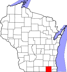 | |
| Villages | ||
| Towns | ||
| CDPs | ||
| Unincorporated communities |
| |
| Ghost towns | ||
| Footnotes | ‡This populated place also has portions in an adjacent county or counties | |
Coordinates: 42°46′44″N 88°26′41″W / 42.77889°N 88.44472°W