Genoa City, Wisconsin
| Genoa City, Wisconsin | |
|---|---|
| Village | |
 Genoa City, Wisconsin | |
| Coordinates: 42°30′13″N 88°19′34″W / 42.50361°N 88.32611°WCoordinates: 42°30′13″N 88°19′34″W / 42.50361°N 88.32611°W | |
| Country | United States |
| State | Wisconsin |
| Counties | Kenosha, Walworth |
| Area[1] | |
| • Total | 2.34 sq mi (6.06 km2) |
| • Land | 2.34 sq mi (6.06 km2) |
| • Water | 0 sq mi (0 km2) |
| Elevation[2] | 830 ft (253 m) |
| Population (2010)[3] | |
| • Total | 3,042 |
| • Estimate (2012[4]) | 3,059 |
| • Density | 1,300.0/sq mi (501.9/km2) |
| Time zone | Central (CST) (UTC-6) |
| • Summer (DST) | CDT (UTC-5) |
| Area code(s) | 262 |
| FIPS code | 55-28675[5] |
| GNIS feature ID | 1565461[2] |
Genoa City is a village located in Kenosha and Walworth Counties in the U.S. state of Wisconsin, 43 mi (69 km) south-southwest of Milwaukee. The population was 3,042 at the 2010 census. Of this, 3,036 were in Walworth County, and only 6 were in Kenosha County. It was named after Genoa, New York.[6]
The CBS soap opera The Young and the Restless takes place in a fictional setting also called Genoa City, Wisconsin, which is unlike the actual village.
Geography
Genoa City is located at 42°30′13″N 88°19′34″W / 42.50361°N 88.32611°W (42.503612, -88.326063).[7]
According to the United States Census Bureau, the village has a total area of 2.34 square miles (6.06 km2), all of it land.[1]
Demographics
| Historical population | |||
|---|---|---|---|
| Census | Pop. | %± | |
| 1880 | 303 | — | |
| 1910 | 709 | — | |
| 1920 | 656 | −7.5% | |
| 1930 | 683 | 4.1% | |
| 1940 | 715 | 4.7% | |
| 1950 | 866 | 21.1% | |
| 1960 | 1,005 | 16.1% | |
| 1970 | 1,085 | 8.0% | |
| 1980 | 1,202 | 10.8% | |
| 1990 | 1,277 | 6.2% | |
| 2000 | 1,949 | 52.6% | |
| 2010 | 3,042 | 56.1% | |
| Est. 2015 | 3,029 | [8] | −0.4% |
2010 census
As of the census[3] of 2010, there were 3,042 people, 1,072 households, and 784 families residing in the village. The population density was 1,300.0 inhabitants per square mile (501.9/km2). There were 1,178 housing units at an average density of 503.4 per square mile (194.4/km2). The racial makeup of the village was 95.4% White, 0.7% African American, 0.3% Native American, 0.4% Asian, 1.9% from other races, and 1.3% from two or more races. Hispanic or Latino of any race were 6.5% of the population.
There were 1,072 households of which 47.3% had children under the age of 18 living with them, 55.2% were married couples living together, 11.6% had a female householder with no husband present, 6.3% had a male householder with no wife present, and 26.9% were non-families. 21.3% of all households were made up of individuals and 6.6% had someone living alone who was 65 years of age or older. The average household size was 2.82 and the average family size was 3.29.
The median age in the village was 31.9 years. 32.1% of residents were under the age of 18; 6.3% were between the ages of 18 and 24; 33.2% were from 25 to 44; 20.7% were from 45 to 64; and 7.7% were 65 years of age or older. The gender makeup of the village was 49.6% male and 50.4% female.
2000 census
As of the census[5] of 2000, there were 1,949 people, 674 households, and 512 families residing in the village. The population density was 875.1 people per square mile (337.4/km²). There were 699 housing units at an average density of 313.9 per square mile (121.0/km²). The racial makeup of the village was 97.49% White, 0.15% African American, 0.15% Native American, 0.51% Asian, 0.31% from other races, and 1.39% from two or more races. Hispanic or Latino of any race were 3.23% of the population.
There were 674 households out of which 48.2% had children under the age of 18 living with them, 60.7% were married couples living together, 11.0% had a female householder with no husband present, and 23.9% were non-families. 19.7% of all households were made up of individuals and 4.3% had someone living alone who was 65 years of age or older. The average household size was 2.87 and the average family size was 3.30.
In the village the population was spread out with 34.0% under the age of 18, 7.1% from 18 to 24, 35.8% from 25 to 44, 15.7% from 45 to 64, and 7.4% who were 65 years of age or older. The median age was 30 years. For every 100 females there were 101.3 males. For every 100 females age 18 and over, there were 98.3 males.
The median income for a household in the village was $49,338, and the median income for a family was $56,298. Males had a median income of $39,890 versus $24,671 for females. The per capita income for the village was $18,044. About 3.7% of families and 4.4% of the population were below the poverty line, including 5.4% of those under age 18 and 5.0% of those age 65 or over.
Transportation
Major highways
The following highways pass through or near Genoa City:
Interstate highways
Federal highways
Wisconsin highways
-
 WIS 50 is six miles north of the village.
County highways
-
 Walworth County B
 -
 Walworth County H
 -
 Walworth County U
 -
 Kenosha County O
 -
 Kenosha County P
Airports
- Burlington Municipal Airport is in Burlington.
- Westosha Airport is in Wilmot.
- Mitchell International Airport, located in Milwaukee, is the village's closest major airport.
Railroads
There are no railway lines in Genoa city. Until 1975 there were 2 lines (Chicago & North Western Williams Bay line and the KD Line).
References
- 1 2 "US Gazetteer files 2010". United States Census Bureau. Retrieved 2012-11-18.
- 1 2 "US Board on Geographic Names". United States Geological Survey. 2007-10-25. Retrieved 2008-01-31.
- 1 2 "American FactFinder". United States Census Bureau. Retrieved 2012-11-18.
- ↑ "Population Estimates". United States Census Bureau. Retrieved 2013-06-24.
- 1 2 "American FactFinder". United States Census Bureau. Retrieved 2008-01-31.
- ↑ Chicago and North Western Railway Company (1908). A History of the Origin of the Place Names Connected with the Chicago & North Western and Chicago, St. Paul, Minneapolis & Omaha Railways. p. 75.
- ↑ "US Gazetteer files: 2010, 2000, and 1990". United States Census Bureau. 2011-02-12. Retrieved 2011-04-23.
- ↑ "Annual Estimates of the Resident Population for Incorporated Places: April 1, 2010 to July 1, 2015". Retrieved July 2, 2016.
- ↑ "Census of Population and Housing". Census.gov. Retrieved June 4, 2015.
External links
Municipalities and communities of Kenosha County, Wisconsin, United States | ||
|---|---|---|
| City | 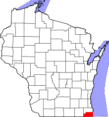 | |
| Villages | ||
| Towns | ||
| CDPs | ||
| Unincorporated communities | ||
| Ghost town | ||
| Footnotes | ‡This populated place also has portions in an adjacent county or counties | |
Municipalities and communities of Walworth County, Wisconsin, United States | ||
|---|---|---|
| Cities | 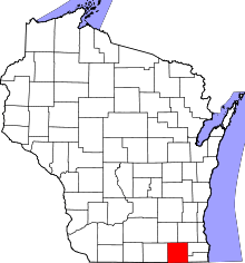 | |
| Villages | ||
| Towns | ||
| CDPs | ||
| Unincorporated communities |
| |
| Ghost towns | ||
| Footnotes | ‡This populated place also has portions in an adjacent county or counties | |