Elyria Township, Lorain County, Ohio
| Elyria Township, Lorain County, Ohio | |
|---|---|
| Township | |
|
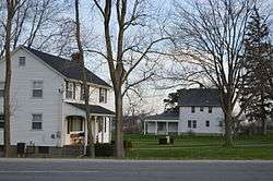
Houses on Murray Ridge Road | |
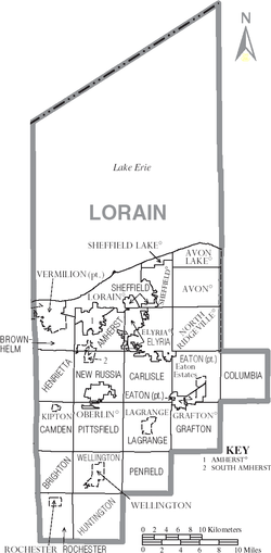 Municipalities of Lorain County, Ohio | |
| Coordinates: 41°23′45″N 82°8′25″W / 41.39583°N 82.14028°WCoordinates: 41°23′45″N 82°8′25″W / 41.39583°N 82.14028°W | |
| Country | United States |
| State | Ohio |
| County | Lorain |
| Area | |
| • Total | 5.9 sq mi (15.3 km2) |
| • Land | 5.9 sq mi (15.3 km2) |
| • Water | 0.0 sq mi (0.1 km2) |
| Elevation[1] | 741 ft (226 m) |
| Population (2000) | |
| • Total | 3,520 |
| • Density | 597.6/sq mi (230.7/km2) |
| Time zone | Eastern (EST) (UTC-5) |
| • Summer (DST) | EDT (UTC-4) |
| ZIP codes | 44000-44099 |
| Area code(s) | 440 |
| FIPS code | 39-25270[2] |
| GNIS feature ID | 1086509[1] |
Elyria Township is one of the eighteen townships of Lorain County, Ohio, United States. The 2000 census found 3,520 people in the unincorporated portions of the township.[3]
Geography
Located in northern Lorain County, it borders the following townships and cities:
- Sheffield Township - north
- Elyria - east
- Carlisle Township - south
- New Russia Township - southwest corner
- Amherst Township - west
- Lorain - northwest
No municipalities are located in Elyria Township, other than the city of Elyria, which has annexed the majority of the township.
Name and history
It is the only Elyria Township statewide.[4] Elyria Township is named for Heman Ely, an early settler.[5]
Government
The township is governed by a three-member board of trustees, who are elected in November of odd-numbered years to a four-year term beginning on the following January 1. Two are elected in the year after the presidential election and one is elected in the year before it. There is also an elected township fiscal officer, who serves a four-year term beginning on April 1 of the year after the election, which is held in November of the year before the presidential election. Vacancies in the fiscal officership or on the board of trustees are filled by the remaining trustees.
References
- 1 2 "US Board on Geographic Names". United States Geological Survey. 2007-10-25. Retrieved 2008-01-31.
- ↑ "American FactFinder". United States Census Bureau. Retrieved 2008-01-31.
- ↑ Lorain County, Ohio — Population by Places Estimates Ohio State University, 2007. Accessed 14 May 2007.
- ↑ "Detailed map of Ohio" (PDF). United States Census Bureau. 2000. Retrieved 2007-02-16.
- ↑ Kilbourn, John (1833). "The Ohio Gazetteer, or, a Topographical Dictionary". Scott and Wright. p. 188. Retrieved 12 December 2013.
External links
Municipalities and communities of Lorain County, Ohio, United States | ||
|---|---|---|
| Cities | 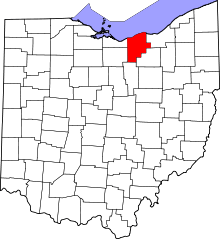 | |
| Villages | ||
| Townships | ||
| CDPs |
| |
| Unincorporated communities | ||
| Ghost town | ||
| Footnotes | ‡This populated place also has portions in an adjacent county or counties | |