Douentza Cercle
| Douentza Cercle | |
|---|---|
| Cercle | |
 Location of the Cercle of Douentza in Mali | |
| Country |
|
| Region | Mopti Region |
| Admin HQ (chef-lieu) | Douentza |
| Area[1] | |
| • Total | 23,481 km2 (9,066 sq mi) |
| Population (2009 census)[2] | |
| • Total | 247,794 |
| • Density | 11/km2 (27/sq mi) |
| Time zone | GMT (UTC+0) |
Douentza Cercle is an administrative subdivision of the Mopti Region of Mali. The administrative center (chef-lieu) is the town of Douentza.
During the Tuareg rebellion of 2012, it was the southernmost part of the state of Azawad, according to the April 2012 MNLA's territorial claim. From June 2012 it was claimed by a series of rival Islamist and local militias.
The route of the annual circular migration of the Gourma elephants crosses a number of communes in the cercles of Douentza and Gourma-Rharous (Tombouctou Region).[3][4][5]
The cercle is divided into 15 communes:[6]
References
- ↑ Synthèsis des Plans de Securité Alimentaire des Communes du Cercle de Douentza 2006-2010 (PDF) (in French), Commissariat à la Sécurité Alimentaire, République du Mali, USAID-Mali, 2006.
- ↑ Resultats Provisoires RGPH 2009 (Région de Mopti) (PDF) (in French), République de Mali: Institut National de la Statistique
- ↑ Community engagement at Lake Banzena, Wild Foundation, 2011, retrieved 7 May 2012.
- ↑ Blake, S.; Bouché, P.; Rasmussen, H.; Orlando, A.; Douglas-Hamilton, I. (2003), The Last Sahelian Elephants: Ranging Behavior, Population Status and Recent History of the Desert Elephants of Mali (PDF), Save the Elephants.
- ↑ Canney, S.; Lindsey, K.; Hema, E.; Douglas-Hamilton, I.; Martin, V. (2007), The Mali elephant initiative: synthesis of knowledge, research and recommendations about the population, its range and the threats to the elephants of the Gourma (PDF), Save the Elephants.
- ↑ Loi N°99-035/ du 10 Aout 1999 Portant Création des Collectivités Territoriales de Cercles et de Régions (PDF) (in French), Ministère de l'Administration Territoriales et des Collectivités Locales, République du Mali, 1999.
| Kayes Region | 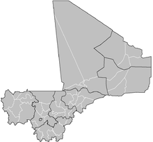 | |
|---|---|---|
| Koulikoro Region | ||
| Sikasso Region | ||
| Ségou Region | ||
| Mopti Region | ||
| Tombouctou Region | ||
| Gao Region | ||
| Kidal Region | ||
| Bamako Capital District | ||

Coordinates: 15°05′N 2°40′W / 15.083°N 2.667°W
This article is issued from Wikipedia - version of the 2/27/2013. The text is available under the Creative Commons Attribution/Share Alike but additional terms may apply for the media files.