Gourma-Rharous Cercle
| Gourma-Rharous Cercle | |
|---|---|
| Cercle | |
 | |
 Location of the Cercle of Gourma-Rharous in Mali | |
| Country |
|
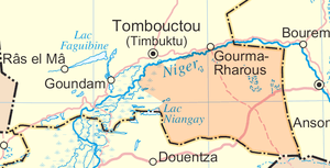
| Region | Tombouctou Region |
| Admin HQ (Chef-lieu) | Gourma-Rharous |
| Area[1] | |
| • Total | 45,000 km2 (17,000 sq mi) |
| Population (2009 census)[2] | |
| • Total | 111,386 |
| • Density | 2.5/km2 (6.4/sq mi) |
| Time zone | GMT (UTC+0) |
Gourma Rharous cercle
Gourma-Rharous Cercle is an administrative subdivision of the Tombouctou Region of Mali. The administrative center is the town of Gourma-Rharous.
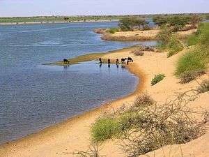
The route of the annual circular migration of the Gourma elephants crosses a number of communes in the cercles of Gourma-Rharous and Douentza (Mopti Region). Lake Banzena (15°40′00″N 2°35′30″W / 15.66667°N 2.59167°W) in the commune of Bambara Maoudé serves as an important source of water for the elephants at the end of the dry season (April to June). [3][4][5]
The cercle is divided into nine communes:[6][7]
References
- ↑ Synthèsis des 108 Plans de Securité Alimentaire de la Région de Tombouctou 2006-2010 (PDF) (in French), Commissariat à la Sécurité Alimentaire, République du Mali, USAID-Mali, 2006.
- ↑ Resultats Provisoires RGPH 2009 (Région de Tombouctou) (PDF) (in French), République de Mali: Institut National de la Statistique
- ↑ Community engagement at Lake Banzena, Wild Foundation, 2011, retrieved 7 May 2012.
- ↑ Blake, S.; Bouché, P.; Rasmussen, H.; Orlando, A.; Douglas-Hamilton, I. (2003), The Last Sahelian Elephants: Ranging Behavior, Population Status and Recent History of the Desert Elephants of Mali (PDF), Save the Elephants.
- ↑ Canney, S.; Lindsey, K.; Hema, E.; Douglas-Hamilton, I.; Martin, V. (2007), The Mali elephant initiative: synthesis of knowledge, research and recommendations about the population, its range and the threats to the elephants of the Gourma (PDF), Save the Elephants.
- ↑ Loi N°99-035/ du 10 Aout 1999 Portant Création des Collectivités Territoriales de Cercles et de Régions (PDF) (in French), Ministère de l'Administration Territoriales et des Collectivités Locales, République du Mali, 1999.
- ↑ Communes de la Région de Tombouctou (PDF) (in French), Ministère de l’administration territoriale et des collectivités locales, République du Mali.
| Kayes Region | 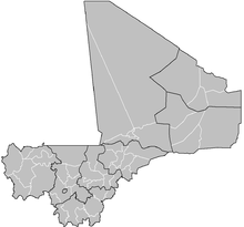 | |
|---|---|---|
| Koulikoro Region | ||
| Sikasso Region | ||
| Ségou Region | ||
| Mopti Region | ||
| Tombouctou Region | ||
| Gao Region | ||
| Kidal Region | ||
| Bamako Capital District | ||
Capital: Timbuktu | ||
| Diré Cercle |  | |
| Goundam Cercle |
| |
| Gourma-Rharous Cercle | ||
| Niafunké Cercle | ||
| Timbuktu Cercle |
| |
Coordinates: 16°05′N 1°45′W / 16.083°N 1.750°W
This article is issued from Wikipedia - version of the 5/7/2015. The text is available under the Creative Commons Attribution/Share Alike but additional terms may apply for the media files.