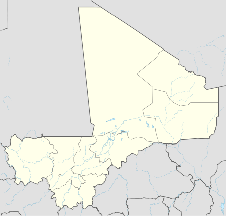
Bamako
| Bamako Bamakɔ | ||
|---|---|---|
| Capital City and Cercle | ||
|
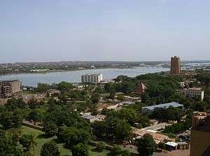
View of Bamako | ||
| ||
 Bamako Bamako on the Niger River | ||
| Coordinates: 12°39′N 8°0′W / 12.650°N 8.000°W | ||
| Country |
| |
| Region | Bamako Capital District | |
| Cercle | Bamako | |
| Subdivisions | ||
| Government | ||
| • Type | Capitol District | |
| • Maire du District | Adama Sangaré[4] | |
| Area | ||
| • Capital City and Cercle | 245.0 km2 (94.6 sq mi) | |
| • Metro | 17,141.61 km2 (6,618.41 sq mi) | |
| Elevation[5] | 350 m (1,150 ft) | |
| Population (1 April 2009)(Census, provisional) | ||
| • Capital City and Cercle | 1,809,106 | |
| • Density | 7,384.11/km2 (19,124.8/sq mi) | |
| • Metro | 2,757,234 | |
| • Metro density | 160.85/km2 (416.6/sq mi) | |
| Time zone | Coordinated Universal Time (UTC-0) | |
.svg.png)
Bamako is the capital and largest city of Mali, with a population of 1.8 million (2009 census, provisional). In 2006, it was estimated to be the fastest growing city in Africa and sixth-fastest in the world.[6] It is located on the Niger River, near the rapids that divide the upper and middle Niger valleys in the southwestern part of the country.
Bamako is the nation's administrative center. The city proper is a cercle in its own right. Bamako's river port is located in nearby Koulikoro, along with a major regional trade and conference center. Bamako is the seventh-largest West African urban center after Lagos, Abidjan, Kano, Ibadan, Dakar, and Accra. Locally manufactured goods include textiles, processed meat, and metal goods. Commercial fishing occurs on the Niger River.
The name Bamako (Bàmakɔ̌ in Bambara) comes from the Bambara word meaning "crocodile tail".[7]
History
The area of the city has evidence of settlements since the Palaeolithic era. The fertile lands of the Niger River Valley provided the people with an abundant food supply and early kingdoms in the area grew wealthy as they established trade routes linking across west Africa, the Sahara, and leading to northern Africa and Europe. The early inhabitants traded gold, ivory, kola nuts, and salt.[8] By the 11th century, the Empire of Ghana became the first kingdom to dominate the area. Bamako had become a major market town, and a centre for Islamic scholars, with the establishment of two universities and numerous mosques in medieval times.[8]
The Mali Empire grew during the early Middle Ages and replaced Ghana as the dominant kingdom in west Africa, dominating Senegal, Gambia, Guinea, and Mauritania.[8] In the 14th century, the Mali Empire became increasingly wealthy because of the trade of cotton, gold and salt. This was eventually succeeded by the Songhai Empire and in the 16th century Berber invaders from Morocco destroyed what remained of the kingdoms in Mali and trans-Saharan trade was taken over by sailors.[8]

By the late 19th century, the French dominated much of western Africa, and in 1883, present-day Mali became part of the colony of French Sudan, and was its capital in 1908. Cotton and rice farming was encouraged through large irrigation projects and a new railroad connected Mali to Dakar on the Atlantic coast.[8] Mali was annexed then into French West Africa, a federation which lasted from 1895 to 1959.[8]
Mali gained independence from France in April 1960, and the Republic of Mali was later established. At this time, Bamako had a population of around 160,000. During the 1960s, the country became socialist and Bamako was subject to Soviet investment and influence.[8] However, the economy declined as state enterprises collapsed and unrest was widespread.[8] Eventually, Moussa Traoré led a successful coup and ruled Mali for 23 years. However his rule was characterised by severe droughts and poor government management and problems of food shortages.[8]
In the late 1980s the people of Bamako and Mali campaigned for a free-market economy and multiparty democracy. In 1990, the National Congress for Democratic Initiative (Congrès National d'Initiative démocratique, CNID) was set up by the lawyer Mountaga Tall, and the Alliance for Democracy in Mali (Alliance pour la démocratie au Mali, ADEMA) by Abdramane Baba and historian Alpha Oumar Konaré. These with the Association des élèves et étudiants du Mali (AEEM) and the Association Malienne des Droits de l'Homme (AMDH) aimed to oust Moussa Traoré. Under the old constitution, all labor unions had to belong to one confederation, the National Union of Malian Workers (UNTM). When the leadership of the UNTM broke from the government in 1990, the opposition grew. Groups were driven by paycuts and layoffs in the government sector, and the Malian government acceding to pressure from international donors to privatise large swathes of the economy that had remained in public hands even after the overthrow of the socialist government in 1968. Students, even children, played an increasing role in the protest marches in Bamako, and homes and businesses of those associated with the regime were ransacked by crowds.
On 22 March 1991, a large-scale protest march in central Bamako was violently suppressed, with estimates of those killed reaching 300. Four days later, a military coup deposed Traoré. The Comité de Transition pour le Salut du Peuple was set up, headed by General Amadou Toumani Touré.[9] Alpha Oumar Konari officially became president on 26 April 1992.[8]
On 20 November 2015, two gunmen took 170 people hostage in Radisson Blu hotel. 21 people‚ including three Chinese businessmen were killed in the "Bamako hotel attack" along with the two gunmen during the seven–hour siege.[10]
Geography
Bamako is situated on the Niger River floodplain, which hampers development along the riverfront and the Niger's tributaries. Bamako is relatively flat, except to the immediate north where an escarpment is found, being what remains of an extinct volcano. The Presidential Palace and main hospital are located here.

Originally, the city developed on the northern side of the river, but as it grew, bridges were developed to connect the north with the south. The first of these was the Pont des Martyrs (2-lane with two pedestrian sections) and the King Fahd Bridge (four-lane with two motorcycle and two pedestrian sections). Additionally, a seasonal causeway between the eastern neighborhoods of Sotuba and Misabugu was inherited from colonial times (alternated traffic on one lane with five crossing sections). The Sotuba Causeway ( Chaussée submersible de Sotuba in French, and Babilikoroni in Bamanankan) is typically under water from July to January. A third bridge (1.4 km long, 24 m wide, four-lane with two motorcycle and two pedestrian sections) is being built at the same location[11] to reduce downtown congestion, notably by trucks.
Climate
Under the Köppen climate classification, Bamako features a tropical savanna climate (Köppen Aw). Located between the Sahara to the north and the Gulf of Guinea to the south, Bamako is very hot on average all year round with the hottest months being March, April, and May. The mildest months are November to February. During the dry season, rainfall is scarce: virtually none falls between November and April due to the dominance of the Saharan anticyclone and the dry trade winds. The rainy season occurs in the summer with the peak during July, August, and September.
| Climate data for Bamako (1950–2000, extremes 1949–1994) | |||||||||||||
|---|---|---|---|---|---|---|---|---|---|---|---|---|---|
| Month | Jan | Feb | Mar | Apr | May | Jun | Jul | Aug | Sep | Oct | Nov | Dec | Year |
| Record high °C (°F) | 38.9 (102) |
42.8 (109) |
43.9 (111) |
43.5 (110.3) |
45.0 (113) |
42.0 (107.6) |
40.0 (104) |
37.8 (100) |
38.4 (101.1) |
38.9 (102) |
42.0 (107.6) |
40.0 (104) |
45.0 (113) |
| Average high °C (°F) | 33.4 (92.1) |
36.4 (97.5) |
38.5 (101.3) |
39.6 (103.3) |
38.5 (101.3) |
35.3 (95.5) |
32.1 (89.8) |
31.1 (88) |
32.2 (90) |
34.6 (94.3) |
35.3 (95.5) |
33.4 (92.1) |
35.0 (95) |
| Average low °C (°F) | 17.0 (62.6) |
19.9 (67.8) |
22.9 (73.2) |
25.2 (77.4) |
25.4 (77.7) |
23.6 (74.5) |
22.2 (72) |
21.8 (71.2) |
21.6 (70.9) |
21.3 (70.3) |
18.4 (65.1) |
16.8 (62.2) |
21.3 (70.3) |
| Record low °C (°F) | 8.7 (47.7) |
9.0 (48.2) |
12.0 (53.6) |
16.7 (62.1) |
17.8 (64) |
16.1 (61) |
17.8 (64) |
17.2 (63) |
18.3 (64.9) |
14.7 (58.5) |
10.8 (51.4) |
6.1 (43) |
6.1 (43) |
| Average rainfall mm (inches) | 0.6 (0.024) |
0.7 (0.028) |
2.1 (0.083) |
19.7 (0.776) |
54.1 (2.13) |
132.1 (5.201) |
224.1 (8.823) |
290.2 (11.425) |
195.9 (7.713) |
66.1 (2.602) |
5.2 (0.205) |
0.5 (0.02) |
991.3 (39.028) |
| Average rainy days (≥ 0.1 mm) | 0.2 | 0.2 | 0.6 | 3.3 | 6.3 | 7.7 | 16.7 | 17.9 | 14.7 | 5.7 | 0.3 | 0.1 | 73.7 |
| Average relative humidity (%) | 24 | 20 | 22 | 33 | 50 | 67 | 77 | 81 | 78 | 65 | 38 | 27 | 49 |
| Mean monthly sunshine hours | 277.4 | 253.0 | 268.1 | 230.4 | 242.6 | 233.6 | 216.6 | 218.3 | 221.7 | 253.7 | 270.7 | 268.6 | 2,954.7 |
| Source #1: World Meteorological Organization[12] | |||||||||||||
| Source #2: NOAA (sun 1961–1990),[13] Deutscher Wetterdienst (extremes and humidity)[14] | |||||||||||||
Administration


The District of Bamako has been divided into six communes (distinguished by numbers, and not named) since Ordinance No. 78-34/CNLM of 18 August 1978, and amended by a law in February 1982 establishing the new boundaries of Communes III and IV.[15] Each commune is administered by the municipal council and a mayor elected from among its members. The last elections were held on 26 April 2009 and the Alliance for Democracy in Mali hold the majority of representatives for the communes.
Communes and neighborhoods
Commune I has a population of 335,407 people (2009) and covers 35 square kilometres (14 sq mi). It is bounded to the north by the rural commune of Djalakorodji (Kati Cercle), west by the Commune II, north-east by the rural commune of Sangarebougou (Kati Cercle), on the east by the rural commune of Gabakourou and south by the Niger River. Nine neighborhoods comprise this commune: Banconi, Boulkassombougou, Djelibougou, Doumanzana Fadjiguila, Sotuba Korofina North and South Korofina Sikoroni.[16]
Commune II has a population of 159,805 people (2009) and covers 18.3 square kilometres (7.1 sq mi). It is bounded to the east by the backwater of Korofina at the west foot of the Point G hill, and to the south by Niger River. The municipality has eleven neighborhoods: Niaréla (the oldest), Bagadadji, Medina-Coura, Bozola, Missira, Hippodrome, Quinzambougou, Bakaribougou, TSF, Industrial Area, and Bougouba. The new Cité du Niger island is also located in the Commune II.[17] The area is the most important in the industry sector in Bamako.[18]
Commune III has a population of 128,872 people (2009) and covers 20.7 square kilometres (8.0 sq mi). It is bounded on the north by the Kati, east by the Boulevard du Peuple, which separates it from the Commune II, south by the portion of the Niger River, between the Pont des Martyrs and the Motel de Bamako, and west by the Farako River and Avenue Cheick Zayed El Mahyan Ben Sultan with the neighborhood of ACI-2000. Commune III is the administrative and commercial center of Bamako. It accommodates in particular the two largest markets in the capital, the Grand Market and Dibida. Twenty neighborhoods make up this commune and the villages of Koulouninko and Sirakorodounfing were attached to the Commune III.[19]
Commune IV has a population of 300,085 people (2009) and covers 42 square kilometres (16 sq mi). It is bounded to the east by Commune III, north, west by Kati Cercle and south by the left bank of the Niger River. Commune IV consists of eight neighborhoods: Taliko, Lassa, Sibiribougou, Djikoroni Para, Sébénikoro, Hamdallaye, Lafiabougou and Kalabambougou.[20]
Commune V has a population of 414,668 people (2009) and covers 42 square kilometres (16 sq mi).[21] It is bounded to the north by the Niger River, south by the airport and the commune of Kalabancoro, and to the east by the Commune VI and Niger. It consists of eight neighborhoods: Badalabougou, Sema I, Quartier Mali, Torokorobougou, Baco-Djicoroni, Sabalibougou, Daoudabougou and Kalaban-Coura.
Commune VI has a population of 470,269 people (2009) and covers 87 square kilometres (34 sq mi). This is the largest of the communes that make up Bamako. It consists of ten neighborhoods: Banankabougou, Djanékéla, Faladié, Magnambougou, Missabougou, Niamakoro, Sénou, Sogoniko, Sokorodji and Yrimadio [20].
Bamako contains the following neighborhoods (quartiers): ACI-2000, Badalabugu, Bajalan I, Bajalan II, Bako Jikoroni, Bagadaji, Bamako Kura, Bankoni, Bolibana, Bozola, Bugudani, Bulkasumbugu, Dar Salam, N'tomikorobougou, Dawdabugu, Dravela, Fajigila, Falaje, Garantigibugu, Jalakoroji, Janekela, Janjigila, Jelibugu, Jikoroni Para, Jumanzana, Hamdallaye, Hippodrome, Kalaban Koro, Kalaban Kura, Korofina, Kuluba, Kulubleni, Lafiabugu, Madina Kura, Magnambugu (Magnambugu Faso Kanu), Misabugu, Misira, Niarela, Ntomikorobugu, Point G, Quartier du Fleuve, Quartier Mali, Quinzanbugu, Sabalibugu I, Sabalibugu II, Safo, Same, Sangarebugu, Saranbugu, Sebeninkoro, Sikoroni, Sirakoro, Senu, Sibiribugu, Sokoniko, Sokoroji, Sotuba, Titibugu, Torokorobugu, TSF-Sans Fil, Wolofobugu, Yirimanjo, Zone Industrielle
Demographics

Bamako has experienced a staggering population growth. In 1884, it had only 2500 inhabitants, 8000 in 1908, 37,000 in 1945, and 100,000 in 1960. Today, the population is at least 18 times what it was in 1960, with over 1,800,000 recorded at the 2009 census, and continues to attract a rural population in search of work. Including illegal squatters and temporary workers, some experts believe the population today is well over 2 million. This uncontrolled growth has caused significant difficulties in terms of traffic, sanitation (including access to safe water), and pollution. Bamako became the crossroads of West Africa and hosts a diverse population, composed of different ethnic groups in Mali, but also from neighboring countries.
Economy

Industry
The traditional commercial center of Bamako was located to the north of the river, and contained within a triangle bounded by Avenue du Fleuve, Rue Baba Diarra, and Boulevard du Peuple. This area contains the Marché Rose and Street Market.
The downtown area is highly congested, polluted, and expensive, and urbanization is sprawling at a rapid pace within a radius of 30 kilometres (19 mi). The largest urbanized area now lies on the southern bank of the Niger River. A modern central business district is rapidly developing immediately west of the downtown area in the ACI-2000 district, taking advantage of a well-designed geometric layout, legacy of the old airport runways and taxiways. A large administrative area is being developed at the junction between ACI-2000 and the King Fadh Bridge, containing most of the state departments (ministries) and administrative services in a central location. Bamako is also the headquarters of many large companies and administrative institutions. Air Mali (formerly Compagnie Aérienne du Mali) has its head office in Bamako.[22] Bamako received much investment by Saudi Arabia for decades which saw a number of important structures being built. In recent years, China has become an important investor in Bamako, developing its infrastructure and facilities.

Agriculture is active in Bamako, with the presence of Bozo fisherman, and it is common to see cattle crossing the streets. However, the most important by far is the manufacturing and service sector. The District of Bamako concentrates 70% of industrial activity.[23] The service sector is the most developed, and the city thrives in crafts and trade.
Music
A music boom in Bamako took off in the 1990s, when vocalist Salif Keita and singer-guitarist Ali Farka Touré achieved international fame.[24] It attracted a number of tourists, record producers, and aspiring musicians to the city to try to follow in their footsteps. It is common to see musicians in the streets with djembes and percussion bands playing traditional Bamana rhythms.
The range of ethnicities involved in Bamako's music scene are diverse, including singers and instrumentalists from Mali's myriad ethnic groups; the Tuaregs of the Sahara, the Sonrai of Timbuktu, the Malinkes from the border region south of Bamako, the Dogon cliff dwellers, the Wassalous near the Ivory Coast, the Fulas of central Mali etc.[24] Bars and nightclubs have grown rapidly including Mr. Keita's Mofu and Oumou Sangare's Hotel Wassulu which featured Malian and other west African artists. Notable western artists such as Robert Plant, Ry Cooder, Bonnie Raitt, John Lee Hooker, Damon Albarn and the French Basque star Manu Chao have all visited Bamako to jam and record with notable local musicians.[24]
Energy
Much of the electricity is generated from the hydroelectric Sélingué Dam. The drinking water supply in Bamako and Kati is also ensured by a pumping station on the Niger River. However, the capacity of 135,000 cubic metres (4,800,000 cu ft) to provide drinking water per day is insufficient for the needs estimated at 152,000 cubic metres (5,400,000 cu ft) during the hot season between April and June. During this period, frequent water shortages are experienced. A new pumping station was to open in Kabala in 2009.
Landmarks

The National Library of Mali was first created by the Institut Français d'Afrique Noire, an arm of the French colonial government, in 1944. Following Mali's 1960 independence, this library became the Government Library; it would later be renamed again as the National Library of Mali. In 1968, the library was transferred from its initial home in Koulouba to Ouolofobougou, a section of Bamako. The library holds more than 60,000 works, including books, periodicals, audio documents, videos, and software. These materials are available free to the public, though a small subscription fee is required for borrowing privileges. The library also hosts some of the exhibits for African Photography Encounters, a biannual Bamako photography festival.
The Bamako Grand Mosque is located in the city centre of Bamako, situated north of the Niger River near the central Market (Grand Marche) and the colonial era Bamako Cathedral. It is one of the tallest structures in Bamako. Built on the site of a precolonial mud-brick mosque, the current mosque was built through funding from the Saudi Arabian government at the end of the 1970s. With its tall concrete minarets built around a square central structure, the building is stylistically closer to Saudi religious structures than West African.[25] The mosque is visible from much of the city and occasionally is opened to tourists.

The BCEAO Tower at 20 stories is the tallest building in the West African nation. It sits of the north ("left") bank of the River Niger in the city centre.[26] The BCEAO Tower is the Malian headquarters of the Central Bank of West African States, which provides development banking and government financial and currency services in several Francophone West African nations. Classified as Neo-Sudanic architecture, it is modeled on the Sudano-Sahelian architecture of the famous mosques of Djenne and Timbuktu. The building is located in the busy Commune III neighbourhood, where "Avenue Moussa Tavele" meets the waterside boulevard between the two main Bamako bridges : King Fahd Bridge a block west and Martyrs Bridge three blocks east. Just to the east of the BCEAO complex, a park and formal garden mark where the diagonally running "Boulevard du Peuple" reaches the river. By contrast, small market gardens and launching points or river canoes lie along the river front.[26] With the Hotel de l'Amitié and the Bamako Grand Mosque, the BCEAO Tower is one of three landmarks visible across most of the city.[26] Also of note is the Bamako Cathedral.
The Cité Administrative (Administrative City) is a complex of buildings located just west of the northern end of the King Fahd Bridge. The complex was begun in 2003 by then President Konaré with the help of funding from the government of Libya. The 10-hectare (25-acre) Cité Administrative was completed in 2010 and houses many of the offices of the government.[27][28]

The National Museum of Mali is an archeological and anthropological museum, presenting permanent and temporary exhibits on the prehistory of Mali, as well as the musical instruments, dress, and ritual objects associated with Mali's various ethnic groups. The National Museum began under French rule as the Sudanese Museum, part of the Institut Français d'Afrique Noire (IFAN) under Théodore Monod. It was opened on 14 February 1953, under the direction of Ukrainian archeologist Y. Shumowskyi. Archaeologist Y. Shumovskyi had worked in the museum for nine years, gathering half (nearly 3000) of today's finds.
With the independence of the Republic of Mali in 1960, the Sudanese Museum became the National Museum of Mali, with the new objectives of promoting national unity and celebrating Malian traditional culture. However, lack of financial means and absence of qualified personnel caused some deterioration in the museum's collections. On 30 March 1956, the National Museum moved into a new cemented structure, created by architect Jean-Loup Pivin from traditional Malian designs. Since the 1996 election of former archaeologist Alpha Oumar Konaré to Mali's presidency, the museum's funding has increased considerably, becoming among the best in West Africa. The museum often hosts part of the biannual African Photography Encounters, photography festival held in Bamako since 1994.
Also of note is the Muso Kunda Museum, the Bamako Regional Museum, Bamako Zoo, the Bamako Botanical Gardens, the National Conference Center Tower (NCC), the Souvenir Pyramid, the Independence Monument, Al Quoods Monument, the triangular Monument de la paix, the Hamdallaye obelisk, the Modibo Keita Memorial and many other monuments, the Palais de la Culture Amadou Hampaté Ba and the Point G hill, containing caves with rock paintings.
In 1988, Bamako was the location of a WHO conference known as the Bamako Initiative that helped reshape health policy of sub-Saharan Africa. The yearly held Budapest-Bamako rally has the endpoint in Bamako, with the Dakar Rally often passing through Bamako.
Image gallery
-

Al Quoods Monument
-

Independence Monument
-

Monument de la paix
-

Hamdallaye obelisk
-

Statue of Gustave Borgnis-Desbordes
-

Pyramide du souvenir
-

Place Abdoul Karim Camara
-

Place des explorateurs
Transport


The Dakar-Niger Railway links Bamako to Dakar via Kati, Négala, Kita, and Kayes. The road network links Bamako to Koulikoro, Kati, Kolokani, Ségou, and Sikasso.
The Bamako-Sénou International Airport is 15 kilometres (9 mi) from the city and opened to passengers in 1974. Passenger traffic steadily increased in the early 2000s. Government figures revealed 403,380 passengers in 1999, 423,506 in 2003, 486,526 in 2004, and 516,000 in 2005, and is predicted to reach over 900,000 by 2015 under a low (4%) yearly growth rate scenario.[29] To date this growth rate has been surpassed. Total air traffic the airport increased by 12.4% in 2007 and 14% in 2008. Most of this increase came in passenger transport, with the number of passengers served increasing by 20% in 2007 and 17% in 2008. Twenty-seven airline carriers operated weekly or better at Bamako-Sénou International Airport in the 2007–2008 period. This continued growth was offset by cargo flights' decline of 16.75% in 2007, and 3.93% in 2008.[30] The highest frequency route is on the Bamako-Dakar sector with 29 weekly non-stop connections. Domestic flights also serve Mali's regional capitals Kayes, Mopti, Timbuktu, Sikasso, Gao, and Kidal. Bamako Senou International Airport is managed by Aéroports du Mali (ADM).[29] Its operations are overseen by the Malian Ministry of Equipment and Transports.[30]
Much of the transportation is either by the Niger River, or by paved roads linking Bamako to other major urban areas. Navigating the river is possible from Koulikoro to Mopti and Gao. The bush taxi is one of the main modes of transport.
Bamako is situated on both sides of the Niger River and two bridges connect the two banks: the Bridge of Martyrs completed in 1960 and renamed in memory of protesters killed in March 1991 by the regime of Moussa Traoré, and the King Fahd Bridge, named after the Saudi Arabian donor. A third bridge project is currently being funded by the People's Republic of China. Located in Sotuba area, it has the objective to decongest traffic in the city.[31]
Healthcare
The Point G hospital, built between 1906 and 1913, covers 25 hectares (62 acres). A former military hospital, it became a civilian hospital shortly before the independence of Mali, and is situated on a hill overlooking Bamako[32]
The second hospital of Bamako is the Gabriel Touré Hospital named after a young doctor and humanist Gabriel Touré who was born in 1910 in Ouagadougou and died in 1935 after having been contaminated by a patient with the pneumonic plague. The hospital was established in 1959.[33]
The contract for the building of a new hospital in Bamako, to relieve pressure on the other hospital resources was signed on 27 December 2008. Located in the district of Yirimadio, the department will include a pediatric and obstetrics-gynecology facilities, a department of internal medicine, medical imagery facilities and hospital care with 150 beds to support the emergency services and intensive care. This hospital, like many recent developments in Bamako is financed and equipped with Chinese investment.[34]
In popular culture
Bamako has provided the backdrop or been the subject of books and films such as Bamako, directed by Abderrahmane Sissako. The film depicts a trial taking place in Bamako, amid the daily life that is going on in the city. In the midst of that trial, two sides argue whether the World Bank and International Monetary Fund, or perhaps corruption, are guilty of the current financial state of many poverty-stricken African countries. The film was first released at the Cannes Film Festival on 21 May 2006 and in Manhattan by New Yorker Films on 14 February 2007 and was the recipient of the first Film Award of the Council of Europe given at the Istanbul International Film Festival in April 2007.[35]
Notable people
Gallery
-
.jpg)
Ministry buildings
-

A Bozo girl in Bamako
-

Pont des Martyres (Martyrs' Bridge)
-

Monument
-

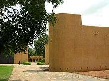
Tower by the Bamako International Conference Center
-

Bamako airport road welcome sign
-
Place de la liberté
Twin towns – Sister cities
-
 Angers, France (since 1974)
 -
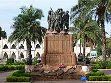
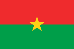 Bobo Dioulasso, Burkina Faso
 -
 Dakar, Senegal
 -
 Leipzig, Germany[36][37]
 -
 Rochester, New York, United States (since 1975)[38]
 -
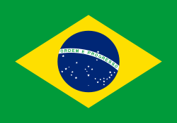 São Paulo, Brazil (since 2000)[39]
See also
References
- 1 2
- 1 2
- 1 2
- ↑ "Coupe du Maire du District : Le Stade reçoit son trophée". L'Essor, 24 September 2008
- ↑ "Population of Bamako, Mali". Mongabay.com. Retrieved 25 May 2015.
- ↑ "City Mayors: World's fastest growing urban areas (1)". Retrieved 25 May 2015.
- ↑ "SUDANESE IMPOSE SENEGAL BOYCOTT; Traders Told to Use Port in Ivory Coast – Move Is Aimed at Dakar's Trade". New York Times, 3 September 1960
- 1 2 3 4 5 6 7 8 9 10 "Bamako – History". Africatravelling.net. Retrieved 23 October 2009.
- ↑ Patrick Manning. Francophone Sub-Saharan Africa, 1880–1995: 1880–1995. Cambridge University Press (1998) ISBN 0-521-64519-0 pp.198–199
- ↑ Mali attack: more than 20 dead after terrorist raid on Bamako hotel, Mamadou Tapily et al, 21 November 2015, The Guardian, Retrieved 5 January 2015
- ↑ "maliweb.net :: Construction du 3e Pont de Bamako : Maliens et Chinois d'accord sur les aspects techniques du projet". Retrieved 25 May 2015.
- ↑ "World Weather Information Service – Bamako". World Meteorological Organization. Retrieved 20 June 2013.
- ↑ "BKO–s (Bamako) Climate Normals 1961–1990". National Oceanic and Atmospheric Administration. Retrieved 10 September 2015.
- ↑ "Klimatafel von Bamako (Flugh. Senou) / Mali" (PDF). Baseline climate means (1961-1990) from stations all over the world (in German). Deutscher Wetterdienst. Retrieved 26 January 2016.
- ↑ Ordonnance n° 78-34/CNLM du 18 août 1978, modifiée par une loi de février 1982 fixant les nouvelles limites des Communes III et IV, cité par Doussou Djiré, Commune IV : entre tradition et modernité, l'Essor, 24 April 2009
- ↑ Badiaga, S. (24 April 2009). "Town I: 26 lists in contention, the Rise"
- ↑ Velton, Ross; Geels, Jolijn (2004-01-01). Mali: The Bradt Travel Guide. Bradt Travel Guides. ISBN 9781841620770.
- ↑ Konate, S. (24 April 2009). "Commune II: the cradle of Bamako, The Rise"
- ↑ Cissé, A.M. (24 April 2009). Commune III : dans un mouchoir de poche ? l'Essor
- ↑ Djiré, Doussou (24 April 2009), Commune IV : entre tradition et modernité, l'Essor
- ↑ Doumbia, B. (24 April 2009). Commune V : La nécessité d’agir, L’Essor]
- ↑ "Contact-us." Air Mali. Retrieved 19 October 2009. Archived 6 May 2015 at the Wayback Machine.
- ↑ Industrial Census in 2006, provided the Council of Ministers of 20 December 2006.
- 1 2 3 Hammer, Joshua (2 April 2006). "The Siren Song of Mali". New York Times.
- ↑ Velton (2000) p.124
- 1 2 3 Velton, Russ (2006). Mali. Chalfont St Peter, Bucks / Guilford, Connecticut: Bradt UK / Globe Pequot Press. ISBN 978-1-84162-077-0.
- ↑ "Orange". Retrieved 25 May 2015.
- ↑ "JournalDuMali.com: Bamako : la Cité administrative inaugurée par ATT". Retrieved 25 May 2015.
- 1 2 Composante aéroport Bamako-Sénou, Proposition MCA-Mali (2006)
- 1 2 "Air traffic at Bamako airport increases by 14% in 2008" Archived 7 July 2011 at the Wayback Machine.. PANA press. 2009-01-14
- ↑ « Troisième pont de Bamako : le compte à rebours a commencé », L'Essor, 19 November 2007.
- ↑ B. Doumbia, « Centenaire du Point G : Un siècle à la pointe des soins et une belle histoire », L'Essor, 11 December 2006.
- ↑ B. Doumbia, Board of Directors of the Gabriel Toure hospital: the quality imperative, L'Essor, 26 February 2009
- ↑ B. Doumbia, Futur « Hôpital du Mali » : les travaux peuvent démarrer, l'Essor, 31 December 2008
- ↑ ""Bamako", winner of the first Council of Europe film award in Istanbul". Council of Europe. 14 April 2007. Retrieved 14 April 2009.
- ↑ Sebastian Klee Medien. "Mali – ein Land voller Gegensätz". Retrieved 25 May 2015.
- ↑ Kulturstiftung Leipzig. "Leipziger Blätter - Heftarchiv - Heft 2 - kulturstiftung-leipzig.de". Retrieved 25 May 2015.
- ↑ "Bamako, Mali - A Rochester Sister City". Retrieved 2014-03-16.
- ↑ Cidades irmãs de São Paulo
- Pascal James Imperato. Historical Dictionary of Mali. Scarecrow Press/ Metuchen. NJ – London (1986) ISBN 0-8108-1369-6
- Ross Velton. Mali: The Bradt Travel Guide. Guilford, Connecticut: Globe Pequot Press, 2000.
External links
| Wikivoyage has a travel guide for Bamako. |
| Wikimedia Commons has media related to Bamako. |
- Bamako-culture.org (French language)
- Bamako at Cités du Monde (French language)
- United States Embassy in Bamako
| Countries |  | |
|---|---|---|
| Sections |
| |
| Tributaries (list) and distributaries | ||
| Cities | ||
| Lakes | ||
| Dams and bridges | ||
| Protected Areas | ||
| Kayes Region |  | |
|---|---|---|
| Koulikoro Region | ||
| Sikasso Region | ||
| Ségou Region | ||
| Mopti Region | ||
| Tombouctou Region | ||
| Gao Region | ||
| Kidal Region | ||
| Bamako Capital District | ||
Coordinates: 12°39′N 8°0′W / 12.650°N 8.000°W