Donald's Hill
| Donald's Hill | |
|---|---|
| Cnoc Dhónaill | |
 | |
| Highest point | |
| Elevation | 399 m (1,309 ft) |
| Listing | Marilyn |
| Geography | |
| Location | Drumsurn, Londonderry, Northern Ireland |
| OSI/OSNI grid | C758178 |
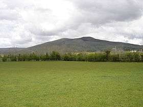
Donald's Hill (Irish: Cnoc Dhónaill) is a hill in County Londonderry, Northern Ireland. The summit reaches 399 metres above sea level and classifies as a Marilyn. Located at the edge of the Sperrin Mountains, the town of Drumsurn sits at the foot of the hill.
The Ordnance Survey Memoirs of 1834 records an alternative name of Knocknahurkle, which is believed to be derived from Irish Cnoc na hEarcola.[1]
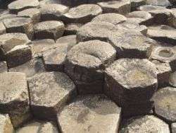
An ignimbrite formation can be found at the western edge of the plateau with approximately 30 kilometres of outcrop between Donald's Hill and Magherafelt.
References
Links
Coordinates: 55°00′07″N 6°48′58″W / 55.00190°N 6.81623°W
Mountains and hills of Ulster | ||
|---|---|---|
| Antrim Hills | 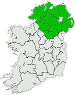 | |
| Antrim Plateau | ||
| Belfast Hills | ||
| Croaghgorms | ||
| Derryveagh | ||
| Inishowen | ||
| Mournes | ||
| Sperrins | ||
| Southwest Donegal | ||
| Others | ||
This article is issued from Wikipedia - version of the 12/20/2015. The text is available under the Creative Commons Attribution/Share Alike but additional terms may apply for the media files.