Ben Crom
| Ben Crom | |
|---|---|
| Binn Chrom | |
 Ben Crom mountain | |
| Highest point | |
| Elevation | 526 m (1,726 ft) [1] |
| Prominence | 81 m (266 ft) [1] |
| Listing | Myrddyn Dewey |
| Coordinates | 54°09′58″N 5°59′26″W / 54.166233°N 5.990448°WCoordinates: 54°09′58″N 5°59′26″W / 54.166233°N 5.990448°W [1] |
| Naming | |
| Translation | curved/stooped peak (Irish) |
| Geography | |
 Ben Crom Location of Ben Crom within Northern Ireland | |
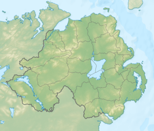
| Location | County Down, Northern Ireland |
| Parent range | Mournes |
| OSI/OSNI grid | 26000 J31300 26000 |
| Topo map | OSNI Discoverer 29 |
Ben Crom (from Irish: Binn Chrom, meaning "curved/stooped peak") is a 526 metres (1,726 ft) mountain in the Mourne Mountains in County Down, Northern Ireland. It is situated beside Ben Crom Reservoir, which is upstream from Silent Valley Reservoir. The mountain is composed of granite.[1][2] An exposed area on the south west of the mountain shows where the Eocene aplitic granite meets the laccolith top of the older Mesozoic granite ring dike. The summit of the mountain features granite crags which are crossed by basic and feldspar porphyry dikes. The mountain is used for sheep grazing and hill walking.[3]
-
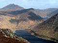
View of Ben Crom (center), Silent Valley Reservoir (bottom) and Ben Crom Reservoir (top right) from Slievenaglogh. Slieve Bearnagh is in the top left of the photo.
References
- 1 2 3 4 "Mourne Mountains Area - Ben Crom". Mountain Views. Retrieved 10 December 2014.
- ↑ Evans, Emyr Estyn (1967). Mourne Country: Landscape and Life in South Down. Dundalgan P. p. 38.
- ↑ "Mournes - Ben Crom". Habitats.org.uk. Retrieved 10 December 2014.
Mountains and hills of Ulster | ||
|---|---|---|
| Antrim Hills | 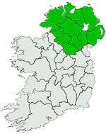 | |
| Antrim Plateau | ||
| Belfast Hills | ||
| Croaghgorms | ||
| Derryveagh | ||
| Inishowen | ||
| Mournes | ||
| Sperrins | ||
| Southwest Donegal | ||
| Others | ||