Belmore Mountain
| Belmore Mountain | |
|---|---|
| Sliabh Bhéal Mór | |
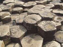
 Belmore Mountain, Spring 2005 | |
| Highest point | |
| Elevation | 398 m (1,306 ft) |
| Prominence | 322 m (1,056 ft) |
| Listing | Marilyn |
| Coordinates | 54°19′26″N 7°47′19″W / 54.3238°N 7.7886°WCoordinates: 54°19′26″N 7°47′19″W / 54.3238°N 7.7886°W |
| Naming | |
| Translation | mountain of the big mouth (Irish) |
| Geography | |
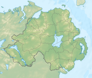 Location of Belmore Mountain in Northern Ireland | |
| Location | County Fermanagh, Northern Ireland |
| OSI/OSNI grid | H138417 |
| Topo map | OSNI Discoverer 17 |
Belmore Mountain (from Irish: Béal Mór[1], meaning "big mouth") is a hill in the townland of Gortgall, western County Fermanagh, Northern Ireland. With a summit roughly 398 metres (1,306 ft) above sea level,[2] it is the second highest point in Fermanagh, the highest being at Cuilcagh on the Northern Ireland–Republic of Ireland border in the south of the county. The historian John O Donovan (1834) states that the indigenous population called the mountain Bel Mor Muintir Pheodachain .[3]
Belmore Mountain dominates the skyline in the nearby county town of Enniskillen and gives its name to Belmore Street.
Geography
Geologically dominated by limestone, outcropping of the sedimentary rock forms extensive sheer cliffs near the summit. Chemical erosion caused by the natural acidity of water has formed a cave system underneath the mountain, accessible at the village of Boho. Faulting has produced the Knockmore escarpment on the western flanks of Belmore. Other small villages and hamlets around the foot of Belmore include Letterbreen and Springfield.
Agriculture is limited due to the steep slopes and thin peaty soils on Belmore, however extensive plantations of coniferous forest can be found on the upper plateau.
In 1894, archeologist Thomas Plunkett excavated both the Eagle’s Knoll Cairn passage tomb and Moylehid ring cairn in the townland of Moylehid; one of which is situated on an eastern spur of Belmore Mountain overlooking the Erne valley.[4]
Eponymy
The mountain also gives its name to an Irish earldom. Somerset Lowry-Corry, 4th Earl Belmore, served from 1868 to 1872 as the 14th Governor of New South Wales, where several features are named for him: the Belmore River, the suburb of Belmore in Sydney, Belmore Park, also in Sydney and in Goulburn. The name is also associated with Belmore Forest in the Boho area.
See also
Notes
- ↑ Placenames Database of Ireland
- ↑ Kelly, p. 226
- ↑ John O Donovon (1834). "John O'Donovan's letters from County Fermanagh" (PDF). p. 5.
- ↑ Martin, p.170
| Wikimedia Commons has media related to Belmore Mountain. |
References
- Hughes, William (1882), Geologic Notes of Ireland, Dublin: Gill
- Kelly, John (1859), "The Carboniferous Rocks of Ireland", The Atlantis (July)
- Martin, C. P. (1935), Prehistoric Man in Ireland, London: Macmillan