Slieve Gallion
| Slieve Gallion | |
|---|---|
| Sliabh gCallann | |
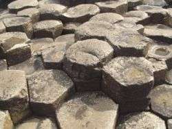
 Slieve Gallion from the southwest | |
| Highest point | |
| Elevation | 528 m (1,732 ft) |
| Listing | Marilyn |
| Coordinates | 54°44′N 6°46′W / 54.73°N 6.76°WCoordinates: 54°44′N 6°46′W / 54.73°N 6.76°W |
| Naming | |
| Translation | mountain of the heights (Irish) |
| Geography | |
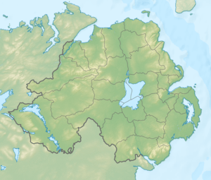 Location in Northern Ireland | |
| Location | County Londonderry, Northern Ireland |
| OSI/OSNI grid | H8188 |
| Topo map | OSNI Discoverer 13 |
Slieve Gallion (from Irish Sliabh gCallann, meaning "mountain of the heights"[1][2]) is a mountain in County Londonderry, Northern Ireland. By road, it is 4 miles (6.4 km) from Moneymore, 8 miles (13 km) from Cookstown, and 8 miles (13 km) from Magherafelt. It is the eastern limit of the Sperrin Mountains range.[3] It has 2 peaks: the southwestern peak at Glenarudda Mountain and Tintagh Mountain reaches a height of 528 metres (1,732 ft), and is the 397th highest peak in Ireland;[2] the northeastern peak reaches a height of 496 metres (1,627 ft), and is the 469th highest peak in Ireland; it is also the furthest-east mountain-top in the Sperrins.[4] The southwestern peak is in Cookstown District, and the northeastern peak is in Magherafelt District.[5] The mountain is part of the parishes of Desertmartin, Lissan and Ballinascreen.
Nature
Slieve Gallion is a volcanic plug.[3] The mountain is formed from volcanic-derived igneous rock, and also granite on the southern slopes. It is steep, and has a flat top. There is a telecommunications mast on the northeastern summit. To the west, the landscape consists of blanket bog and coniferous forest;[3] most of the trees in the Slieve Gallion area are Sitka spruce.[6] There are also lodgepole pine trees, as well as oak towards the south of the area. Animal species living in the area include the Irish hare (a sub-species of the mountain hare[7]), the curlew, and the red grouse. The otter can also be found around nearby rivers.[6] Slieve Gallion is classed by the Northern Ireland Planning Service as an area of "High Scenic Value".[8]
History
Peat formed at Slieve Gallion in the early Holocene period, around 10,000 years ago.[9] The radiocarbon dating of pollen has shown that there were plants in the area 10,000 years ago. 7,000 ago, the number of alder trees steeply increased.[9] In recent decades, there has been an increase in the number of sheep grazing in the area, as well as an increase in mountain biking and hill walking, contributing to erosion.[9]
Sport
A challenge walk/run from the village of Moneymore to the summit of Slieve Gallon took participants through idyllic countryside such as Cairndaisy glen and the Postmans Way. This sadly ended a number of years ago. More recently a mountain race from the foot of Inniscarn Forest to the summit and back has become an annual event which normally takes place on the last Saturday of September or the first Saturday of October. Organised under the Northern Ireland Mountain Running Association, this event attracts some of Northern Ireland's top athletes and hosted the British & Ireland Junior Mountain Running Championships in October 2006. The sports of Hang Gliding and Paragliding use Slieve Gallion. This site is considered a good starting point to go cross country as there is little in the way of airspace restrictions in a down wind direction from its predominate flyable faces.
References
- ↑ Placenames Database of Ireland
- 1 2 "Slieve Gallion". Mountain Views. Retrieved 2008-05-17.
- 1 2 3 "Environment & Heritage Service - Slieve Gallion Landscape". Environment and Heritage Service. Retrieved 2008-05-17.
- ↑ "Slieve Gallion NE Top". Mountain Views. Retrieved 2008-05-17.
- ↑ OS Discoverer Series 13
- 1 2 "Environment & Heritage Service - Slieve Gallion Biodiversity Profile". Environment and Heritage Service. Retrieved 2008-05-17.
- ↑ "Irish hare (Lepus timidus hibernicus)". Environment and Heritage Service. Retrieved 2008-05-17.
- ↑ "Drafy Magherafelt Area Plan 2015". Planning Service NI. Retrieved 2008-05-16.
- 1 2 3 "Slieve Gallion Londonderry". National Museums and Galleries of Northern Ireland. 2003. Retrieved 2008-05-17. horizontal tab character in
|title=at position 15 (help)
Mountains and hills of Ulster | ||
|---|---|---|
| Antrim Hills |  | |
| Antrim Plateau | ||
| Belfast Hills | ||
| Croaghgorms | ||
| Derryveagh | ||
| Inishowen | ||
| Mournes | ||
| Sperrins | ||
| Southwest Donegal | ||
| Others | ||