Didihat
| Didihat डीडीहाट | |
|---|---|
| Town | |
|
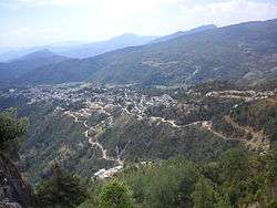
View of Didihat from sherakot | |
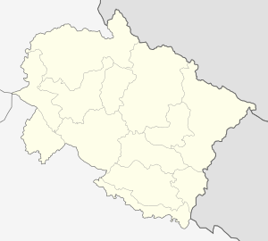 Didihat  Didihat Location of Didihat in India | |
| Coordinates: 29°58′N 80°09′E / 29.97°N 80.15°ECoordinates: 29°58′N 80°09′E / 29.97°N 80.15°E | |
| Country |
|
| State | Uttarakhand |
| Division | Kumaon |
| District | Pithoragarh |
| Area | |
| • Total | 4 km2 (2 sq mi) |
| Elevation | 1,725 m (5,659 ft) |
| Population (2011) | |
| • Total | 6,522 |
| • Density | 1,600/km2 (4,200/sq mi) |
| Languages | |
| • Official | Hindi |
| Time zone | IST (UTC+5:30) |
| PIN | 262551 |
Didihat is a town and a nagar panchayat in Pithoragarh district in the state of Uttarakhand, India.[1] It is one of the eleven administrative subdivisions of Pithoragarh district and also serves as its administrative headquarters.[2] With a population of 6522, Didihat is located at a distance of 520 km (320 mi) from the state capital Dehradun.[3]:681
Didihat is named after Kumauni word 'Dand' meaning a small hillock. Didihat falls on the pilgrimage route to Kailash Mansarovar.[4]
History


The area of present-day Didihat was historically ruled by feudal Raika Malla kings of Sirakot. The ancient Shirakot Temple of Lord Malay Nath was built by the Raika Kings. Till the time of King Hari Malla, this region was under Doti Kingdom of Nepal. Later on in 1581 AD at the time of Chand dynasty ruler Rudra Chand, this region came under the control of Chand rulers defeating Raikas of Doti.[5] Still today some remnants of ancient fort and temples are present in Didihat.
Didihat was a Tehsil in the Almora district of United Provinces in 1947, when India won its Independence from Britain.[6] The Didihat Tehsil, along with other north-eastern parts of Almora district were transferred to the newly created Pithoragarh district in 1960.[7][8] During 2001-2011 new tehsil Berinag was created by transferring 298 villages from Didihat tehsil. The creation of a new district, Didihat was declared on 15 August 2011, by then Chief Minister of Uttarakhand, Ramesh Pokhriyal, however, the district is yet to be officially formed.[9]
Geography
Didihat lies at 29°58′N 80°09′E / 29.97°N 80.15°E in Northern India at 1,725 m (5,659 ft) above sea level, in Pithoragarh district of Uttarakhand, India. It is located at a distance of 54 km (34 mi) from District Headquarter Pithoragarh.[10] It covers an area of 4 km2 (1.5 sq mi). The Nearest city with population of one lakh and more is Haldwani (252 km (157 mi)) while the Nearest city with population of five lakh and more is Bareilly (285 km (177 mi)).
According to the Bureau of Indian Standards, the town falls under seismic zone 5, in a scale of 2 to 5 (in order of increasing vulnerability to earthquakes).[11][12] Didihat has been struck by Flash Flood two times; on 20 July 2003 and 13 August 2007.[13]:15[14] 4 People lost their life in both these disasters.[13]:15[14] Flash floods are very common hydro-meteorological hazards due to excessive rainfall or snowmelt, bursting of dams, cloudburst, etc.[13]:13 Such floods are common due to the high velocity of water with much energetic capacity to carry away everything in its way.[13]:13
Demographics
| Population Growth of Didihat | |||
|---|---|---|---|
| Census | Pop. | %± | |
| 1981 | 2,044 | — | |
| 1991 | 3,514 | 71.9% | |
| 2001 | 4,806 | 36.8% | |
| 2011 | 6,522 | 35.7% | |
| source:[3]:681[15] | |||
According to the 2011 Census of India, the population of Didihat Nagar Panchayat was 6,522. Didihat has a literacy rate of 91.03%; 95.20% of the men and 86.44% of the women are literate. Didihat's sex ratio in 2011 was 889 women per 1000 men. Almost all of the residents of Didihat are native Kumaonis. About 20.55% of the population belongs to the Scheduled Castes, numbering over 1,340 in the 2011 census. In addition, the city is home to some 649 people, who belong to the Scheduled Tribes. Didihat is the native place of 'Rajis', a Scheduled Tribe.[17]:424 Approximately 1,400 people live in slums within the city. Didihat had a population of 4805 according to the 2001 Census[18] and 3514 according to the 1991 Census of India.[19]
Economy
Didihat had traditionally been a place where merchants from adjoining areas brought their goods for sale on a prescribed day of the week.[20] Wool and salt from tibet was exchanged for grain here.[20] The "Kumaon Scheduled Tribes Development Corporation" established a "Carpet Center", a "Blanket Production Center" and a "Wool Production and Sales Center" at Didihat for the all-around economic-development of the Scheduled Tribes living here.[17]:93–94
Culture
Didihat observes a wide range of festivals. Popular celebrations and observances include Kumauni Holi, which is celebrated in different forms such as the Baithki Holi, the Khari Holi and the Mahila Holi. The festival of lights, Deepavali, is celebrated with the lighting of lamps in every house, decorating the floors with rangoli, and sharing of sweets with relatives and Friends. Kumaoni is the mother tongue of majority in Didihat; however a few people speak Hindi also. The dialect of Kumaoni spoken in Didihat is called 'Sirali'.
Tourism
Didihat is a deep Himalayan tourist destination situated 54 km from Pithoragarh. Didihat is situated on the hilltop plain of 'Digtarh' with the river Charamgad (Bhadigad) streaming below. Below the town there is a fertile 'Haat valley'. The small hilly town is full of pure natural beauty with lush green flora at an altitude of 1725 m. In Didihat the famous temple (mandir) is known as Sirakot (Malaynath Mandir) of Lord Shiva (Bholenath). Another famous mandir is situated in the top hill of the nanpaupu village is well known as dechula.
Clear view of Himalayan snow-capped peaks is observed from Didihat, especially Panchachuli and Trishul. Didihat is famous for ancient Shirakot Temple of Lord Malay Nath, built by Raika Kings. Nearby eight km from here, Narayan Swamy Ashram at Narayan Nagar is worth visiting. Regional Headquarters of ITBP is situated at Merthi at 6 km from Didihat. Askot Musk Deer Sanctuary is administratively situated in Didihat Tehsil.
About 53 km from Didihat, the small hilly town Berinag is well known for its pure natural beauty. Berinag is well known for its nag mandirs. One small tea garden also there. The one of the most famous gufa is known as "Patal Bhuvaneshwar", this is related to "Pandavas" Dwapar Yuga.
Administration
Didihat is a Class-V town and a nagar panchayat in Pithoragarh district in the state of Uttarakhand, India.[3]:681 The Didihat city is divided into 4 wards for which elections are held every 5 years. Didihat Nagar Panchayat has a committee consisting of a chairman with ward members. Membership consists of a minimum of ten elected ward members and three nominated members. The Notified Area Committee members of the Nagar Panchayat are elected from the several wards of the Nagar Panchayat on the basis of adult franchise for a term of five years. Two Non-Notified Slums exist in Didihat; Nai Basti having 150 households and G.I.C. Ward with 180 households.[3]:686
Administratively it is also a tehsil and a subdivision of the Pithoragarh district.[21] Tehsil Didihat is divided into three developmental blocks—Didihat, Kanalichhina, and Berinag. Didihat tehsil is the second most populous tehsil in Pithoragarh and has the highest number of villages. There are about 367 villages in Didihat Tehsil.[22]
Transport
.jpg)
Buses form the main form of Transport that connect the town to national capital Delhi and other cities. Buses are either run by state controlled Uttarakhand Transport Corporation or private K.M.O.U. Nearest Railway station is Tanakpur (210 km (130 mi))
Education
Didihat had a literacy rate of 79% in 2001 which rose to 91.03 percent in 2011. As of 2011, literacy rate among male and female were 95.20 and 86.44 percent respectively.[16]:23 Schools in Didihat are run either by the municipal corporation, or privately by entities, trusts and corporations. The majority of schools are affiliated with the Uttarakhand Board of School Education, although some are affiliated with the Central Board for Secondary Education, Council for the Indian School Certificate Examinations and National Institute of Open Schooling.
References
- ↑ District Nagar Panchayat, Nagar Panchayats in Uttarakhand (PDF). Retrieved 1 November 2016.
- ↑ Indusnettechnologies, Goutam Pal, Dipak K S, SWD. "District Profile: District of Pithoragarh , Uttarakhand, India". pithoragarh.nic.in. Retrieved 18 October 2016.
- 1 2 3 4 District Census Handbook Pithoragarh Part-A (PDF). Dehradun: Directorate of Census Operations, Uttarakhand. Retrieved 17 October 2016.
- ↑ Chamaria, Pradeep. Kailash Manasarovar on the Rugged Road to Revelation. Abhinav Publications. p. 41. ISBN 9788170173366. Retrieved 26 October 2016.
- ↑ Rawat, Ajay Singh. Forest Management in Kumaon Himalaya: Struggle of the Marginalised People. Indus Publishing. p. 30. ISBN 9788173871016.
- ↑ Times World Atlas, 1967 Edition, Plate 30
- ↑ Aggarwal, J. C.; Agrawal, S. P. Uttarakhand: Past, Present, and Future. Concept Publishing Company. p. 331. ISBN 9788170225720.
- ↑ Bhat, G. D. Empowerment and Status of Rural Women: A Central Himalayan Perspective. M.D. Publications Pvt. Ltd. p. 3. ISBN 9788175330740.
- ↑ "Uttarakhand CM announces four new districts". Dehradun: Zee News. PTI. 15 August 2011. Retrieved 28 October 2016.
- ↑ Silas, Sandeep. Discover India by Rail. Sterling Publishers Pvt. Ltd. p. 50. ISBN 9788120729391. Retrieved 26 October 2016.
- ↑ Hazard profiles of Indian districts (PDF). National Capacity Building Project in Disaster Management, UNDP. Retrieved 17 October 2016.
- ↑ "Complete sdmap, Uttarakhand" (PDF). Retrieved 26 October 2016.
- 1 2 3 4 "NIDM, Uttarakhand - National Disaster Risk Reduction Portal" (PDF). Retrieved 26 October 2016.
- 1 2 SEOC Data, 2011. State Emergency Operation Centre, Disaster Management and Mitigation Centre, Govt. of Uttarakhand
- ↑ Pradesh, India Director of Census Operations, Uttar; Sinha, Dharmendra Mohan. District Census Handbook: Series 21, Uttar Pradesh.
- 1 2 District Census Handbook Pithoragarh Part-b (PDF). Dehradun: Directorate of Census Operations, Uttarakhand. Retrieved 17 October 2016.
- 1 2 Verma, Mahendra Mohan. Tribal Development in India: Programmes and Perspectives. Mittal Publications. ISBN 9788170996606. Retrieved 26 October 2016.
- ↑ "Census of India 2001: Data from the 2001 Census, including cities, villages and towns (Provisional)". Census Commission of India. Archived from the original on 2004-06-16. Retrieved 2008-11-01.
- ↑ "Didihat (Pithoragarh, Uttarakhand, India) - Population Statistics and Location in Maps and Charts". www.citypopulation.de. Retrieved 24 October 2016.
- 1 2 Sharma, Veena. Kailash Manasarovar: A Sacred Journey. Roli Books Private Limited. ISBN 9789351940210. Retrieved 26 October 2016.
- ↑ Budhwar, Prem K. The Call of the Mountains: Uttrakhand Explored. Har-Anand Publications. p. 101. ISBN 9788124115299.
- ↑ "List of Villages in Didihat Tehsil | villageinfo.in". villageinfo.in. Retrieved 28 October 2016.