Berinag
| Berinag बीणाग | |
|---|---|
| hill station | |
 Berinag  Berinag Location in Uttarakhand, India | |
| Coordinates: 29°48′N 80°04′E / 29.80°N 80.07°ECoordinates: 29°48′N 80°04′E / 29.80°N 80.07°E | |
| Country |
|
| State | Uttarakhand |
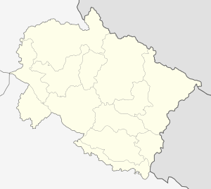
| District | Pithoragarh |
| Elevation | 1,860 m (6,100 ft) |
| Languages | |
| • Official | Hindi |
| Time zone | IST (UTC+5:30) |
| Vehicle registration | UK |
| Website |
uk |
Berinag, is a hill station, located 12 km from Chaukori in the Pithoragarh district, which is the easternmost Himalayan district in the state of Uttarakhand, India. It is one of the six Administrative Subdivisions (tehsil) of Pithoragarh.[1] It is accessible by road. Closest prominent villages include Garawon, Dhanoli, Bana, Bhattigaon, Banoli,Quarali,Tripuradevi and Sangarh. Previously known as Bedinag, it is famous for the snake temples present here. Berinag offers a panoramic view of the Greater Himalayas, from Garhwal Himalayas to the Nepal ranges, especially lofty peaks like Panchachuli and Nanda Devi. The region is famous for tea estates developed during the British rule.
Geography
Berinag is located at 29°48′N 80°04′E / 29.80°N 80.07°E.[2] It has an average elevation of 1,860 metres (6,100 feet).
Transport
- Nearest airport is Naini Saini, Pithoragarh : 112 km.
- Nearest rail station is Kathgodam : 214 km.
- Chaukori is well connected by road with Almora-100 k, Nainital-183 km, Bageshwar-56 km, Pithoragarh-85 km[3]
Image Gallery
-

The Panchchuli as seen from Berinag, 2015
-

a Himalayan peak
-

The Panchchuli as seen from Berinag, 2016
Notes
- ↑ "Tehsils in Pithoragarh District, Uttarakhand". www.census2011.co.in. Retrieved 3 October 2016.
- ↑ Falling Rain Genomics, Inc - Berinag
- ↑ "Chaukori". Retrieved 2006-09-24.
External links
- Pithoragar district website
- Map and photos of area
- Temples in the general area
- {https://web.archive.org/web/20130808094323/http://BerinAg.com Tourist website ]