Trisul

| Trishul (त्रिशूल) | |
|---|---|
 Trishul from Bedini Bugyal | |
| Highest point | |
| Elevation | 7,120 m (23,360 ft) [1][2] |
| Prominence | 1,616 m (5,302 ft) [3] |
| Listing | Ultra |
| Coordinates | 30°18′46″N 79°46′38″E / 30.31278°N 79.77722°ECoordinates: 30°18′46″N 79°46′38″E / 30.31278°N 79.77722°E [1] |
| Geography | |
 Trisul India | |
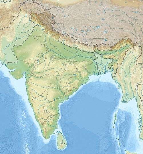
| Location | Bageshwar, Uttarakhand, India |
| Parent range | Kumaun Himalaya |
| Climbing | |
| First ascent | 12 June 1907 by Tom Longstaff, A. Brocherel, H. Brocherel, Karbir[4] |
| Easiest route | Northeast flank/north ridge: snow/glacier climb |
Trisul (Hindi: त्रिसूल) is a group of three Himalayan mountain peaks of western Kumaun, with the highest (Trisul I) reaching 7120m. The three peaks resemble a trident - in Hindi/Sanskrit, Trishula, trident, is the weapon of Shiva. The Trishul group forms the southwest corner of the ring of peaks enclosing the Nanda Devi Sanctuary, about 15 kilometres (9 mi) west-southwest of Nanda Devi itself. The main peak, Trisul I, was the first peak over 7,000 m (22,970 ft) to have ever been climbed, in 1907.
Description of the massif and neighboring peaks
The three peaks are named Trisul I, Trisul II, and Trisul III. The massif is a north-south ridge, with Trisul I at the north end and Trisul III at the south. The massif runs roughly North-South, and hence appears compressed when viewed from the south (Ranikhet, Kausani), and more stretched out from the Southeast (Chamoli, Bedini Bugyal).
Nanda Ghunti lies a few kilometers to the northwest, while Mrigthuni is just to the southeast.
| Mountain | Height (m) | Height (ft) | Coordinates | Prominence (m) | First ascent |
|---|---|---|---|---|---|
| Trisul I | 7,120 | 23,359 | 30°18′46″N 79°46′38″E / 30.31278°N 79.77722°E | 1616 | 1907 |
| Trisul II | 6,690[5] | 21,949 | 30°17′24″N 79°46′12″E / 30.29000°N 79.77000°E[6] | <200[7] | 1960 |
| Trisul III | 6,007 | 19,708 | 30°15′00″N 79°46′12″E / 30.25000°N 79.77000°E | <200[7] | 1960 |
Climbing history
Trisul I
.JPG)

T. G. Longstaff made the first climbing reconnaissance of Trisul, in September 1905, focussing on the western and southern sides. He returned in 1907 with two other Britons, three Alpine guides, and a number of Gurkhas. They ascended through the Rishiganga valley, to the north of the peak, onto the Trisul Glacier, which lies on the east side. From there they climbed the northeast flank to the north ridge, reaching the summit on 12 June. At the time Trisul was probably the highest mountain to have been climbed.[8] The climb was noted also for the first use of supplementary oxygen in a major climb. [9] During the 1950s Harold Williams led Indian Army expeditions to the summit.
Routes on the west face and south ridge of Trisul I have also been climbed. The west face was first ascended in 1976; this was the first ascent of the main summit not using the first-ascent route.
Trisul II and III
Trisul II and Trisul III were first climbed in 1960 by the Yugoslav team JAHO I. They climbed from the Bidalgwar glacier, achieving the summit of Trisul II via the southern ridge and Trisul III via the north ridge.
Another Yugoslav expedition made the first traverse of the three peaks in 1987, and two members paraglided from the summit.
Trivia
Aleš Kunaver was a member of the first Yugoslav team which climbed Trisul in 1960. In 1987, his daughter Vlasta Kunaver climbed Trisul I and was one of the paragliders.
Access
The Trisul massif can be accessed via the following route: Almora - Kausani - Garur- Gwaldam - Debal - Bagargad - Wan - Bedini Bugyal - Kalu Vinayak - Roopkund - Trisul.
References
- 1 2 H. Adams Carter, "Classification of the Himalaya", American Alpine Journal, 1985, p. 137.
- ↑ Some sources give 7,172 m (23,530 ft).
- ↑ "High Asia I: The Karakoram, Pakistan Himalaya and India Himalaya (north of Nepal)". Peaklist.org. Retrieved 2014-05-28.
- ↑ Jill Neate, High Asia: An Illustrated History of the 7000 Metre Peaks, ISBN 0-89886-238-8.
- ↑ This elevation is from the Himalayan Index. Some sources give 6,660 m (21,850 ft).
- ↑ From the Himalayan Index.
- 1 2 Garhwal-Himalaya-Ost (1:150,000 scale topographic map), Swiss Foundation for Alpine Research, 1992; based on maps by the Survey of India.
- ↑ Mason, Kenneth (1955). Abode of the Snow. Rupert Hart-Davis. p. 117. Reprinted 1987 by Diadem Books, ISBN 978-0-906371-91-6
- ↑ John B. West (May 2003). "George I. Finch and his pioneering use of oxygen for climbing at extreme altitudes". J. Applied Physiology. 94 (5): 1702–1713. Quote: "The first use of supplementary oxygen in the Himalayas was apparently in 1907 when A. L. Mumm, Thomas Longstaff, and Charles Bruce went to the Garhwal and made the first ascent of Trisul (7,127 m), which remained the highest summit to be climbed for 21 years."
Other sources
- This My Voyage by T. G. Longstaff.
- Across Peaks and Passes of Kumaun Himalayas by Harish Kapadia.
| Wikimedia Commons has media related to Trisul. |