Des Arc, Missouri
| Des Arc, Missouri | |
|---|---|
| Village | |
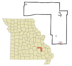 Location of Des Arc, Missouri | |
| Coordinates: 37°17′3″N 90°38′6″W / 37.28417°N 90.63500°WCoordinates: 37°17′3″N 90°38′6″W / 37.28417°N 90.63500°W | |
| Country | United States |
| State | Missouri |
| County | Iron |
| Area[1] | |
| • Total | 0.21 sq mi (0.54 km2) |
| • Land | 0.21 sq mi (0.54 km2) |
| • Water | 0 sq mi (0 km2) |
| Elevation | 551 ft (168 m) |
| Population (2010)[2] | |
| • Total | 177 |
| • Estimate (2012[3]) | 173 |
| • Density | 842.9/sq mi (325.4/km2) |
| Time zone | Central (CST) (UTC-6) |
| • Summer (DST) | CDT (UTC-5) |
| ZIP code | 63636 |
| Area code(s) | 573 |
| FIPS code | 29-19198[4] |
| GNIS feature ID | 0716847[5] |
Des Arc is a village in Iron County, Missouri, United States. The population was 177 at the 2010 census.
History
Des Arc was laid out in 1871.[6] According to folk etymology, Des Arc, meaning "the bend", was so named from a big bend in the railroad at the town site.[7] However, the State Historical Society of Missouri believes the name may be a corrupton of aux arcs, the origin of the name Ozarks.[6] A post office called Des Arc has been in operation since 1871.[8]
Geography
Des Arc is located at 37°17′03″N 90°38′06″W / 37.284235°N 90.635063°W.[9]
According to the United States Census Bureau, the village has a total area of 0.21 square miles (0.54 km2), all of it land.[1]
Demographics
| Historical population | |||
|---|---|---|---|
| Census | Pop. | %± | |
| 1880 | 94 | — | |
| 1890 | 413 | 339.4% | |
| 1900 | 180 | −56.4% | |
| 1910 | 287 | 59.4% | |
| 1920 | 167 | −41.8% | |
| 1930 | 152 | −9.0% | |
| 1940 | 399 | 162.5% | |
| 1950 | 376 | −5.8% | |
| 1960 | 275 | −26.9% | |
| 1970 | 222 | −19.3% | |
| 1980 | 237 | 6.8% | |
| 1990 | 173 | −27.0% | |
| 2000 | 187 | 8.1% | |
| 2010 | 177 | −5.3% | |
| Est. 2015 | 166 | [10] | −6.2% |
2010 census
As of the census[2] of 2010, there were 177 people, 68 households, and 46 families residing in the village. The population density was 842.9 inhabitants per square mile (325.4/km2). There were 86 housing units at an average density of 409.5 per square mile (158.1/km2). The racial makeup of the village was 94.92% White, 1.69% Black or African American, 0.56% Native American, and 2.82% from two or more races.
There were 68 households of which 38.2% had children under the age of 18 living with them, 51.5% were married couples living together, 11.8% had a female householder with no husband present, 4.4% had a male householder with no wife present, and 32.4% were non-families. 30.9% of all households were made up of individuals and 10.3% had someone living alone who was 65 years of age or older. The average household size was 2.60 and the average family size was 3.20.
The median age in the village was 40.1 years. 28.2% of residents were under the age of 18; 7.3% were between the ages of 18 and 24; 19.7% were from 25 to 44; 31% were from 45 to 64; and 13.6% were 65 years of age or older. The gender makeup of the village was 48.0% male and 52.0% female.
2000 census
As of the census[4] of 2000, there were 187 people, 74 households, and 52 families residing in the village. The population density was 889.6 people per square mile (343.8/km²). There were 85 housing units at an average density of 404.4 per square mile (156.3/km²). The racial makeup of the village was 98.93% White, 0.53% Native American, and 0.53% from two or more races.
There were 74 households out of which 33.8% had children under the age of 18 living with them, 56.8% were married couples living together, 9.5% had a female householder with no husband present, and 28.4% were non-families. 23.0% of all households were made up of individuals and 10.8% had someone living alone who was 65 years of age or older. The average household size was 2.53 and the average family size was 3.00.
In the village the population was spread out with 27.8% under the age of 18, 2.7% from 18 to 24, 28.3% from 25 to 44, 21.4% from 45 to 64, and 19.8% who were 65 years of age or older. The median age was 39 years. For every 100 females there were 96.8 males. For every 100 females age 18 and over, there were 98.5 males.
The median income for a household in the village was $22,917, and the median income for a family was $23,750. Males had a median income of $37,083 versus $15,000 for females. The per capita income for the village was $10,461. About 26.6% of families and 29.1% of the population were below the poverty line, including 33.9% of those under the age of 18 and 20.0% of those 65 or over.
References
- 1 2 "US Gazetteer files 2010". United States Census Bureau. Retrieved 2012-07-08.
- 1 2 "American FactFinder". United States Census Bureau. Retrieved 2012-07-08.
- ↑ "Population Estimates". United States Census Bureau. Retrieved 2013-05-30.
- 1 2 "American FactFinder". United States Census Bureau. Retrieved 2008-01-31.
- ↑ "US Board on Geographic Names". United States Geological Survey. 2007-10-25. Retrieved 2008-01-31.
- 1 2 "Iron County Place Names, 1928–1945 (archived)". The State Historical Society of Missouri. Retrieved 11 October 2016.
- ↑ Eaton, David Wolfe (1916). How Missouri Counties, Towns and Streams Were Named. The State Historical Society of Missouri. p. 176.
- ↑ "Post Offices". Jim Forte Postal History. Retrieved 11 October 2016.
- ↑ "US Gazetteer files: 2010, 2000, and 1990". United States Census Bureau. 2011-02-12. Retrieved 2011-04-23.
- ↑ "Annual Estimates of the Resident Population for Incorporated Places: April 1, 2010 to July 1, 2015". Retrieved July 2, 2016.
- ↑ "Census of Population and Housing". Census.gov. Retrieved June 4, 2015.
Municipalities and communities of Iron County, Missouri, United States | ||
|---|---|---|
| Cities | 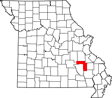 | |
| Village | ||
| Townships | ||
| Unincorporated communities | ||
| Ghost towns | ||
| Footnotes | ‡This populated place also has portions in an adjacent county or counties | |