List of county routes in Suffolk County, New York (26–50C)
|
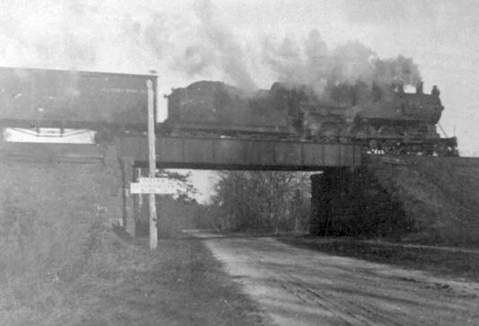
Suffolk County Road 47 begins at NY 27A in Copiague. | |
| Highway names | |
|---|---|
| Interstates: | Interstate X (I-X) |
| US Highways: | U.S. Route X (US X) |
| State: | New York State Route X (NY X) |
| County: | County Route X (CR X) |
| System links | |

County routes in Suffolk County, New York, are maintained by the Suffolk County Department of Public Works and signed with the Manual on Uniform Traffic Control Devices-standard yellow-on-blue pentagon route marker. The designations do not follow any fixed pattern. Routes 26 to 50 (including former suffixed routes of CR 50) are listed below.
County Route 26
| |
|---|---|
| Location: | Mattituck–Cutchogue |
| Length: | 4.7 mi[1] (7.6 km) |
| Existed: | 1930–present |
County Route 26 is the designation for New Suffolk Road from Mattituck to New Suffolk, and New Suffolk Lane from New Suffolk to Cutchogue. However this designation was proposed to be relocated to the formerly proposed North Brookhaven Expressway, a former eastern extension of NY 347 from Mount Sinai to Wading River.
- Route description
CR 26 begins at NY 25 just southwest of the eastern terminus of Sound Avenue. It begins as New Suffolk Avenue, which is surrounded mostly spares houses and farmland. The road passes by the south side of Marratooka Pond, and then the north side of Mattituck Airport. The road then crosses Deep Hole Creek then Downs Creek before passing south of the North Fork Country Club.
In New Suffolk, CR 26 is lined with houses as it approaches the intersection of Fifth Street and Main Street, and immediately turns north onto Fifth Street. Main Street continues east toward the Cutchogue Harbor, while Southbound 5th Street continues toward Great Peconic Bay north of Robin's Island. 5th Street is paved with old concrete, compared to New Suffolk Lane. At Orchard Street Fifth Street becomes New Suffolk Road where it then passes the New Suffolk Shipyard.
As CR 26 intersects with George Road it enters Cutchogue. Eventually it passes by some farmland as it takes a slight reverse curve to the left then returns north. The farmland surrounding the road is replaced by early 20th-century houses once again. Residential zoning ends at the Cutchogue Fire Department and the road finally ends at NY 25.
- Major intersections
| Location | mi[1] | km | Destinations | Notes | |
|---|---|---|---|---|---|
| Mattituck | 0.00 | 0.00 | |||
| New Suffolk | 3.20 | 5.15 | Main Street / 5th Street | Route direction changes from east/west to north/south | |
| Cutchogue | 4.70 | 7.56 | |||
| 1.000 mi = 1.609 km; 1.000 km = 0.621 mi | |||||
County Route 27
| |
|---|---|
| Location: | Mattituck–Greenport |
| Existed: | 1930–1980s |
County Route 27 was the original designation for Middle Road on the North Fork of Long Island. This road is now known as CR 48.
County Route 27A
| |
|---|---|
| Location: | Mattituck–East Mattituck |
| Existed: | 1960s–1960s |
County Route 27A was a newer section of Middle Road in Mattituck called New Middle Road. It was merged into CR 27 before that route was replaced by CR 48.
County Route 27B
| |
|---|---|
| Location: | Mattituck–East Mattituck |
| Existed: | 1960s–1960s |
County Route 27B was Wickham Avenue, a former segment of Middle Road that is now owned by the town of Southold.
County Route 28
| |
|---|---|
| Location: | North Lindenhurst–Melville |
| Length: | 5.4 mi[2] (8.7 km) |
County Route 28 is a north-south road in southwestern Suffolk County known as New Highway and Republic Road. Officially designated as the Corporal Tony Casamento Highway, the road is a four-lane undivided highway between NY 27 and the interchange with Southern State Parkway where it narrows down to two lanes.
- Route description
The road begins at NY 27 just west of the intersection of CR 3 (Straight Path), and an Educational Bus Transport garage for school buses and intercity buses of Suffolk County Transit. This section of the road then curves towards the old section which runs along Trinity Cemetery, the site of the former Zahn's Airport, and behind the Sisters of St. Dominic Motherhouse Complex, which was previously known as the Queen of the Rosary Academy. After bi-secting Albany Avenue, the road approaches an at-grade crossing of the Central Branch of the Long Island Rail Road and immediately intersects NY 109.
North of NY 109, CR 28 runs along the western edge of the Cemetery zone of Southwestern Suffolk County. Mount Ararat Cemetery is on the opposite side of the Southern State Parkway interchanges with both NY 109 and CR 28. At the Southern State interchange, the road narrows down from a four-lane undivided highway to two lanes and the east side of the road contains the Roman Catholic Church Diocese of Brooklyn Cemetery from Southern State Parkway to the Main Line of the LIRR, and also winds around a runway and the grounds of Republic Airport on the west side. After crossing the LIRR Main Line CR 28 runs along the western border of Pinelawn Cemetery.
When CR 28 leaves the cemetery zone, it enters an industrial area. The road intersects Conklin Street, which runs along the airport's northern border to NY 24, as well as Marcus Drive, where the road changes names to become Republic Road. Republic Road terminates at CR 5 (Ruland Road) in Melville; however, just to the east of this terminus is a de facto extension called Maxess Road, which leads to the eastbound service road of the Long Island Expressway between NY 110 and CR 3 (Pinelawn Road).[3]
- Major intersections
| Location | mi[3] | km | Destinations | Notes | |
|---|---|---|---|---|---|
| North Lindenhurst | 0.00 | 0.00 | |||
| East Farmingdale | 1.80 | 2.90 | |||
| 1.90 | 3.06 | Exit 34 on Southern Parkway | |||
| 4.00 | 6.44 | Conklin Street | To NY 24 | ||
| Melville | 5.40[2] | 8.69 | Ruland Road (CR 5) | ||
| 1.000 mi = 1.609 km; 1.000 km = 0.621 mi | |||||
County Route 29
| |
|---|---|
| Location: | Bohemia–Ronkonkoma |
| Length: | 1.8 mi[4] (2.9 km) |
County Route 29 is an unsigned county route connecting CR 93 to the Long Island Expressway. The road was being widened around the period that Ronkonkoma Station was facing major reconstruction itself, and included a replacement for the wooden bridge that previously crossed over the Main Line of the Long Island Rail Road. The CR 29 signs were installed between 1989 and 1995, but have since been taken down.
Within the town of Islip, the road is named Smithtown Avenue. After it crosses the Main Line of the Long Island Rail Road and simultaneously the Islip–Brookhaven town line, it becomes Ronkonkoma Avenue, a name that continues north of the terminus of I-495 until it reaches Hawkins Avenue in Lake Ronkonkoma.
- Major intersections
| Location | mi[4] | km | Destinations | Notes | |
|---|---|---|---|---|---|
| Bohemia | 0.00 | 0.00 | |||
| 1.30 | 2.09 | Railroad Avenue – LIRR Commuter Parking | |||
| Ronkonkoma | 1.50 | 2.41 | Johnson Avenue – LIRR Commuter Parking | ||
| 1.80 | 2.90 | Exit 60 (I-495) | |||
| 1.000 mi = 1.609 km; 1.000 km = 0.621 mi | |||||
County Route 30
| |
|---|---|
| Location: | Montauk |
| Length: | 2.9 mi[5] (4.7 km) |
| Existed: | 1979–present |
County Route 30 is the north-south road along the east side of Lake Montauk, hence the name East Lake Drive. The east side of this road consists of parts of Theodore Roosevelt County Park (formerly Montauk County Park), a residential enclave, and Montauk Airport. The road terminates at the a parking lot north of the Inlet Seafood Restaurant on the Block Island Sound.
- Major intersections
| mi[5] | km | Destinations | Notes | ||
|---|---|---|---|---|---|
| 0.00 | 0.00 | ||||
| 2.20 | 3.54 | ||||
| 2.90 | 4.67 | Block Island Sound | Dead end | ||
| 1.000 mi = 1.609 km; 1.000 km = 0.621 mi | |||||
County Route 31
| |
|---|---|
| Location: | Westhampton Beach–Riverside |
| Length: | 4.0 mi[2][6] (6.4 km) |
| Existed: | 1930–present |
County Route 31 is a short north-south county highway running across rural eastern Suffolk County. The road serves as a connection between Westhampton Beach and the Riverhead area, feeding directly into CR 104 as it makes its way north.
- Route description
The road begins at Montauk Highway (CR 80), just north of the downtown area of Westhampton Beach. It serves in function as a continuation of Oak Street, which heads south to connect with the town's main street before crossing over to the Dune Road beaches.
Heading north, this arrow-straight portion of the road crosses the Long Island Rail Road's Montauk Branch railroad tracks and then runs through the grounds of Francis S. Gabreski Airport, a former base of the United States Air Force, which is now home to the 106th Rescue Wing of the New York Air National Guard.
North of the base, the road continues through a section of the Long Island Central Pine Barrens, which feature the indigenous dwarf pine. This area fell victim to a widespread wildfire that burned a significant portion of the core of the Pine Barrens in 1995. The section of CR 31 within the village of Westhampton Beach is ceremoniously dedicated "Volunteers Way" in honor of volunteer first responders to the Sunrise Fire.
The road widens as it crosses NY 27, with which it has a full cloverleaf interchange. About one-half mile beyond this interchange, the road ends at a wye intersection (now converted into a traffic circle with CR 104.
- History
Between January 18, 1961 and May 23, 1972, CR 31 was extended south of Montauk Highway between Oak Street and Mill Road (formerly CR 100). Mill Road was intended to be converted into part of the formerly proposed Port Jefferson–Westhampton Beach Highway.
- Major intersections
| Location | mi[6] | km | Destinations | Notes | |
|---|---|---|---|---|---|
| Westhampton Beach | 0.00 | 0.00 | |||
| Westhampton | 1.50 | 2.41 | |||
| 3.20 | 5.15 | Exit 63 on NY 27 | |||
| Riverside | 4.00 | 6.44 | Traffic circle | ||
| 1.000 mi = 1.609 km; 1.000 km = 0.621 mi | |||||
County Route 32
| |
|---|---|
| Location: | Hampton Bays–Flanders |
| Length: | 3.21 mi[2] (5.17 km) |
| Existed: | 1930–present |
County Route 32 is Ponquogue Road, the main two-lane highway between Ponquogue Point on Westhampton Beach Barrier Island and downtown Hampton Bays.
- Route description
CR 32 begins at Dune Road at Ponquogue Point, where it immediately crosses the Ponquogue Bridge over Shinnecock Bay. After doing this, it becomes Light House Road, and then shifts over to Porter Road which terminates at Shinnecock Avenue. CR 32 then takes a left turn onto Shinnecock Avenue, moving west for a few blocks until reaching the intersection of Ponquogue Avenue, where it makes a right turn and heads north again.
The grade crossing of the Montauk Branch of the Long Island Rail Road and the immediate intersection with Good Ground Road serve as the east side of the Hampton Bays Railroad Station. CR 32 and Ponquogue Avenue terminate at CR 80 (Montauk Highway). North of CR 80 however, the road turns into Squiretown Road, then runs underneath Sunrise Highway, but not before taking Old Riverhead Road with it momentarily. After crossing under Sunrise Highway, Old Riverhead Road branches off to the west on a new section that goes around Sunrise before reuniting with the original section. Meanwhile, Squiretown Road curves back to the north as it enters the former hamlet that the road was named after. Within Squiretown itself, Squiretown Road becomes Red Creek Road at the intersection of Newtown Road, then begins to make a northwest turn along the edge of the Great Peconic Bay. From there it passes by Camp Tekawitha, a former Nassau County Girl Scout Camp that became Suffolk County preserved land in 2007.
The road turns west as it enters Flanders. Just after it runs between Red Creek Pond and Wehrman Pond, it splits into Upper Red Creek Road and Lower Red Creek Road, where they both enter Hubbard County Park, and turn south, although not simultaneously. Upper Red Creek Road continues westward a bit longer until it approaches the east bank of Hubbard Creek and then turns south, while Lower Red Creek Road remains inland and runs closer to Penny Pond. Both segments will remain in Hubbard County Park for the rest of their existence. Upper and Lower Red Creek Roads intersect once again, north of the bridge over Hubbard Creek, before the road turns southwest as it finally terminates at NY 24.[7]
- History
The formerly proposed Ponquogue Causeway was intended to either run parallel to or replace CR 32 between the 1930s and 1960s.
- Major intersections
| Location | mi[7] | km | Destinations | Notes | |
|---|---|---|---|---|---|
| Hampton Bays | 0.00 | 0.00 | Dune Road (CR 89) | ||
| 0.20– 0.80 | 0.32– 1.29 | Ponquogue Bridge over Shinnecock Bay | |||
| 3.40 | 5.47 | ||||
| 4.70 | 7.56 | Newton Road east | To CR 62 | ||
| Flanders | 8.10 | 13.04 | |||
| 1.000 mi = 1.609 km; 1.000 km = 0.621 mi | |||||
County Route 32A
| |
|---|---|
| Location: | Hampton Bays |
| Existed: | 1943–1960s |
County Route 32A was concurrent with CR 32 from Montauk Highway to the LIRR station.
County Route 32B
| |
|---|---|
| Location: | Westhampton Beach Barrier Island–Ponquogue |
| Existed: | 1943–1960s |
County Route 32B was Foster Avenue and the former Ponquogue Bridge. It was integrated with CR 32.
County Route 33
| |
|---|---|
| Location: | Amagansett–Napeague |
| Length: | 3.8 mi[8] (6.1 km) |
| Existed: | 1930–present |
County Route 33 is Cranberry Hole Road, Promised Land Road, and Napeague Meadow Road.
CR 33 begins in Amagansett at the intersection of NY 27 (Montauk Point State Parkway) and Bluff Road as Cranberry Hole Road, and is carried over a bridge above the Montauk Branch of the Long Island Rail Road, the easternmost LIRR bridge to exist. The name Cranberry Hole Road continues until the intersection with Bendigo Road (former CR 33A and unmarked CR 74). From there it becomes Promised Land Road. Both segments run along the northern edge of Napeague State Park, and continues to run through the park even as it turns southeast onto Napeague Meadow Road. Promised Land Road continues northeast as Lazy Point Road where it enters "downtown" Napeague.
The route crosses the LIRR Montauk branch for the second time, but this time it is at an at-grade crossing, where it enters a section of Napeague formerly known as East Hampton Beach, before finally terminating at Montauk Point State Parkway.
- Major intersections
| Location | mi[8] | km | Destinations | Notes | |
|---|---|---|---|---|---|
| Amagansett | 0.00 | 0.00 | |||
| Napeague | 1.00 | 1.61 | Bendigo Road north (CR 74) | Southern terminus of CR 74 | |
| 3.80 | 6.12 | ||||
| 1.000 mi = 1.609 km; 1.000 km = 0.621 mi | |||||
County Route 33A
| |
|---|---|
| Location: | Amagansett–Napeague |
| Length: | 2.44 mi[2] (3.93 km) |
| Existed: | 1930–1960s |
County Route 33A was for Abrahams Landing Road and Bendigo Road. It was a former suffixed route of CR 33, that is now unmarked CR 74.
County Route 34
| |
|---|---|
| Location: | Babylon–North Babylon |
| Length: | 2.3 mi[9] (3.7 km) |
| Existed: | 1970–present |
County Route 34 is Deer Park Avenue in the Village of Babylon and North Babylon. It was a former segment of CR 35 that was established in 1970 when the New York State Department of Transportation created what was intended to be a temporary alignment of NY 231.
Babylon village maintains the section of CR 34 within the village. Here, CR 34 is the eastern terminus of CR 12 on the southeast corner of Babylon Station, and after crossing under the Babylon–Montauk Branch of the Long Island Rail Road, instantly intersects the western terminus of CR 50.
Outside of the village limits, CR 34 crosses over Sunrise Highway as part of exit 40, which is primarily for NY 231 to the east. Though CR 34 terminates at NY 231 in Deer Park, just south of the Southern State Parkway's exit 39, Deer Park Avenue continues northward as NY 231 well into Dix Hills.
Before its current designation, CR 34 was assigned to Greenlawn Road, today a portion of CR 9 along with Cuba Hill Road, until the late 1960s.
- Major intersections
| Location | mi[9] | km | Destinations | Notes | |
|---|---|---|---|---|---|
| Village of Babylon | 0.00 | 0.00 | |||
| 0.30 | 0.48 | Railroad Avenue west (CR 12) | Eastern terminus of CR 12 | ||
| 0.40 | 0.64 | Brief concurrency with CR 50 | |||
| North Babylon | 1.40 | 2.25 | Access via local roads; exit 40 (NY 27) | ||
| 2.30 | 3.70 | Deer Park Avenue continues north along NY 231 | |||
1.000 mi = 1.609 km; 1.000 km = 0.621 mi
| |||||
County Route 35
| |
|---|---|
| Location: | Dix Hills–Halesite |
| Length: | 6.60 mi[10] (10.62 km) |
| Existed: | 1930–present |
County Route 35 serves as a de facto extension of NY 231. It spans from the northern terminus of NY 231 and runs northwest to NY 110 in Halesite. The road originally included NY 231 and CR 34 until 1970, when the New York State Department of Transportation turned the segment between Southern and Northern State Parkways into the temporary alignment of NY 231, before the hopeful transfer of the road onto the formerly proposed Babylon–Northport Expressway (BNE). The south end of CR 35 and CR 66 and the north end of NY 231 was intended to include a formerly proposed North Deer Park Avenue Spur leading to the unbuilt BNE.[11]
- Route description
The segment of CR 35 between NY 231 and NY 25 is four-lanes wide and is known as Deer Park Road West, as opposed to CR 66, which is known as Deer Park Road East. CR 35 is the last intersection with Old Country Road before both move north and intersect with NY 25. After this CR 35 narrows down to two lanes, where it becomes Park Avenue and turns to the northwest at the 2nd Precinct of the Suffolk County Police Department before intersecting with CR 86 near Dix Hills. At the north end of Dix Hills Road, the road narrows down to two lanes and contains frontage roads for residences. From there the road serves as the east end of Mapelwood Road where it briefly overlaps with New York State Bicycle Route 25A until it reaches the west end of Little Plains Road, which is a block away from Little Plains Park.[10]
The road briefly becomes four lanes wide again at the intersection of CR 11, but narrows back down to two lanes. Continuing northwest, CR 35 has a grade crossing of the Port Jefferson Branch of the Long Island Rail Road, which has been the site of many tractor-trailer accidents, and was the original location for the first "Low Ground Clearance" warning sign. The next major intersection after this crossing is Broadway, which runs west towards Huntington Station. Here CR 35 becomes an unconventional two-lane divided highway. The divider ends at Tasman Lane. As it goes downhill, CR 35 passes by three Jewish Centers and the town of Huntington's Hilaire Woods preserve before approaching Huntington Arts Cinema at the southwest corner of NY 25A. North of NY 25A, CR 35 runs along the eastern edge of Heckscher Park, then makes a northeast turn at Sabbath Day Path and passes Huntington Memorial Hospital before reaching NY 110. The two routes share a short concurrency between two traffic circles, before CR 35 exits and proceeds north to its terminus at West Shore Road.[10]
- Major intersections
| Location | mi[10] | km | Destinations | Notes | |
|---|---|---|---|---|---|
| Dix Hills | 0.00 | 0.00 | Exit 42 on Northern Parkway; northern terminus of NY 231 Southern terminus of CR 66 | ||
| 0.10 | 0.16 | Northern terminus of concurrency with CR 66 | |||
| 1.10 | 1.77 | Old Country Road | |||
| 1.40 | 2.25 | ||||
| 1.90 | 3.06 | ||||
| Huntington Station | 3.60 | 5.79 | |||
| Huntington | 5.40 | 8.69 | |||
| Halesite | 6.10 | 9.82 | Southern terminus of concurrency with NY 110; traffic circle | ||
| 6.20 | 9.98 | Northern terminus of concurrency with NY 110; traffic circle | |||
| 6.60 | 10.62 | West Shore Road | |||
1.000 mi = 1.609 km; 1.000 km = 0.621 mi
| |||||
County Route 35A
| |
|---|---|
| Location: | Huntington–Halesite |
| Existed: | 1930–1960s |
County Route 35A was an extension of CR 35 that ran north of NY 25A then made a northeast turn at Sabbath Day Path before reaching NY 110. It was eventually absorbed into CR 35. This segment runs along parkland east of Heckscher Park and is the location of Huntington Memorial Hospital.
County Route 35B
| |
|---|---|
| Location: | Dix Hills–Elwood |
| Existed: | 1940–1972 |
County Route 35B was Deer Park Road East and today is CR 66.
County Route 35C
| |
|---|---|
| Location: | Halesite–Huntington |
| Existed: | 1930–c. 1950 |
County Route 35C was an extension of CR 35 northwest of NY 110 that included Mill Dam Road, and West Shore Road on the west side of Huntington Harbor. The road was integrated into CR 35; however, it was later transferred to the town of Huntington.
County Route 36
| |
|---|---|
| Location: | East Patchogue–Brookhaven |
| Length: | 5.6 mi[12] (9.0 km) |
| Existed: | 1930–present |
County Route 36 is a former segment of Montauk Highway known as South Country Road. Though it is signed as an east–west road, it runs southeast to northwest from CR 80 (Montauk Highway) and Lake Drive in East Patchogue into Bellport, and north and south back to Montauk Highway in Brookhaven. The entire road is two lanes wide, with exceptions for provisions for left turns at some intersections.
- Route description
South Country Road begins on the east bank of the Swan River at the intersection of Montauk Highway and Lake Drive, with a four way intersection that includes an eastbound connecting ramp. Almost immediately it crosses the Montauk Branch of the Long Island Rail Road after the intersection of Robinson Avenue. The former East Patchogue Station was located west of this intersection (Hagerman Station was further east along the line). Luxurious houses line the road from most of this point on. The bridge over Robinson Pond has a similar appearance to the one on Montauk Highway over Forge River between Mastic and Moriches.[13] On the opposite side of Robinson Pond is the Mud Creek County Nature Preserve, a protected area controlled by the Suffolk County Department of Parks and Recreation. Other protected land exists along Strongs Creek and Abet's Creek in Hagerman, the latter of which used to be the location of a Greenhouse. The last intersection outside of the village of Bellport is Munsell Road, a pre-automotive era road that once went as far north as West Yaphank.
Bellport County Club serves as the unofficial border of the historic village of Bellport. The intersection with Bellport Avenue to the north and Bellport Lane to the south is the heart of Bellport. Bellport Avenue leads to the town's LIRR station, but also through North Bellport, the edges of Yaphank and Medford, and once lead as far north as Gordon Heights. Bellport Lane, along with CR 36 is one of the streets bordering the Bellport Village Historic District, which has been listed on the National Register of Historic Places since 1980.[14]
Just outside the village at Mott's Brook, CR 36 passes by the Gateway Playhouse which was established in 1941 on the grounds of a former farm owned by J. L. B. Mott. Well past the intersection of Bellhaven Avenue, the road begins to turn north as it follows the west bank of Beaver Dam Creek, which is hidden off to the east. Very little evidence of this or any other waterway exists along this section of the road until it reaches a hidden driveway leading to a Yacht Club near the southeast corner of Beaver Dam Road. Most of the houses along the road appear to be far more Victorian from this point on. For a moment, the road curves back to the east before intersecting with Fireplace Road, then heads back into a northerly direction. The northeastern end runs beneath a low bridge for the Montauk Branch of the Long Island Rail Road[15] where it intersects with Railroad Avenue (the former location of Brookhaven Station) before finally terminating at Montauk Highway.
- History
Originally part of Montauk Highway, the road was created on February 24, 1930, when it shared a designation with NY 27 which was part of Montauk Highway at the time. It was completely turned over to Suffolk County on July 17, 1932, when the state of New York realigned Montauk Highway on the north side of the Montauk Branch of the Long Island Rail Road. Since then it has been used as the main road through the village of Bellport.
Until the late 1980s, flood insurance maps published by the Federal Emergency Management Agency have misrepresented South Country Road as being NY 95. South Country Road has never been either NY 95, nor CR 95.
- Major intersections
| Location | mi[12] | km | Destinations | Notes | |
|---|---|---|---|---|---|
| East Patchogue | 0.00 | 0.00 | |||
| Bellport | 3.10 | 4.99 | Station Road north (CR 64) | Southern terminus of CR 64 | |
| Community of Brookhaven | 5.60 | 9.01 | |||
| 1.000 mi = 1.609 km; 1.000 km = 0.621 mi | |||||
County Route 37
| |
|---|---|
| Location: | Shelter Island |
County Route 37 was Manwaring Road on Shelter Island. It began at NY 114 and ran east toward the intersection of Ram Island Road, Saint Mary's Road, and Manhassett Road.
County Route 38
| |
|---|---|
| Location: | Southampton–Sag Harbor |
| Length: | 12.5 mi[16] (20.1 km) |
| Existed: | 1931–present |
County Route 38 is the main road along the north shore of the South Fork of Long Island in the town of Southampton. It begins in the Village of Southampton at the Nugent Street, Hampton Road, and South Main Street, although it actually begins as North Main Street, which branches off on its own and enters the North Main Street Historic District. CR 38 continues northwest onto North Sea Road before that can happen.
Beneath the Montauk Branch of the Long Island Rail Road It then passes by the Southampton Post Office, and later intersects the overlapping routes of NY 27 and CR 39. After this intersection, it continues northwest towards Tuckahoe, where it approaches the northern terminus of CR 52 (Sandy Hollow Road), and moves directly north.
In North Sea, CR 38 makes a sharp right turn from North Sea Road to Noyack Road with a right-turn ramp. From here, it passes by North Sea Fire Department, and then take a more northerly turn between North Sea Harbor and Fish Cove where it meets a similar intersection with a right-turn ramp at Indian Road. The road tries to go east, but soon curves northeast before the intersections of Majors Path, then Old Sag Harbor Road, and even further northeast as it approaches Water Mill Towd Road. Just after this, CR 38 runs north again and then encounters a marina and restaurant on the western edge of Wooley Pond on the opposite side of Turtle Pond Road. Just north of this intersection, is the creek leading to the pond that the residential dead end street is named for.
After Deerfield Road, CR 38 makes a sharp easterly turn in Noyack. It runs along the northern edge of Noyack Golf and Country Club, and the southern edge of the Morton National Wildlife Refuge, but turns slightly northeast again before approaching the intersection of Millstone Road. This direction is interrupted momentarily, when it moves to the east again at a popular swimming hole Trout Pond Park, where the road actually runs below lake level. It moves back to the northeast when it passes Ruggs Path and another restaurant, bar, and marina.
CR 38 takes a sudden turn from the northeast to the southeast at Elm Street and Bay Avenue, where it passes by a restaurant, general store and local supermarket. The edge of Noyack Bay is in close site and reach as the road gets ready to approach the at-grade interchange with CR 60 (Noyack–Long Beach Road) the southeast corner of which is at Payne's Creek. CR 38 continues along the west edge of Payne's Creek until it makes a left turn at a wye at Story Hill Road and moves east. This continues until it makes a right turn at Cove Road West and heads southeast again, passing by Noyack Cemetery on the south side, and along part of the west bank of Sag Harbor Cove on the north side.
Noyack Road ends at the intersection of Brick Kiln Road, but CR 39 makes a sharp left turn onto Brick Kiln and goes northeast. From there, it joins CR 79 onto Main Street as they head northeast towards their shared terminus with NY 114.
- History
As far back as the 1930s the road was planned to be extended along the north shore of the South Fork of Long Island to the Amagansett–Promised Land area.[17] Besides the existing segments of North Sea Road and Noyack Road, the new segment was to begin at the intersection of Brick Kiln Road then continue southeast until it reaches Town Line Road, where it would curve east. The CR 38 extension would gradually move southeast again, running along the headwaters of Northwest Creek and Three Mile Harbor, through Barnes Hole, and Devon until reaching Promised Land Road (CR 33), which it would replace until it reached NY 27 (Montauk Point State Parkway) in the East Hampton Beach section of Napeague. Though the extension was dropped due to anti-highway sentiment, the official description still includes the extension, thus the 25 miles.[2]
- Major intersections
| Location | mi[16] | km | Destinations | Notes | |
|---|---|---|---|---|---|
| Village of Southampton | 0.00 | 0.00 | Continues south without designation | ||
| Tuckahoe | 1.20 | 1.93 | Northern terminus of CR 52 | ||
| Noyack | 9.60 | 15.45 | Southern terminus of CR 60; former CR 38A | ||
| Sag Harbor | 11.60 | 18.67 | Main Street (CR 79 / Jermain Avenue east | Southern terminus of concurrency with CR 79 | |
| 12.50 | 20.12 | Northern terminus of CR 79; southern terminus of CR 81 | |||
1.000 mi = 1.609 km; 1.000 km = 0.621 mi
| |||||
County Route 38A
| |
|---|---|
| Location: | Noyack–North Haven |
| Existed: | 1931–1970s |
County Route 38A is a former spur of CR 38 known as Noyack–Long Beach Road. Today the road is designated as CR 60.
County Route 39
| |
|---|---|
| Location: | Shinnecock Hills–Southampton |
| Length: | 6.0 mi[18] (9.7 km) |
| Existed: | 1931–present |
County Route 39 is North Highway in the town of Southampton. Most of the road is concurrent with NY 27, where it is known as the Southampton Bypass, except for the portion along the Shinnecock Canal and the Great Peconic Bay. This section has an interchange with NY , both at the beginning of the freeway portion (Sunrise Highway) and the first interchange (exit 66). The multiplex between NY 27 and CR 39 was only meant to be temporary, since NY 27 was proposed to be moved to the Sunrise Highway Extension.
Like CR 38, Suffolk County was planning to extend CR 39 east of Flying Point Road through CR 79 (Bridgehampton–Sag Harbor Turnpike) at the proposed Sunrise Highway Extension, and if necessary as a substitute for the Sunrise Highway Extension. These plans also date back to the 1930s, and included what became part of the proposed Sunrise Highway extension.
- Major intersections
| Location | mi[18] | km | Destinations | Notes | |
|---|---|---|---|---|---|
| Shinnecock Hills | 0.00 | 0.00 | |||
| 0.30 | 0.48 | Western terminus of CR 39B; exit 66 on NY 27 | |||
| 0.80 | 1.29 | Eastern terminus of CR 39B; exit 66 on NY 27 | |||
| 1.90 | 3.06 | Gap in route for eastbound CR 39; western terminus of concurrency with NY 27 | |||
| Tuckahoe | 5.30 | 8.53 | Southern terminus of CR 52 | ||
| Village of Southampton | 6.00 | 9.66 | Southern terminus of CR 38; NY 27 continues east | ||
1.000 mi = 1.609 km; 1.000 km = 0.621 mi
| |||||
County Route 39A
| |
|---|---|
| Location: | Village of Southampton |
| Length: | 1.5 mi[19] (2.4 km) |
County Route 39A is a short and little known suffixed route that runs along NY 27 (also known as North Highway or the Southampton Bypass) between North Sea Road (CR 38) and Montauk Highway. East of David Whites Lane, CR 39 was intended to be rerouted onto the formerly proposed Hampton Bays–Amagansett Road. While all businesses on this short stretch of highway use "County Road 39A" for the street name, it commonly known as part of CR 39.
- Major intersections
The entire route is in the Village of Southampton.
| mi[19] | km | Destinations | Notes | ||
|---|---|---|---|---|---|
| 0.00 | 0.00 | Eastern terminus of CR 39; southern terminus of CR 38 | |||
| 0.90 | 1.45 | David Whites Lane | Site of formerly proposed Hampton Bays–Amagansett Road | ||
| 1.50 | 2.41 | NY 27 continues east | |||
1.000 mi = 1.609 km; 1.000 km = 0.621 mi
| |||||
County Route 39B
| |
|---|---|
| Location: | Shinnecock Hills |
| Length: | 0.7 mi[20] (1.1 km) |
County Route 39B is Canal Road East and Old North Highway on the east side of the Shinnecock Canal. The road runs beneath the Sunrise Highway (NY 27) bridge over the Canal, just as CR 39 does, and provides closer access to Meschutt Park.
- Major intersections
The entire route is in Shinnecock Hills.
| mi[20] | km | Destinations | Notes | ||
|---|---|---|---|---|---|
| 0.00 | 0.00 | Exit 66 (NY 27) | |||
| 0.70 | 1.13 | Exit 66 (NY 27) | |||
| 1.000 mi = 1.609 km; 1.000 km = 0.621 mi | |||||
County Route 40
| |
|---|---|
| Location: | East Hampton–Springs |
| Length: | 5.5 mi[21] (8.9 km) |
| Existed: | 1931–present |
County Route 40 is North Main Street in East Hampton, which is the namesake for the North Main Street Historic District and Three Mile Harbor Road north of CR 41.
- Route description
CR 40 begins on NY 27, at the aforementioned North Main Street Historic District, which spans as far north as the bridge under the Montauk Branch of the Long Island Rail Road. This bridge contains provisions for a pair of southbound lanes, although it is currently being used as a bikeway. The first major intersection north of the historic district is Cedar Street which leads to Cedar Point County Park, and the second one is CR 41 (Springs–Fireplace Road) in Freetown, which also leads motorists into Gerard Park.
A fork in the road for Springy Banks Road is the southern border Three Mile Harbor, both the waterway and the former hamlet. This road leads motorists northwest to Lafarges Landing and Sammy's Beach, while CR 40 continues to the northeast as it passes by East Hampton Marina, Three Mile Harbor Boat Yard, and Gardiner's Marina. Other marians on the same side include Halsey's Marina and Shagwong Marina, although in these two cases, the water does not come as close to the road.
Curving slightly to the east, the road enters the former hamlet of Maidstone Park, which contains sites such as Edwards Cemetery and then Camp Blue Bay, a Girl Scout Camp run by the Nassau County chapter of the Girl Scouts of the USA. Just as CR 40 intersects Isle of Wight Road and enters the Springs (formerly known as Fireplace), Three Mile Harbor Road makes a sharp right onto Hog Creek Road and terminates at CR 45.
- Major intersections
| Location | mi[21] | km | Destinations | Notes | |
|---|---|---|---|---|---|
| Village of East Hampton | 0.00 | 0.00 | |||
| 0.60 | 0.97 | Southern terminus of CR 41 | |||
| Springs | 5.50 | 8.85 | Northern terminus of CR 45 | ||
| 1.000 mi = 1.609 km; 1.000 km = 0.621 mi | |||||
County Route 40A
| |
|---|---|
| Location: | East Hampton |
| Existed: | 1931–post-1960s |
County Route 40A was concurrent with CR 40 along Three Mile Harbor Road until after the 1960s.
County Route 41
| |
|---|---|
| Location: | East Hampton–Springs |
| Length: | 3.7 mi[22] (6.0 km) |
| Existed: | 1931–present |
County Route 41 is Springs–Fireplace Road, which spans from East Hampton to Springs. Though CR 41 terminates at CR 45 in Springs, Springs–Fireplace Road continues north into the Springs.
- Major intersections
| Location | mi[22] | km | Destinations | Notes | |
|---|---|---|---|---|---|
| Village of East Hampton | 0.00 | 0.00 | |||
| Springs | 3.70 | 5.95 | CR 45 continues north | ||
| 1.000 mi = 1.609 km; 1.000 km = 0.621 mi | |||||
County Route 42
| |
|---|---|
| Location: | Shelter Island Heights |
| Length: | 1.0 mi[23] (1.6 km) |
County Route 42 is a short unsigned east-west county road in the hamlet of Shelter Island Heights, in the town of Shelter Island.
- Major intersections
The entire route is in Shelter Island Heights.
| mi[23] | km | Destinations | Notes | ||
|---|---|---|---|---|---|
| 0.00 | 0.00 | Rocky Point Avenue | |||
| 1.20 | 1.93 | Western terminus of CR 115 | |||
| 1.000 mi = 1.609 km; 1.000 km = 0.621 mi | |||||
County Route 43
| |
|---|---|
| Location: | Riverhead–Northville |
| Length: | 3.4 mi[2][24] (5.5 km) |
| Existed: | 1931–present |
County Route 43, known as Northville Turnpike for its entire length, is a contained completely within the township of Riverhead. It heads north-northeast from downtown Riverhead toward the North Shore of Long Island, ending at Sound Avenue.
- Route description
It begins at CR 73 just north of its crossing with the Long Island Rail Road Main Line tracks. After cutting a slice through part of downtown Riverhead, CR 43 heads off in an almost straight path toward the North Shore. After crossing CR 58, CR 43 enters the farm fields that characterize much of Riverhead town. The road crosses CR 105 just before its end at Sound Avenue.
- History
Originally, CR 43's southern terminus was on Roanoke Avenue at NY 25 (Main Street) in Riverhead. The southern terminus was truncated in 1943, when CR 73 took over Roanoke Avenue.
- Major intersections
| Location | mi[24] | km | Destinations | Notes | |
|---|---|---|---|---|---|
| Community of Riverhead | 0.00 | 0.00 | |||
| 1.20 | 1.93 | ||||
| Northville | 2.90 | 4.67 | At-grade intersection | ||
| 3.40 | 5.47 | Sound Avenue | |||
| 1.000 mi = 1.609 km; 1.000 km = 0.621 mi | |||||
County Route 44
| |
|---|---|
| Location: | North Haven |
County Route 44, was an unbuilt county road along the west side of NY 114 in North Haven that was intended to be four-lanes wide and take motorists to a new bridge across the southern Shelter Island Sound. Suffolk County Department of Public Works had also hoped it would be acquired by the NYSDOT as a realignment for NY 114.[25][26][27]
County Route 45
| |
|---|---|
| Location: | Amagansett–Springs |
| Length: | 5.8 mi[28] (9.3 km) |
| Existed: | 1931–present |
County Route 45 is primarily known as Old Stone Highway (Springs–Amagansett Road), Springs Fireplace Road, and Hog Creek Road.
- Route description
CR 45 begins at NY 27 as Abrahms Landing Road, where it instantly crosses the Montauk Branch of the Long Island Rail Road at Amagansett Station, and immediately makes a left-turn onto Old Stone Highway (Springs–Amagansett Road), at the South Fork Country Club. The road slants to the north as it approaches the intersection of Town Road and then to the northeast. From here, the road continues into Springs, at a former hamplet known as Barnes Hole, where it encounters Red Dirt Road, Barnes Hole Road, and the south end of Neck Path. The road continues to move northeast but suddenly curves northwest in order to avoid Accabonac Cliff, which is accessible from a side road called Louise Point Road. CR 45 intersects at Neck Path again east of the former hamlet of Kingstown, but this time it merges with the road and then immediately turns onto Accabonac Road. Curving back to the northwest, CR 45 passes by Springs General Store, then over a creek leading to Pussys Pond, and instantly intersects a fork in the road at Parsons Place, which leads to the historic Charles Parsons Blacksmith Building as well as the NRHP-listed Ambrose Parsons House. In between both roads are the Springs Cannon, Ashawagh Hall, and for CR 45, the Springs Community Presbyterian Church on the opposite side. In front of the church Springs–Amagansett Road/Old Stone Highway curves to the right, until it reaches a wye at Springs–Fireplace Road, thus serving as the terminus of CR 41.[28]
This segment of Springs–Fireplace Road is where one can find the NRHP-listed Pollock-Krasner House and Studio. The rest of the road runs along the northwest shore of Accabonac Harbor, along preserved land such as the Meadow Lake and Kaplan Meadows Sanctuaries. CR 45 makes a sharp left turn onto Hog Creek Road, and heads north again, while Springs–Fireplace Road continues towards Fireplace in Gardiners' Bay, as well as a former hamlet called Gerard Park. Along Hog Creek Road, CR 45 skirts the border of Springs and Fireplace, until the intersection of Kings Point Road where it makes a sharp left onto Three Mile Harbor Road and terminates at CR 40.[28]
- Major intersections
| Location | mi[28] | km | Destinations | Notes | |
|---|---|---|---|---|---|
| Amagansett | 0.00 | 0.00 | Southern terminus | ||
| 0.06 | 0.097 | Abrahams Landing Road east (CR 74) | Western terminus of CR 74; former CR 33A | ||
| Springs | 4.00 | 6.44 | Northern terminus of CR 41 | ||
| 5.80 | 9.33 | Northern terminus of CR 40 | |||
| 1.000 mi = 1.609 km; 1.000 km = 0.621 mi | |||||
County Route 46
| |
|---|---|
| Location: | Smith Point Park–East Shoreham |
| Length: | 15.4 mi[29] (24.8 km) |
| Existed: | March 30, 1931[30]–present |
County Route 46 is the county designation for William Floyd Parkway, a four-lane highway spanning from Smith Point County Park to almost near Wading River.
County Route 46A
| |
|---|---|
| Location: | Upton |
County Route 46A was the original designation for the alignment along the west side of Brookhaven National Laboratory between Yaphank–Moriches Road and south of the unnumbered interchange with NY 25. It was eventually integrated as part of CR 46 while the old CR 46 (Upton Road) was abandoned to both the lab and private developers.
County Route 47
| |
|---|---|
| Location: | Copiague–South Farmingdale |
| Length: | 3.77 mi[2] (6.07 km) |
| Existed: | 1931–present |
County Route 47 is the designation for Great Neck Road from NY 27A in Copaigue through NY 110 in East Farmingdale until it reaches the Nassau–Suffolk county line in Farmingdale.
- Route description
CR 47 is almost entirely two lanes with a center-left-turn lane, with the exception of the southern terminus at NY 27A. Aside from the Copaigue Fire Department and a school or two, the street is almost entirely residential until the intersection of Hollywood Avenue and becomes a commercial strip, especially as it approaches CR 12 (Oak Street), which once carried a streetcar line between Amityville and Babylon. One block later CR 47 runs beneath Copiague Station.
The commercial zoning ends at the intersection of Campagnoli Avenue. Scattered commercial operations can be found near the intersection with CR 2 (Dixon Avenue) which spans from Amityville to Half Hollow Hills, but for the most part, the road remains primarily residential.
As the road runs along the west side of Copiague Middle School, it approaches the cloverleaf interchange with NY 27 and becomes a two-lane divided highway. After the interchange with NY 27, the road resumes its status as a two-lane corridor with a center-left-turn lane and shifts from north and south to northwest and southeast at the intersection of Bethpage Road. The next major intersection is Albany Avenue, which spans from downtown Amityville to the Sisters of St. Dominic Motherhouse Complex.
Prior to reaching the intersection of NY 110, CR 47 runs over the Southern State Parkway and a former gas station that existed in the median until 1985. It also shared an interchange with the Southern State until the 1950s.[31] Though CR 47 continues north of NY 110, it ceases to be a county road one block away, when it crosses the Nassau County line and becomes South Main Street in both South Farmingdale and Farmingdale.[32]
- Major intersections
| Location | mi[32] | km | Destinations | Notes | |
|---|---|---|---|---|---|
| Copiague | 0.00 | 0.00 | |||
| 0.80 | 1.29 | ||||
| 1.20 | 1.93 | ||||
| North Lindenhurst | 1.60 | 2.57 | Cloverleaf interchange | ||
| North Amityville | 3.60 | 5.79 | |||
| 3.77[2] | 6.07 | Main Street north | Continuation into Nassau County | ||
| 1.000 mi = 1.609 km; 1.000 km = 0.621 mi | |||||
County Route 48
| |
|---|---|
| Location: | Mattituck–Greenport |
| Length: | 13.3 mi[33] (21.4 km) |
| Existed: | 1988[34]–present |
County Route 48 is the designation for Middle Road on the North Fork of Long Island between Mattituck and Greenport. It was intended to be converted into an extension of the Long Island Expressway, and was originally designated CR 27.
County Route 49
| |
|---|---|
| Location: | Montauk |
| Length: | 3.10 mi[2] (4.99 km) |
County Route 49 runs north and south from NY 27 in Montauk to the loop on the west side of Montauk Harbor. It starts along the east side of Fort Pond as Edgemere Street, and then onto Flamingo Avenue before reaching Montauk Station. From this point, the road moves northeast above Fort Pond Bay before reaching CR 77.
- Major intersections
The entire route is in Montauk.
| mi[2] | km | Destinations | Notes | ||
|---|---|---|---|---|---|
| 0.00 | 0.00 | Traffic circle | |||
| 3.10 | 4.99 | Northern terminus of CR 77 | |||
| 1.000 mi = 1.609 km; 1.000 km = 0.621 mi | |||||
County Route 50
| |
|---|---|
| Location: | Babylon–Great River |
| Length: | 9.8 mi[35] (15.8 km) |
| Existed: | 1932–present |
County Route 50 is an east-west county road running from Babylon to Great River, along the Montauk Branch of the Long Island Rail Road. The road serves as a commuter-feeder route in southwestern Suffolk County. Most of the road is two lanes wide, although there are some areas where it opens up to four lanes, or simply allows center-left-turn lanes.
- Route description
CR 50 begins at the intersection of Deer Park Avenue in the village of Babylon, north of the Montauk Branch of the Long Island Rail Road as Simon Street, but this name doesn't carry the designation very long. At the intersection of Cedar and Cooper streets, CR 50 makes a sharp right turn along Cooper Street to cross under the tracks and immediately make a left onto John Street along the south side of the Montauk Branch for a slightly longer distance until reaching the quarter cloverleaf interchange with the New York State Route 231 (NY 231, the Babylon–Northport Expressway) on the Babylon Village–West Islip border, where it suddenly takes on the name Union Boulevard, the street that defines CR 50. Union Boulevard continues to carry CR 50 along the south side of the Montauk Branch of the Long Island Rail Road between Babylon and Great River.
East of the intersection of CR 82 (Higbie Lane), CR 50 runs beneath a pedestrian-railroad bridge, that spans between a shopping center and the intersection of Orinoco Drive and Patricia Avenue across the Montauk Branch, and another limited-access highway known as the Robert Moses Causeway in West Islip. Unlike the BNE, no access to this road is provided. The bridge that carries the Robert Moses Causeway over Union Boulevard, also carries it over the LIRR railroad tracks. After passing through northern sections of West Bay Shore and the village of Brightwaters, CR 50 approaches southbound-only Clinton Avenue (CR 13A) and northbound-only Fifth Avenue (CR 13) in Bay Shore. Continuing its eastbound run on the south side of Bay Shore's LIRR train station then intersecting with CR 57 (Third Avenue), the road would serve as the unofficial northern border of downtown Bay Shore if it were not for the LIRR's Montauk Branch.
The last major intersection within Bay Shore is Brentwood Road, although Saxon Avenue also leads through NY 27. While Union Boulevard runs south of the railroad tracks, another street called Moffit Boulevard runs parallel to the north side of the tracks, which runs between Brentwood Road and Carleton Avenue. As the road enters the heart of Islip it intersects Nassau Avenue and more importantly NY 111, two streets that serve Islip's train station. Shortly after passing over the north end of Knapp Lake and Champlin Creek, the road curves somewhat further southeast as it intersects with Carleton Avenue (CR 17) in East Islip, which was originally a segment of NY 111 until 1966.
Union Boulevard runs beneath a third limited-access road between East Islip and Great River. This time it is the Heckscher State Parkway. No access to this parkway is provided, however exit 45W on the parkway leads to Harwood Road, which takes commuters to both NY 27A and CR 50. From the parkway bridge, the road enters both Suffolk County and New York State protected areas then intersects with Connetquot Avenue south of Great River's train station. The road finally terminates at an at-grade interchange with NY 27A and the entrance to the Bayard Cutting Arboretum.
- Major intersections
| Location | mi[35] | km | Destinations | Notes | |
|---|---|---|---|---|---|
| Village of Babylon | 0.00 | 0.00 | |||
| 1.00 | 1.61 | Brief concurrency with CR 34 | |||
| 1.50 | 2.41 | Parclo interchange | |||
| West Islip | 1.90 | 3.06 | |||
| Bay Shore | 4.80 | 7.72 | One-way southbound | ||
| 4.90 | 7.89 | One-way northbound | |||
| 5.20 | 8.37 | ||||
| East Islip | 7.50 | 12.07 | |||
| 8.40 | 13.52 | ||||
| Great River | 9.80 | 15.77 | |||
1.000 mi = 1.609 km; 1.000 km = 0.621 mi
| |||||
County Route 50A
| |
|---|---|
| Location: | Oakdale–Sayville |
County Route 50A was reserved for the unbuilt Union Boulevard Extension between Oakdale and Sayville. This 1964 proposal was to run mostly along the north side of the Montauk Branch of the LIRR, terminating east of the low railroad bridge over Montauk Highway in Sayville.
County Route 50B
| |
|---|---|
| Location: | Amityville |
County Route 50B was Oak Street, Railroad Avenue, and Trolley Line Road from Amityville at the Nassau–Suffolk county line to Babylon at Deer Park Avenue.[11] Today, it is CR 12.
County Route 50C
| |
|---|---|
| Location: | Babylon |
County Route 50C was Park Avenue between NY 109 and Deer Park Avenue within Babylon. This was a proposed extension that was phased out during the mid-1980s, although Suffolk County Department of Public Works still lists this street as being part of CR 50.
See also
-
.svg.png) New York Roads portal
New York Roads portal
References
- 1 2 Google (June 1, 2015). "CR 26" (Map). Google Maps. Google. Retrieved June 1, 2015.
- 1 2 3 4 5 6 7 8 9 10 11 "County Road System – County of Suffolk, New York" (PDF). Suffolk County Department of Public Works. December 29, 2005. Retrieved April 1, 2010.
- 1 2 Google (June 1, 2015). "CR 28" (Map). Google Maps. Google. Retrieved June 1, 2015.
- 1 2 Google (June 2, 2015). "CR 29" (Map). Google Maps. Google. Retrieved June 2, 2015.
- 1 2 Google (June 2, 2015). "CR 30" (Map). Google Maps. Google. Retrieved June 2, 2015.
- 1 2 Google (June 2, 2015). "CR 31" (Map). Google Maps. Google. Retrieved June 2, 2015.
- 1 2 Google (June 2, 2015). "CR 32" (Map). Google Maps. Google.
- 1 2 Google (June 2, 2015). "CR 33" (Map). Google Maps. Google. Retrieved June 2, 2015.
- 1 2 Google (June 2, 2015). "CR 34" (Map). Google Maps. Google. Retrieved June 2, 2015.
- 1 2 3 4 Google (June 2, 2015). "CR 35" (Map). Google Maps. Google. Retrieved June 2, 2015.
- 1 2 Atlas of Suffolk County, New York (Map). Hagstrom Map. 1969.
- 1 2 Google (June 3, 2015). "CR 36" (Map). Google Maps. Google. Retrieved June 3, 2015.
- ↑ Intelligentlove (December 28, 2009). File:E P-South-Country-Rd.JPG (photograph). Retrieved July 6, 2012.
- ↑ "Suffolk County Listings at the National Register of Historic Places (NRHP #02001451)". Retrieved April 2, 2010.
- ↑ "1900 View of South Country Road railroad bridge in Brookhaven, New York". TrainsAreFun. Retrieved April 2, 2010.
- 1 2 Google (June 3, 2015). "CR 38" (Map). Google Maps. Google. Retrieved June 3, 2015.
- ↑ Map of Eastern Suffolk County, New York 1941@NYCRoads.com
- 1 2 Google (June 2, 2015). "CR 39" (Map). Google Maps. Google. Retrieved June 2, 2015.
- 1 2 Google (June 2, 2015). "CR 39A" (Map). Google Maps. Google. Retrieved June 2, 2015.
- 1 2 Google (June 2, 2015). "CR 39B" (Map). Google Maps. Google. Retrieved June 2, 2015.
- 1 2 Google (June 2, 2015). "CR 40" (Map). Google Maps. Google. Retrieved June 2, 2015.
- 1 2 Google (June 2, 2015). "CR 41" (Map). Google Maps. Google. Retrieved June 2, 2015.
- 1 2 Google (June 2, 2015). "CR 42" (Map). Google Maps. Google. Retrieved June 2, 2015.
- 1 2 Google (June 2, 2015). "CR 44" (Map). Google Maps. Google. Retrieved June 2, 2015.
- ↑ "Suffolk County Gets New Bridges". The New York Times. April 12, 1931. p. RE3. Retrieved February 27, 2009.
- ↑ "New Long Island Spans". The New York Times. May 22, 1938. p. 53. Retrieved February 27, 2009.
- ↑ "High Court Blocks Suffolk Projects". The New York Times. March 1, 1933. p. 29. Retrieved February 27, 2009.
- 1 2 3 4 Google (June 2, 2015). "CR 45" (Map). Google Maps. Google. Retrieved June 2, 2015.
- ↑ Google (June 2, 2015). "CR 46 (William Floyd Parkway)" (Map). Google Maps. Google. Retrieved June 2, 2015.
- ↑ "County Road System – County of Suffolk, New York" (PDF). Suffolk County Department of Public Works. December 29, 2005. Retrieved April 2, 2010.
- ↑ Hagstroms Western Suffolk County Road Atlas (1941)
- 1 2 Google (June 2, 2015). "CR 47" (Map). Google Maps. Google. Retrieved June 2, 2015.
- ↑ Google (June 2, 2015). "CR 48" (Map). Google Maps. Google. Retrieved June 2, 2015.
- ↑ Anderson, Steve. "Suffolk County Roads 26–50". NYCRoads. Retrieved December 28, 2012.
- 1 2 Google (June 2, 2015). "CR 50" (Map). Google Maps. Google. Retrieved June 2, 2015.
External links
| Wikimedia Commons has media related to County routes in Suffolk County, New York. |