Hauppauge, New York
| Hauppauge, New York | |
|---|---|
| Hamlet and census-designated place | |
|
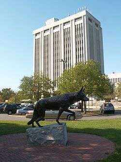
H. Lee Dennison Suffolk County Executive Building with a monument to war dogs | |
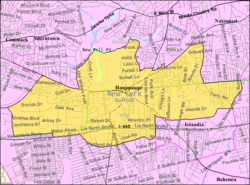 U.S. Census map | |
 Hauppauge U.S. Census map | |
| Coordinates: 40°49′6″N 73°12′25″W / 40.81833°N 73.20694°WCoordinates: 40°49′6″N 73°12′25″W / 40.81833°N 73.20694°W | |
| Country | United States |
| State | New York |
| County | Suffolk |
| Area | |
| • Total | 10.8 sq mi (28.1 km2) |
| • Land | 10.7 sq mi (27.7 km2) |
| • Water | 0.2 sq mi (0.4 km2) |
| Elevation | 62 ft (19 m) |
| Population (2010) | |
| • Total | 20,882 |
| • Density | 1,900/sq mi (740/km2) |
| Time zone | Eastern (EST) (UTC-5) |
| • Summer (DST) | EDT (UTC-4) |
| ZIP codes | 11749, 11760, 11788 |
| Area code(s) | 631 |
| FIPS code | 36-32732 |
| GNIS feature ID | 0952381 |
Hauppauge (/ˈhɔːpɒɡ/ HOP-og) is a hamlet and census-designated place (CDP) in the towns of Islip and Smithtown in Suffolk County, New York, United States. The population was 20,882 at the time of the 2010 census.[1]
Geography
Hauppauge is located at 40°49′6″N 73°12′25″W / 40.81833°N 73.20694°W (40.818205, -73.206878).[2] According to the United States Census Bureau, the CDP has a total area of 10.8 square miles (28.1 km2), of which 10.7 square miles (27.7 km2) is land and 0.15 square miles (0.4 km2), or 1.37%, is water.[1] The name comes from the Native American word for "sweet waters." Local Native American tribes would get their fresh drinking water from this area, instead of near Lake Ronkonkoma where the water was not drinkable. Hauppauge is known for the underground water springs and high underground water table.
History
According to the historian Simeon Wood, the first house in greater Hauppauge dates to 1731, being located on what would be the Arbuckle Estate, and later the southeast corner of the Hauppauge Industrial Park, near the intersection of Motor Parkway and Old Willets Path.[3] The settlement of Hauppauge proper commenced with the family of Thomas Wheeler prior to 1753, at the present-day location of the Wave gas station between Townline and Wheeler Road.[3] The locale would take the Wheelers' name as its own until the 1860s when the name Hauppauge was restored.[3] On March 13, 1806, "a meeting of the male members of the Methodist Society of the 'Haupogues' was convened at the School House agreeable to public notice for the express purpose of Incorporating and Electing Trustees for said Society." The first trustees elected at the meeting presided by Timothy Wheeler and Issac Wheeler were Issac Nichols, Elkanah Wheeler, George Wheeler, and Samuel Brush. They were known as the "Trustees of the Methodist Episcopal Church and Congregation of the Haupogues".[4] In 1812 the Hauppauge Methodist Church that stands today was constructed on land donated by the Wheeler family.
Hauppauge gained significance as a waypoint on the King's Highway, laid out by the colonial legislature of New York in 1702.[3] The present-day right of way departs westward from Route 111 as Conklin's Road or Half Mile Road, passing St. Thomas More Roman Catholic Church before terminating at the border between Smithtown and Islip. Hauppauge was effectively split between the towns of Smithtown and Islip in 1798 with the survey of New Highway, or what is now known as Townline Road (County Route 76).[3]
Demographics of the CDP
As of the census[5] of 2000, there were 20,100 people, 7,006 households, and 5,597 families residing in the CDP. The population density was 1,860.0 per square mile (717.9/km²). There were 7,153 housing units at an average density of 661.9/sq mi (255.5/km²). The racial makeup of the CDP was 93.25% White, 1.14% African American, 0.03% Native American, 3.59% Asian, 0.03% Pacific Islander, 0.76% from other races, and 1.19% from two or more races. Hispanic or Latino of any race were 4.41% of the population.
There were 7,006 households, out of which 34.2% had children under the age of 18 living with them, 68.6% were married couples living together, 8.2% had a female householder with no husband present, and 20.1% were non-families. 16.4% of all households were made up of individuals and 4.5% had someone living alone who was 65 years of age or older. The average household size was 2.85 and the average family size was 3.21.
In the CDP the population was spread out, with 24.0% under the age of 18, 6.2% from 18 to 24, 31.2% from 25 to 44, 27.7% from 45 to 64, and 11.0% who were 65 years of age or older. The median age was 38 years. For every 100 females there were 98.2 males. For every 100 females age 18 and over, there were 95.5 males.
According to a 2007 estimate,[6] the median income for a household in the CDP was $90,136, and the median income for a family was $101,213. Males had a median income of $58,103 versus $38,750 for females. The per capita income for the CDP was $30,915. About 2.0% of families and 3.1% of the population were below the poverty line, including 2.2% of those under age 18 and 3.2% of those age 65 or over.
Hauppauge Industrial Park
The Hauppauge Industrial Park, located at the edge of the hamlet, is the largest on Long Island, and by some accounts the second largest in the nation. The park has more than 1,300 companies, and employs over 55,000 Long Islanders. The companies in the industrial park provide the tax revenue that makes up the bulk of the Hauppauge school district's budget. As a result, school taxes for residents are relatively low, while the budget for schools is actually higher than usual. It is noted for its well-funded schools, with multiple internet-accessible computers in every classroom and many after-school activities.
Economy
Royal Apparel is also headquartered here since 1992, producing American made apparel here and several other east coast locations.In May 2000, Skidmore, Owings & Merrill opened an office in Hauppauge. The 2,500-square-foot (230 m2) office is located on the second floor of the 1300 Veterans Memorial Highway building. Carl Galioto, the head of the company's technical division, stated that it opened the office because it had difficulty hiring New York City-area recruits. The location was established to attract professionals who would have otherwise been required to commute.[7] Voxx International, a consumer electronics company, is also headquartered here.
Notable people
- Buddy Harrelson, former Mets player, coach, and manager (1986 World Series). Owner of Long Island Ducks
- Lori Loughlin, actress
- Candice Night, vocalist/lyricist and the wife of hard rock guitarist Ritchie Blackmore
- Erick Sermon, rapper and producer (formally of EPMD)
- Sarah Vandella, American pornographic actress
- Eddie Yost, former Mets third base coach (1969 World Series)
- [ Patti Lupone], Broadway dancer/actress
- [Barry Titone], popular saxophonist formely with Lionel Hampton
Schools
Hauppauge Union Free School District operates public schools.
- Hauppauge High School
- Hauppauge Middle School
- Bretton Woods Elementary School
- Forest Brook Elementary School
- The Pines Elementary School
Media
The hyperlocal news website, Hauppauge Patch, provides daily online coverage of breaking news, sports and community events. Hauppauge is also home to master control facilities for several media organizations, including Home Box Office, Showtime Networks, Thomson Reuters and Viacom Media Networks.
See also
References
- 1 2 "Geographic Identifiers: 2010 Demographic Profile Data (G001): Hauppauge CDP, New York". U.S. Census Bureau, American Factfinder. Retrieved 2013-01-02.
- ↑ "US Gazetteer files: 2010, 2000, and 1990". United States Census Bureau. 2011-02-12. Retrieved 2011-04-23.
- 1 2 3 4 5 Marr, Jack J., A History of Hauppauge, Hauppauge, NY: Jack Marr Publishing Company, 1981.
- ↑ A Copy of the Record of Proceedings of the M.E. Church at Hauppauge from year 1806 to the year 1886 inclusive.
- ↑ "American FactFinder". United States Census Bureau. Retrieved 2008-01-31.
- ↑ "American FactFinder". Factfinder2.census.gov. Retrieved 2012-09-22.
- ↑ Breskin, Ira. "REGIONAL MARKET: Long Island; Reverse Commute: Bringing the Office to the Employee." New York Times. December 31, 2003. Retrieved 2011-12-14.