Southern State Parkway
| |
|---|---|
|
Map of Long Island with Southern State Parkway highlighted in red | |
| Route information | |
| Maintained by NYSDOT | |
| Length: | 25.53 mi[1] (41.09 km) |
| Existed: | 1927[2] – present |
| Restrictions: | No commercial vehicles |
| Major junctions | |
| West end: |
|
|
| |
| East end: |
|
| Location | |
| Counties: | Nassau, Suffolk |
| Highway system | |


The Southern State Parkway (also known as the Southern State or Southern Parkway) is a 25.53-mile (41.09 km) limited-access highway on Long Island, New York, in the United States. The parkway begins at an interchange with the Belt and Cross Island parkways in Elmont, in Nassau County, and travels east to an interchange with the Sagtikos State Parkway in West Islip, Suffolk County, where it becomes the Heckscher State Parkway. The Southern State Parkway comprises the western portion of unsigned New York State Route 908M (NY 908M), with the Heckscher Parkway occupying the eastern section.
Construction of the highway, designed by Robert Moses, began in 1925. The first section of the parkway opened in 1927. It reached its original eastern terminus (Bay Shore Road) in 1949, and was extended to its current eastern terminus in 1962.
Route description

The Southern State Parkway begins at an interchange (exit 25A) with the Belt Parkway and the Cross Island Parkway on the Queens and Nassau County border in Elmont and North Valley Stream. After the interchange, the Southern State proceeds east as a six-lane divided parkway through North Valley Stream, passing north of St. Johns Cemetery before entering exit 13S and exit 13N, which serves Central Avenue, which connects to the Linden Boulevard that runs through Queens. Bending southeast through North Valley Stream, the parkway enters a partial diamond interchange with North Fletcher Avenue (exit 14).[3]
Running along the northern end of Valley Stream State Park, the parkway provides a ramp designated exit 15A, which connects to the park. A short distance later, the parkway enters exit 15, which connects to Corona Avenue. Proceeding westbound, a junction is also present with Franklin Avenue (designated exit 16N). After crossing into Malverne, the Southern State enters a cloverleaf interchange with Hempstead Avenue (exit 17). Crossing a line for the Long Island Rail Road, the parkway winds through Lakeview before crossing into Hempstead State Park. Crossing through the park, the parkway enters exit 18 for Eagle Avenue. After crossing Hempstead Lake, the parkway enters a cloverleaf interchange with Peninsula Boulevard (exit 19).[3]
Winding north of Mercy Medical Center, the route enters Rockville Centre, passing north of Molloy College before entering a cloverleaf with exit 20 (Baldwin Road and Grand Avenue). The six-lane parkway makes a bend after exit 20, crossing through North Baldwin, and into exit 21 with Nassau Road. After making a large bend to the northeast and turning east, the Southern State enters exit 22, a cloverleaf interchange with the Meadowbrook State Parkway in North Merrick. Proceeding westbound, a ramp is present to Meadowbrook Road (exit 23). Just east of that, the parkway enters exit 24S–N, a cloverleaf interchange with Merrick Avenue.[3]
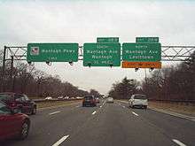
Winding northeast, the parkway enters an interchange with NY 106 (North Newbridge Road). Now in North Bellmore, exit 26 connects to South Bismark Avenue on a northeastern stretch of parkway. Making a gradual bend eastward, the Southern State enters exit 27S–N, which is an interchange with the Wantagh State Parkway. Just east of the Wantagh, the Southern State enters an exit with Wantagh Avenue (exit 28S–N). After a short eastern stretch through the village of North Wantagh, the parkway enters an interchange with the Seaford–Oyster Bay Expressway (NY 135), designated as Exit 28A S–N.[3]
After the Seaford–Oyster Bay Expressway, the parkway enters an exit with Hicksville Road. Now in the town of Oyster Bay, the Southern State Parkway exit 30, with serves North Broadway in North Massapequa. Now in Massapequa State Park, the parkway enters exit 31, which serves as the southern terminus of the Bethpage State Parkway. Just before entering exit 32S–N, the parkway crosses into Suffolk County and the town of Babylon. After crossing into Suffolk County, the Southern State enters exit 32S–N, which serves NY 110 (Broad Hollow Road). Bending northeast through Babylon, the Southern State Parkway enters exit 33, which serves NY 109 (Farmingdale Road). Near the interchange, the parkway passes south of Republic Airport, which is connected via exit 34. Winding northeast through Babylon, the parkway enters exit 35, an interchange with CR 3 (Wellwood Avenue). Passing south of New Montefiore Cemetery, the Southern State Parkway crosses exit 36S–N, with CR 2 (Straight Path).[3]
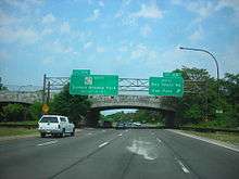
After winding east through Babylon, the parkway crosses through Belmont Avenue before crossing into Belmont Lake State Park. Within the park, the Southern State crosses into exit 38, which serves the park directly. After winding out of Belmont Lake State Park, the parkway enters an interchange with NY 231 (the Babylon–Northport Expressway and Deer Park Avenue). Crossing south of Guggenheim Lake, the Southern State Parkway enters exit 40, which serves the northern end of the Robert Moses Causeway. From here, the highway enters West Islip, where it connects to Bay Shore Road at exit 41S. The westbound direction of the parkway between exit 40 and exit 41 is split into a local-express lane setup for about 1 mile (1.6 km). Each half of the split is two lanes wide. After the Bay Shore Road interchange is the Sagtikos State Parkway, which is connected via exit 41A. At this interchange, the Southern State Parkway becomes the Heckscher State Parkway, which continues east and south towards Heckscher State Park.[3]
History
Construction began in 1925 under the direction of Robert Moses, for the purpose of improving access to Jones Beach.[4] The land used had originally been a conduit path for water, owned by Brooklyn.[5] The first section of the parkway, eastward from the Queens–Nassau county line, opened in 1927.[2] By 1932, the four-lane, undivided road extended to Suffolk County. Further extensions used more modern road construction principles. It reached its originally planned eastern terminus (Bay Shore Road) in 1949, and its current eastern terminus (Heckscher State Parkway) in 1962. Following the post-war housing boom on Long Island, the parkway was widened and straightened in numerous places to serve commuters traveling at speeds unanticipated when the road was first constructed.[6]
Southern Parkway's first exit at Elmont is numbered 13. Cross Island Parkway once began the exit numbering scheme at the Whitestone Bridge as exit 1 and continued east on Southern State Parkway, before the construction of the Belt Parkway. The Cross Island Parkway's exit numbering scheme was changed to match the Belt Parkway's easterly number progression from the Belt's start at the Gowanus Expressway to the current Cross Island's terminus, now exit 36 at the Whitestone Bridge.
Originally constructed as a four-lane parkway, similar to Northern State Parkway, Southern Parkway was widened in the early 1950s to eight lanes from the city line to Hempstead Lake, and six lanes east of there. Since Southern Parkway was originally conceived as a "linear park" to connect Jones Beach and other state parks with the city, it was built in a meandering style appropriate for the low speeds and traffic density of the day. Stone and concrete arched overpasses were purposely constructed with low clearances for both aesthetic reasons and to ensure that commercial traffic would not be able to use the parkway system.
Of interest is the original route of the Southern State at Hempstead Lake. Before the current fill that carries the present day parkway across the lake was built, traveling east before Eagle Avenue, the parkway veered sharply to the right, continued on what now is the park road in Hempstead Lake Park, crossed the dam at the southern end of Hempstead Lake, and turned sharply left on Peninsula Boulevard. The divided section of Peninsula Boulevard next to Hempstead Lake Park is the old Southern State Parkway, which was abandoned for a number of years until Nassau County bought the roadway in the late 1940s.[7]
Just east of exit 32, a service area used to operate beneath the underpass of County Route 47 (CR 47, named Great Neck Road) until 1985.[6] Exit 32, which is for NY 110, also once included CR 47.[8] Another service area was once located between exits 17 and 18.[9] Lastly, there were once toll booths located on the parkway between exits 13 and 14 near its western terminus at the Cross Island Parkway until 1978, although many road maps covered the toll booths until the early-to-mid-1980s.[6][10]
Some interchanges were redesigned. The original version of exit 32 contained a partial cloverleaf with NY 110 and connecting ramps to and from CR 47.[11] The original version of exit 36 was also a partial cloverleaf. The old version of exit 37 was a partial cloverleaf that included a direct entrance to the former headquarters of the Long Island State Park Commission,[12] and utilized eastbound re-entry to nearby exit 38, which had a north to east loop ramp, and eastbound connecting ramps to and from Sylvan Road,[13] the frontage road along the eastbound lane of the parkway between exits 37 and 39. The interchange between the Southern, Sagtikos, and Heckscher state parkways (exit 41A), was originally intended to be another trumpet interchange,[14] rather than the wye interchange it became.
Exit list
| County | Location | mi[1][15] | km | Exit | Destinations | Notes |
|---|---|---|---|---|---|---|
| Nassau | North Valley Stream | 0.00 | 0.00 | – | Exit 25A on Belt Parkway | |
| South end of Cross Island Parkway | ||||||
| 0.58 | 0.93 | 13 | Central Avenue / Linden Boulevard – Valley Stream, Elmont | Signed as exits 13S (south) and 13N (north) eastbound | ||
| 1.55 | 2.49 | 14 | North Fletcher Avenue – Valley Stream | No westbound exit; to Valley Stream State Park | ||
| 1.90 | 3.06 | 15A | Valley Stream State Park | Eastbound exit only | ||
| 2.23 | 3.59 | 15 | Corona Avenue / Franklin Avenue | Signed as exits 15S (south) and 15N (north) westbound | ||
| Franklin Square | 2.50 | 4.02 | 16N | Franklin Avenue (CR 5A) | Westbound exit and eastbound entrance | |
| Malverne Park Oaks | 3.56 | 5.73 | 17 | Hempstead Avenue – West Hempstead, Malverne | Signed as exits 17S (south) and 17N (north) | |
| Lakeview | 4.72 | 7.60 | 18 | Eagle Avenue | To Hempstead Lake State Park | |
| South Hempstead | 5.38 | 8.66 | 19 | Peninsula Boulevard (CR 2) – Hempstead, Rockville Centre | Signed as exits 19S (south) and 19N (north) | |
| 6.37 | 10.25 | 20 | Baldwin Road / Grand Avenue (CR 55) | Signed as exits 20S (south) and 20N (north) | ||
| Roosevelt | 7.55 | 12.15 | 21 | Nassau Road (CR 7B) – Hempstead, Freeport | ||
| North Merrick | 8.55 | 13.76 | 22 | Signed as exits 22S (south) and 22N (north) | ||
| 9.06 | 14.58 | 23 | Meadowbrook Road | |||
| 9.31 | 14.98 | 24 | Merrick Avenue – Westbury, Merrick | Signed as exits 24S (south) and 24N (north) | ||
| North Bellmore | 10.60 | 17.06 | 25 | Signed as exits 25S (south) and 25N (north); to Nassau University Medical Center | ||
| 10.90 | 17.54 | 26 | Bellmore Road | Eastbound exit and entrance | ||
| North Wantagh | 11.77 | 18.94 | 27 | Signed as exits 27S (south) and 27N (north) | ||
| 12.50 | 20.12 | 28 | Wantagh Avenue (CR 189) – Levittown, Wantagh | Signed as exits 28S (south) and 28N (north) | ||
| Wantagh | 13.35 | 21.48 | Signed as exits 28AS (south) and 28AN (north) | |||
| North Massapequa | 13.79 | 22.19 | 29 | Signed as exits 29S (south) and 29N (north) westbound | ||
| 14.94 | 24.04 | 30 | Broadway – Massapequa, Farmingdale | Signed as exits 30S (south) and 30N (north) | ||
| 15.38 | 24.75 | 31 | South end of and exit B1 on Bethpage Parkway; no westbound access to Linden Street | |||
| Suffolk | North Amityville | 16.88 | 27.17 | 32 | Signed as exits 32S (south) and 32N (north); exit 32S also serves CR 1 eastbound | |
| North Lindenhurst | 18.30 | 29.45 | 33 | Same-direction connections only | ||
| 18.30 | 29.45 | 34 | New Highway (CR 28) | Westbound entrance is via exit 33 | ||
| 19.03 | 30.63 | 35 | ||||
| West Babylon | 20.12 | 32.38 | 36 | Signed as exits 36S (south) and 36N (north) | ||
| 21.73 | 34.97 | 37 | Belmont Avenue (CR 107) – West Babylon | Signed as exits 37S (south) and 37N (north) | ||
| North Babylon | 22.12 | 35.60 | 38 | Belmont Lake State Park | Parclo interchange with eastbound loop ramps | |
| 23.06 | 37.11 | 39 | Signed as exits 39S (south) and 39N (north) | |||
| West Islip | 24.87 | 40.02 | 40 | North end of Robert Moses Causeway | ||
| 24.90 | 40.07 | 41 | Signed as exits 41S (south) and 41N (north) | |||
| 25.53 | 41.09 | 41A | South end of Sagtikos Parkway | |||
| – | West end of Heckscher Parkway | |||||
| 1.000 mi = 1.609 km; 1.000 km = 0.621 mi | ||||||
See also
-
.svg.png) New York Roads portal
New York Roads portal
References
- 1 2 "2007 Traffic Data Report for New York State" (PDF). New York State Department of Transportation. July 25, 2008. Retrieved July 17, 2009.
- 1 2 Regional Plan of New York and its Environs. Regional Plan Association. 1929.
- 1 2 3 4 5 6 Microsoft; Nokia (August 23, 2012). "overview map of the Southern State Parkway" (Map). Bing Maps. Microsoft. Retrieved August 23, 2012.
- ↑ Long Island State Parkway System. New York State Department of Transportation. 1985.
- ↑ Robert A. Caro (1975) [1974]. The Power Broker: Robert Moses and the Fall of New York (Vintage ed.). Vintage Books (Random House). pp. 157–162.
- 1 2 3 Anderson, Steve. "Southern State Parkway". NYCRoads. Retrieved March 18, 2010.
- ↑ 1939 Nassau County Atlas (Dolph & Stewart)
- ↑ Nassau County (Map). Hagstrom Map. 1940. Retrieved April 1, 2010.
- ↑ Hempstead Lake State Park, 1966 (Historic Aerials)
- ↑ New York and Vicinity (Map). H.M. Gousha Company. 1967. Retrieved April 1, 2010.
- ↑ Nassau County (Map). Hagstrom Map. 1940. Retrieved April 1, 2010.
- ↑ Southern State Parkway, Exits 37 in 1953 (Historic Aerials)
- ↑ Southern State Parkway, Exit 38 in 1953 (Historic Aerials)
- ↑ Southern State and Sagtikos State Parkway termini with unbuilt Heckscher State Park Spur interchange R.O.W.; 1953 (Historic Aerials)
- ↑ Google (January 6, 2016). "Southern State Parkway" (Map). Google Maps. Google. Retrieved January 6, 2016.
External links
| Wikimedia Commons has media related to Southern State Parkway. |
- Southern State Parkway at Alps' Roads • New York State Highway Termini
- Interchange of the Week; Monday, March 19, 2001 (Empire State Roads)
- Southern Parkway (Greater New York Roads)