Conconully, Washington
| Conconully | |
|---|---|
| Town | |
| Conconully, Washington | |
|
Overview of Conconully | |
 Location of Conconully, Washington | |
| Coordinates: 48°33′32″N 119°45′4″W / 48.55889°N 119.75111°WCoordinates: 48°33′32″N 119°45′4″W / 48.55889°N 119.75111°W | |
| Country | United States |
| State | Washington |
| County | Okanogan |
| Area[1] | |
| • Total | 0.31 sq mi (0.80 km2) |
| • Land | 0.31 sq mi (0.80 km2) |
| • Water | 0 sq mi (0 km2) |
| Elevation | 2,303 ft (702 m) |
| Population (2010)[2] | |
| • Total | 210 |
| • Estimate (2015)[3] | 213 |
| • Density | 677.4/sq mi (261.5/km2) |
| Time zone | Pacific (PST) (UTC-8) |
| • Summer (DST) | PDT (UTC-7) |
| ZIP code | 98819 |
| Area code(s) | 509 |
| FIPS code | 53-14310 |
| GNIS feature ID | 1518000[4] |
| Website | Town of Conconully |

Conconully is a town in Okanogan County, Washington, United States. The population was 210 at the 2010 census.
History
Conconully was officially incorporated on November 11, 1908. It was originally named Salmon City after the nearby Salmon Creek.[5] It began as a gold miners camp.
Geography
Conconully is located at 48°33′32″N 119°45′4″W / 48.55889°N 119.75111°W (48.558820, -119.751054).[6]
According to the United States Census Bureau, the town has a total area of 0.31 square miles (0.80 km2), all of it land.[1] The city is flanked by two separate reservoirs of the United States Bureau of Reclamation, created by the 1911 Conconully Dam and the 1921 Salmon Lake Dam.
Climate
This climatic region is typified by large seasonal temperature differences, with warm to hot (and often humid) summers and cold (sometimes severely cold) winters. According to the Köppen Climate Classification system, Conconully has a humid continental climate, abbreviated "Dfb" on climate maps.[7]
| Climate data for Conconully | |||||||||||||
|---|---|---|---|---|---|---|---|---|---|---|---|---|---|
| Month | Jan | Feb | Mar | Apr | May | Jun | Jul | Aug | Sep | Oct | Nov | Dec | Year |
| Record high °F (°C) | 61 (16) |
70 (21) |
73 (23) |
88 (31) |
96 (36) |
101 (38) |
110 (43) |
109 (43) |
98 (37) |
84 (29) |
66 (19) |
56 (13) |
110 (43) |
| Average high °F (°C) | 31.3 (−0.4) |
39.1 (3.9) |
51.4 (10.8) |
63.5 (17.5) |
71.6 (22) |
77.9 (25.5) |
87.2 (30.7) |
85.6 (29.8) |
75.7 (24.3) |
60.5 (15.8) |
42.5 (5.8) |
33.6 (0.9) |
60 (16) |
| Average low °F (°C) | 17.8 (−7.9) |
20.7 (−6.3) |
27.9 (−2.3) |
33.4 (0.8) |
40.2 (4.6) |
45.7 (7.6) |
49.2 (9.6) |
47.3 (8.5) |
41.3 (5.2) |
33.9 (1.1) |
27.9 (−2.3) |
22 (−6) |
33.9 (1.1) |
| Record low °F (°C) | −29 (−34) |
−29 (−34) |
−17 (−27) |
10 (−12) |
20 (−7) |
29 (−2) |
32 (0) |
27 (−3) |
20 (−7) |
6 (−14) |
−18 (−28) |
−31 (−35) |
−31 (−35) |
| Average precipitation inches (mm) | 1.42 (36.1) |
1.26 (32) |
1.16 (29.5) |
1.04 (26.4) |
1.46 (37.1) |
1.58 (40.1) |
0.81 (20.6) |
0.82 (20.8) |
0.72 (18.3) |
1.02 (25.9) |
1.63 (41.4) |
1.68 (42.7) |
14.6 (371) |
| Average snowfall inches (cm) | 13.8 (35.1) |
6.7 (17) |
2.5 (6.4) |
0.5 (1.3) |
0 (0) |
0 (0) |
0 (0) |
0 (0) |
0 (0) |
0.3 (0.8) |
5.8 (14.7) |
12.6 (32) |
42.2 (107.2) |
| Average precipitation days | 8 | 7 | 6 | 6 | 7 | 8 | 4 | 4 | 4 | 5 | 8 | 9 | 76 |
| Source: [8] | |||||||||||||
Demographics
| Historical population | |||
|---|---|---|---|
| Census | Pop. | %± | |
| 1890 | 232 | — | |
| 1910 | 357 | — | |
| 1920 | 270 | −24.4% | |
| 1930 | 102 | −62.2% | |
| 1940 | 187 | 83.3% | |
| 1950 | 141 | −24.6% | |
| 1960 | 108 | −23.4% | |
| 1970 | 122 | 13.0% | |
| 1980 | 157 | 28.7% | |
| 1990 | 153 | −2.5% | |
| 2000 | 185 | 20.9% | |
| 2010 | 210 | 13.5% | |
| Est. 2015 | 213 | [9] | 1.4% |
| U.S. Decennial Census[10] 2015 Estimate[3] | |||
2010 census
As of the census[2] of 2010, there were 210 people, 103 households, and 63 families residing in the town. The population density was 677.4 inhabitants per square mile (261.5/km2). There were 189 housing units at an average density of 609.7 per square mile (235.4/km2). The racial makeup of the town was 91.0% White, 0.5% African American, 2.4% Native American, 0.5% Asian, 3.3% from other races, and 2.4% from two or more races. Hispanic or Latino of any race were 5.7% of the population.
There were 103 households of which 13.6% had children under the age of 18 living with them, 55.3% were married couples living together, 2.9% had a female householder with no husband present, 2.9% had a male householder with no wife present, and 38.8% were non-families. 31.1% of all households were made up of individuals and 7.7% had someone living alone who was 65 years of age or older. The average household size was 2.04 and the average family size was 2.49.
The median age in the town was 55.1 years. 12.4% of residents were under the age of 18; 5.6% were between the ages of 18 and 24; 11.9% were from 25 to 44; 43.4% were from 45 to 64; and 26.7% were 65 years of age or older. The gender makeup of the town was 51.9% male and 48.1% female.
2000 census
As of the census of 2000, there were 185 people, 94 households, and 53 families residing in the town. The population density was 834.3 people per square mile (324.7/km²). There were 192 housing units at an average density of 865.8 per square mile (337.0/km²). The racial makeup of the town was 96.22% White, 3.24% Native American, and 0.54% from two or more races.
There were 94 households out of which 13.8% had children under the age of 18 living with them, 47.9% were married couples living together, 6.4% had a female householder with no husband present, and 42.6% were non-families. 31.9% of all households were made up of individuals and 12.8% had someone living alone who was 65 years of age or older. The average household size was 1.97 and the average family size was 2.43.
In the town the population was spread out with 11.9% under the age of 18, 3.8% from 18 to 24, 21.6% from 25 to 44, 32.4% from 45 to 64, and 30.3% who were 65 years of age or older. The median age was 52 years. For every 100 females there were 107.9 males. For every 100 females age 18 and over, there were 103.8 males.
The median income for a household in the town was $23,214, and the median income for a family was $24,750. Males had a median income of $29,167 versus $22,000 for females. The per capita income for the town was $16,168. About 17.5% of families and 18.7% of the population were below the poverty line, including 21.7% of those under the age of eighteen and none of those sixty five or over.
References
- 1 2 "US Gazetteer files 2010". United States Census Bureau. Archived from the original on 2012-07-14. Retrieved 2012-12-19.
- 1 2 "American FactFinder". United States Census Bureau. Retrieved 2012-12-19.
- 1 2 "Population Estimates". United States Census Bureau. Retrieved July 13, 2016.
- ↑ "Conconully". Geographic Names Information System. United States Geological Survey.
- ↑ Wilma, David (March 26, 2003). "First county seat of Okanogan County is established at Ruby City on March 7, 1888". HistoryLink. Retrieved February 10, 2013.
- ↑ "US Gazetteer files: 2010, 2000, and 1990". United States Census Bureau. 2011-02-12. Retrieved 2011-04-23.
- ↑ Climate Summary for Conconully, Washington
- ↑ "CONCONULLY, WASHINGTON (451666)". Western Regional Climate Center. Retrieved November 16, 2015.
- ↑ "Annual Estimates of the Resident Population for Incorporated Places: April 1, 2010 to July 1, 2015". Retrieved July 2, 2016.
- ↑ United States Census Bureau. "Census of Population and Housing". Archived from the original on May 11, 2015. Retrieved September 25, 2014.
Municipalities and communities of Okanogan County, Washington, United States | ||
|---|---|---|
| Cities | 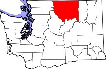 | |
| Towns | ||
| CDPs | ||
| Unincorporated communities | ||
| Indian reservation | ||
| Ghost towns | ||
| Footnotes | ‡This populated place also has portions in an adjacent county or counties | |