Twisp, Washington
| Twisp | |
|---|---|
| Town | |
| Twisp, Washington | |
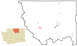 Location of Twisp, Washington | |
| Coordinates: 48°21′50″N 120°7′11″W / 48.36389°N 120.11972°WCoordinates: 48°21′50″N 120°7′11″W / 48.36389°N 120.11972°W | |
| Country | United States |
| State | Washington |
| County | Okanogan |
| Area[1] | |
| • Total | 1.18 sq mi (3.06 km2) |
| • Land | 1.18 sq mi (3.06 km2) |
| • Water | 0 sq mi (0 km2) |
| Elevation | 1,637 ft (499 m) |
| Population (2010)[2] | |
| • Total | 919 |
| • Estimate (2015)[3] | 942 |
| • Density | 778.8/sq mi (300.7/km2) |
| Time zone | Pacific (PST) (UTC-8) |
| • Summer (DST) | PDT (UTC-7) |
| ZIP code | 98856 |
| Area code(s) | 509 |
| FIPS code | 53-73080[4] |
| GNIS feature ID | 1527565[5] |
| Website | Town of Twisp |
Twisp is a town in Okanogan County, Washington, United States. The population was 938 at the 2000 census and decreased to 919 at the 2010 census.
Geography
Twisp is located at 48°21′50″N 120°7′11″W / 48.36389°N 120.11972°W (48.363971, -120.119620).[6]
According to the United States Census Bureau, the town has a total area of 1.18 square miles (3.06 km2), all of it land.[1]
Twisp is located on the Methow River at its confluence with the Twisp River.
Climate
| Climate data for Twisp, Washington | |||||||||||||
|---|---|---|---|---|---|---|---|---|---|---|---|---|---|
| Month | Jan | Feb | Mar | Apr | May | Jun | Jul | Aug | Sep | Oct | Nov | Dec | Year |
| Record high °F (°C) | 57 (14) |
62 (17) |
77 (25) |
89 (32) |
100 (38) |
100 (38) |
106 (41) |
105 (41) |
100 (38) |
87 (31) |
68 (20) |
54 (12) |
106 (41) |
| Average high °F (°C) | 31 (−1) |
39 (4) |
51 (11) |
62 (17) |
71 (22) |
78 (26) |
86 (30) |
86 (30) |
78 (26) |
62 (17) |
42 (6) |
29 (−2) |
59.6 (15.5) |
| Average low °F (°C) | 15 (−9) |
18 (−8) |
26 (−3) |
32 (0) |
40 (4) |
46 (8) |
50 (10) |
49 (9) |
41 (5) |
32 (0) |
25 (−4) |
14 (−10) |
32.3 (0.2) |
| Record low °F (°C) | −32 (−36) |
−28 (−33) |
−10 (−23) |
13 (−11) |
20 (−7) |
28 (−2) |
31 (−1) |
30 (−1) |
18 (−8) |
5 (−15) |
−17 (−27) |
−48 (−44) |
−48 (−44) |
| Average precipitation inches (mm) | 1.95 (49.5) |
1.37 (34.8) |
1.03 (26.2) |
0.76 (19.3) |
1.12 (28.4) |
1.18 (30) |
0.75 (19) |
0.54 (13.7) |
0.42 (10.7) |
1.08 (27.4) |
2.09 (53.1) |
2.50 (63.5) |
14.79 (375.6) |
| Source: [7] | |||||||||||||
History
The name of Twisp comes from the Okanagan placename /txʷəc'p/,[8] meaning "wasp" or "yellowjacket". It was settled by H.C. Glover, and the townsite was plotted in 1897.[9]
2015 Okanogan Complex wildfire
Twisp, along with several neighboring towns in Okanogan County, was evacuated in August 2015 as a result of the Okanogan Complex fire. Three firefighters were killed while battling one of the complex's fires near Twisp on August 19.[10]
Demographics
| Historical population | |||
|---|---|---|---|
| Census | Pop. | %± | |
| 1910 | 227 | — | |
| 1920 | 289 | 27.3% | |
| 1930 | 335 | 15.9% | |
| 1940 | 477 | 42.4% | |
| 1950 | 776 | 62.7% | |
| 1960 | 750 | −3.4% | |
| 1970 | 756 | 0.8% | |
| 1980 | 911 | 20.5% | |
| 1990 | 872 | −4.3% | |
| 2000 | 938 | 7.6% | |
| 2010 | 919 | −2.0% | |
| Est. 2015 | 942 | [11] | 2.5% |
| U.S. Decennial Census[12] 2015 Estimate[3] | |||
2010 census
As of the census[2] of 2010, there were 919 people, 474 households, and 222 families residing in the town. The population density was 778.8 inhabitants per square mile (300.7/km2). There were 524 housing units at an average density of 444.1 per square mile (171.5/km2). The racial makeup of the town was 94.6% White, 0.2% African American, 1.2% Native American, 0.5% Asian, 0.4% Pacific Islander, 0.3% from other races, and 2.7% from two or more races. Hispanic or Latino of any race were 3.3% of the population.
There were 474 households of which 20.3% had children under the age of 18 living with them, 31.2% were married couples living together, 11.4% had a female householder with no husband present, 4.2% had a male householder with no wife present, and 53.2% were non-families. 46.0% of all households were made up of individuals and 15.1% had someone living alone who was 65 years of age or older. The average household size was 1.94 and the average family size was 2.72.
The median age in the town was 46.1 years. 17.5% of residents were under the age of 18; 6.7% were between the ages of 18 and 24; 24.3% were from 25 to 44; 33.3% were from 45 to 64; and 18.2% were 65 years of age or older. The gender makeup of the town was 49.6% male and 50.4% female.
2000 census
As of the census[4] of 2000, there were 938 people, 438 households, and 258 families residing in the town. The population density was 807.9 people per square mile (312.2/km²). There were 505 housing units at an average density of 434.9 per square mile (168.1/km²). The racial makeup of the town was 96.16% White, 0.96% Native American, 0.53% Asian, 0.75% from other races, and 1.60% from two or more races. Hispanic or Latino of any race were 2.77% of the population.
There were 438 households out of which 29.9% had children under the age of 18 living with them, 39.5% were married couples living together, 16.0% had a female householder with no husband present, and 40.9% were non-families. 34.7% of all households were made up of individuals and 14.6% had someone living alone who was 65 years of age or older. The average household size was 2.13 and the average family size was 2.70.
In the town the population was spread out with 24.2% under the age of 18, 5.3% from 18 to 24, 26.8% from 25 to 44, 26.7% from 45 to 64, and 17.1% who were 65 years of age or older. The median age was 42 years. For every 100 females there were 86.1 males. For every 100 females age 18 and over, there were 84.2 males.
The median income for a household in the town was $26,354, and the median income for a family was $31,944. Males had a median income of $26,250 versus $17,857 for females. The per capita income for the town was $16,257. About 14.6% of families and 19.8% of the population were below the poverty line, including 27.3% of those under age 18 and 8.2% of those age 65 or over.
References
- 1 2 "US Gazetteer files 2010". United States Census Bureau. Retrieved 2012-12-19.
- 1 2 "American FactFinder". United States Census Bureau. Retrieved 2012-12-19.
- 1 2 "Population Estimates". United States Census Bureau. Retrieved July 13, 2016.
- 1 2 "American FactFinder". United States Census Bureau. Retrieved 2008-01-31.
- ↑ "Twisp". Geographic Names Information System. United States Geological Survey.
- ↑ "US Gazetteer files: 2010, 2000, and 1990". United States Census Bureau. 2011-02-12. Retrieved 2011-04-23.
- ↑ "weather.com". Retrieved November 15, 2011.
- ↑ Bright, William (2004). Native American placenames of the United States. University of Oklahoma Press. p. 526. ISBN 978-0-8061-3598-4. Retrieved 11 April 2011.
- ↑ Majors, Harry M. (1975). Exploring Washington. Van Winkle Publishing Co. p. 40. ISBN 978-0-918664-00-6.
- ↑ Howard, Cory (August 20, 2015). "Three firefighters killed in wildfire near Twisp; One firefighter remains in critical condition". KHQ-TV. Retrieved August 26, 2015.
- ↑ "Annual Estimates of the Resident Population for Incorporated Places: April 1, 2010 to July 1, 2015". Retrieved July 2, 2016.
- ↑ United States Census Bureau. "Census of Population and Housing". Retrieved September 8, 2014.
External links
Municipalities and communities of Okanogan County, Washington, United States | ||
|---|---|---|
| Cities | 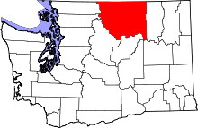 | |
| Towns | ||
| CDPs | ||
| Unincorporated communities | ||
| Indian reservation | ||
| Ghost towns | ||
| Footnotes | ‡This populated place also has portions in an adjacent county or counties | |