Eaton, Ohio
| Eaton, Ohio | ||
|---|---|---|
| City | ||
|
Preble County Courthouse downtown | ||
| ||
| Motto: "A Rural Community Growing In To The Future" | ||
 Location in Ohio | ||
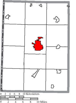 Location of Eaton in Preble County | ||
| Coordinates: 39°44′51″N 84°38′2″W / 39.74750°N 84.63389°WCoordinates: 39°44′51″N 84°38′2″W / 39.74750°N 84.63389°W | ||
| Country | United States | |
| State | Ohio | |
| County | Preble | |
| Government | ||
| • Mayor | Gary Wagner | |
| Area[1] | ||
| • Total | 6.20 sq mi (16.06 km2) | |
| • Land | 6.19 sq mi (16.03 km2) | |
| • Water | 0.01 sq mi (0.03 km2) 0.16% | |
| Elevation | 1,040 ft (317 m) | |
| Population (2010)[2] | ||
| • Total | 8,407 | |
| • Estimate (2012[3]) | 8,330 | |
| • Density | 1,358.2/sq mi (524.4/km2) | |
| census | ||
| Time zone | EST (UTC−4) | |
| • Summer (DST) | EDT (UTC−4) | |
| Zip code | 45320 | |
| Area code(s) | 937 | |
| FIPS code | 39-24234[4] | |
| GNIS feature ID | 1040043[5] | |
| Website | http://www.cityofeaton.org/ | |


Eaton is a city in and the county seat of Preble County, Ohio, United States.[6] The population was 8,407 at the 2010 census. Eaton's sister city is Rödental bei Coburg (Germany).
History
Eaton was platted in 1806.[7] The village derives its name from Gen. William Eaton[8] (1764–1811), the U.S. Consul at Tunis, who led a diverse army in a harrowing march from Egypt to Tripoli to meet the U.S. Naval forces. In addition to the city of Eaton and the county of Preble, various streets in Eaton (Decatur, Israel, Wadsworth and Somers) were also named in honor of various heroes of the First Barbary War and the Second Barbary War.[9]
The town grew quickly following its establishment. In 1846, the town first had 1000 inhabitants. This growth was primarily derived from the town's location at the strategic junction of two turnpikes. In 1849, Eaton was the site of a cholera outbreak. About half of the inhabitants fled; of the remaining 600 people, 120 died.
19th century fire
In June 1859 a fire in Eaton destroyed thirteen of its primary business establishments. The total loss was estimated at $40,000 to $50,000. Caused by incendiaries, the fire scorched the courthouse and left it a brown color. The disaster was first reported by the Cincinnati Commercial.[10]
Geography
Eaton is located at 39°44′51″N 84°38′2″W / 39.74750°N 84.63389°W (39.747603, -84.633818).[11]
According to the United States Census Bureau, the city has a total area of 6.20 square miles (16.06 km2), of which 6.19 square miles (16.03 km2) is land and 0.01 square miles (0.03 km2) is water.[1]
The city includes Crystal Lake and Seven Mile Creek. Parks include: Fort St. Clair, Water Works Park, 7-Mile Park, and Washington Landing Park.
Demographics
| Historical population | |||
|---|---|---|---|
| Census | Pop. | %± | |
| 1820 | 255 | — | |
| 1830 | 510 | 100.0% | |
| 1840 | 859 | 68.4% | |
| 1850 | 1,346 | 56.7% | |
| 1870 | 1,748 | — | |
| 1880 | 2,143 | 22.6% | |
| 1890 | 2,934 | 36.9% | |
| 1900 | 3,155 | 7.5% | |
| 1910 | 3,187 | 1.0% | |
| 1920 | 3,210 | 0.7% | |
| 1930 | 3,347 | 4.3% | |
| 1940 | 3,552 | 6.1% | |
| 1950 | 4,242 | 19.4% | |
| 1960 | 5,034 | 18.7% | |
| 1970 | 6,020 | 19.6% | |
| 1980 | 6,839 | 13.6% | |
| 1990 | 7,396 | 8.1% | |
| 2000 | 8,133 | 10.0% | |
| 2010 | 8,407 | 3.4% | |
| Est. 2015 | 8,217 | [12] | −2.3% |
| Sources:[4][13][14][15][16][17][18][19] | |||
2010 census
As of the census[2] of 2010, there were 8,407 people, 3,486 households, and 2,181 families residing in the city. The population density was 1,358.2 inhabitants per square mile (524.4/km2). There were 3,903 housing units at an average density of 630.5 per square mile (243.4/km2). The racial makeup of the city was 96.3% White, 0.6% African American, 0.2% Native American, 1.0% Asian, 0.5% from other races, and 1.5% from two or more races. Hispanic or Latino of any race were 0.8% of the population.
There were 3,486 households of which 30.3% had children under the age of 18 living with them, 44.2% were married couples living together, 13.7% had a female householder with no husband present, 4.6% had a male householder with no wife present, and 37.4% were non-families. 32.7% of all households were made up of individuals and 15.5% had someone living alone who was 65 years of age or older. The average household size was 2.33 and the average family size was 2.90.
The median age in the city was 40.4 years. 23.3% of residents were under the age of 18; 8% were between the ages of 18 and 24; 23.7% were from 25 to 44; 25.7% were from 45 to 64; and 19.1% were 65 years of age or older. The gender makeup of the city was 47.2% male and 52.8% female.
2000 census
As of the census[4] of 2000, there were 8,133 people, 3,274 households, and 2,183 families residing in the city. The population density was 1,434.2 people per square mile (553.8/km2). There were 3,467 housing units at an average density of 611.4 per square mile (236.1/km2). The racial makeup of the city was 98.02% White, 0.39% African American, 0.09% Native American, 0.55% Asian, 0.02% Pacific Islander, 0.07% from other races, and 0.85% from two or more races. Hispanic or Latino of any race were 0.57% of the population.
There were 3,274 households out of which 30.3% had children under the age of 18 living with them, 51.3% were married couples living together, 11.2% had a female householder with no husband present, and 33.3% were non-families. 29.1% of all households were made up of individuals and 14.0% had someone living alone who was 65 years of age or older. The average household size was 2.37 and the average family size was 2.89.
In the city the population was spread out with 24.0% under the age of 18, 8.7% from 18 to 24, 27.5% from 25 to 44, 21.6% from 45 to 64, and 18.1% who were 65 years of age or older. The median age was 38 years. For every 100 females there were 89.6 males. For every 100 females age 18 and over, there were 85.6 males.
The median income for a household in the city was $37,231, and the median income for a family was $42,241. Males had a median income of $32,404 versus $24,006 for females. The per capita income for the city was $16,771. About 5.8% of families and 8.7% of the population were below the poverty line, including 10.0% of those under age 18 and 9.5% of those age 65 or over.
Schools
Public schools
- Hollingsworth East Elementary School (grades K-2)
- Eaton Middle School (grades 3-8)
- Eaton High School (grades 9-12)
Higher education
- Preble County Learning Center (Sinclair Community College)
Notable people
- Andrew L. Harris - Civil War general and former governor of Ohio.
- Travis Miller - former Major League Baseball pitcher for the Minnesota Twins.
- William Stephens - former mayor of Los Angeles and governor of California 1917-1923.
- Kent Vosler - Diver in the 1976 Olympics in Montreal.
- Jane LeCompte - Novelist who has written over 20 Romance novels under the name Jane Ashford
- Victor J. Banis - "the godfather of modern popular gay fiction."
Miscellaneous
Eaton hosts the annual Preble County Pork Festival, held the third full weekend each September, and the summer Preble County Fair.
References
- 1 2 "US Gazetteer files 2010". United States Census Bureau. Retrieved 2013-01-06.
- 1 2 "American FactFinder". United States Census Bureau. Retrieved 2013-01-06.
- ↑ "Population Estimates". United States Census Bureau. Retrieved 2013-06-17.
- 1 2 3 "American FactFinder". United States Census Bureau. Retrieved 2008-01-31.
- ↑ "US Board on Geographic Names". United States Geological Survey. 2007-10-25. Retrieved 2008-01-31.
- ↑ "Find a County". National Association of Counties. Retrieved 2011-06-07.
- ↑ Overman, William Daniel (1958). Ohio Town Names. Akron, OH: Atlantic Press. p. 41.
- ↑ Gannett, Henry (1905). The Origin of Certain Place Names in the United States. Govt. Print. Off. p. 113.
- ↑ http://www.ohiohistorycentral.org/entry.php?rec=1923
- ↑ Disastrous Incendiary Fire at Eaton, Ohio, New York Times, June 9, 1859, pg. 8.
- ↑ "US Gazetteer files: 2010, 2000, and 1990". United States Census Bureau. 2011-02-12. Retrieved 2011-04-23.
- ↑ "Annual Estimates of the Resident Population for Incorporated Places: April 1, 2010 to July 1, 2015". Retrieved July 2, 2016.
- ↑ "Population of Civil Divisions Less than Counties" (PDF). Statistics of the Population of the United States at the Tenth Census. U.S. Census Bureau. Retrieved 28 November 2013.
- ↑ "Population of Civil Divisions Less than Counties" (PDF). Statistics of the Population of the United States at the Tenth Census. U.S. Census Bureau. Retrieved 28 November 2013.
- ↑ "Population: Ohio" (PDF). 1910 U.S. Census. U.S. Census Bureau. Retrieved 28 November 2013.
- ↑ "Population: Ohio" (PDF). 1930 US Census. U.S. Census Bureau. Retrieved 28 November 2013.
- ↑ "Number of Inhabitants: Ohio" (PDF). 18th Census of the United States. U.S. Census Bureau. Retrieved 22 November 2013.
- ↑ "Ohio: Population and Housing Unit Counts" (PDF). U.S. Census Bureau. Retrieved 22 November 2013.
- ↑ "Incorporated Places and Minor Civil Divisions Datasets: Subcounty Population Estimates: April 1, 2010 to July 1, 2012". U.S. Census Bureau. Retrieved 25 November 2013.
External links
Municipalities and communities of Preble County, Ohio, United States | ||
|---|---|---|
| City | 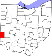 | |
| Villages | ||
| Townships | ||
| CDP | ||
| Unincorporated communities | ||
| Ghost towns | ||
| Footnotes | ‡This populated place also has portions in an adjacent county or counties | |