Circle line (London Underground)
| Circle line | |
|---|---|
|
| |
.jpg) S7 Stock train at Wood Lane, bound for Hammersmith. | |
| Overview | |
| Type | Sub-surface |
| System | London Underground |
| Stations | 36 |
| Ridership | 114.6 million (2011/12)[lower-alpha 1][1] passenger journeys |
| Colour on map | Yellow |
| Website | tfl.gov.uk |
| Operation | |
| Opened | Infrastructure opened in stages between 1863 and 1884, shown as a separate line on the tube map from 1949. |
| Depot(s) | Hammersmith |
| Rolling stock | S7 Stock (7 cars per trainset) |
| Technical | |
| Line length | 27 km (17 mi) |
| Track gauge | 4 ft 8 1⁄2 in (1,435 mm) |
The Circle line is a London Underground service in a spiralling shape, running from Hammersmith to Edgware Road and then looping once around central London back to Edgware Road. The railway is below ground in the central section and on the loop east of Paddingdon, and, unlike London's deep-level tube railways, the railway tunnels are just below the surface and of similar size to those on British main lines. Coloured yellow on the tube map, the 17-mile (27 km) line serves 36 stations, including most of London's main line railway termini. Most of the route and all of the stations are shared with the District, Hammersmith & City and Metropolitan lines. On the Circle line and the Hammersmith & City line combined, over 114 million passenger journeys are made each year. 21 of the 36 stations are below ground.
The first section opened in 1863 when the Metropolitan Railway opened the world's first underground line between Paddington and Farringdon with wooden carriages and steam locomotives. The same year a select committee report recommended an 'inner circle' of railway lines connecting the London railway termini, and the Metropolitan District Railway (commonly known as the District Railway) was formed to build the southern portion of the line. Due to conflict between the two companies it was October 1884 before the inner circle was completed. The line was electrified in 1905, and in July 1933 the two companies were amalgamated into the London Passenger Transport Board. In 1949 the Circle line appeared as a separate line for the first time on the Tube map. In December 2009 the closed loop around the centre of London on the north side of the River Thames was broken at Edgware Road and extended west to become a spiral serving Hammersmith.
The signalling system is being upgraded and the C Stock trains have recently been replaced by new 7-car S Stock trains, in a programme completed in 2015.
History
Origins
In 1863 the Metropolitan Railway, the world's first underground railway, opened in London between Paddington and Farringdon, connecting Great Western Railway's relatively remote terminus at Paddington with Euston and King's Cross stations and the City, London's financial heart. In the same year a select committee report recommended an 'inner circle' of railway lines connecting the London termini that had been built or under construction. In the next year the Metropolitan District Railway (commonly known as the District Railway) was formed to build and operate a railway from South Kensington to Tower Hill. The Metropolitan western extension opened in 1868 from a new station at Paddington to South Kensington. By May 1870 the District railway had opened its line from West Brompton to Blackfriars via Gloucester Road and South Kensington, services being operated at first by the Metropolitan.[2] In 1871 the District had built a terminus at Mansion House, on 18 November 1876 the Met had opened its terminus at Aldgate[3] and due to conflict between the two companies it took an Act of Parliament before further work was done on the inner circle.[4] In 1882 the Met extended its line from Aldgate to a temporary station at Tower Hill, the District completed its line to Whitechapel and on 6 October 1884 the temporary station was replaced with a joint station and the inner circle was complete.[5][6] The Metropolitan provided the clockwise or 'outer rail' trains, the District the 'inner rail' or anti-clockwise.[7]
Other circle routes
As well as the inner circle, other routes circumnavigated London, although these were not a complete loop. From 1872 the L&NWR began an "outer circle" service from Broad Street to Mansion House via Willesden Junction and Earl's Court, diverting an earlier service that had run to Victoria, and the GWR began a "middle circle" service from Moorgate to Mansion House via Latimer Road and Earl's Court. Both of these routes were cut back to Earl's Court in 1900 for the "middle circle" and 1909 for the "outer circle". The GWR service survived as a shuttle service from the Hammersmith & City line to Addison Road [now Kensington (Olympia)] until 1940.[7]
The Midland Railway briefly ran a "super outer circle" from St Pancras to Earl's Court from 1878–1880.[7] Today London Overground runs services between Clapham Junction, Willesden Junction and Dalston Junction and between Dalston Junction and Clapham Junction.
Electrification
Wooden carriages were originally hauled by steam locomotives, and at the start of the 20th century the District and Metropolitan were seeing increased competition in central London from the new electric underground tube lines and trams. The use of steam underground led to smoke-filled stations and carriages, which was unpopular with passengers, and conversion to electric traction was seen as the way forward.[8] Experiments were carried out on the Earl's Court to High Street Kensington section, and a jointly-owned six-carriage train began passenger service in 1900. Following this an AC system was suggested, and this was accepted by both parties. However, the District was looking for a way to raise the finance needed and in 1901 found an investor, the American Charles Yerkes. He formed the Underground Electric Railways of London (UERL), and his experience in the United States led him to favour DC, with third-rail pick-up similar to that in use on the City & South London Railway and Central London Railway. After arbitration by the Board of Trade the DC system was taken up, and the railways began electrifying the routes, using multiple-unit stock.[9]
The District and Metropolitan Railways bought different designs of electric multiple unit. Both had open saloons; the Metropolitan trains with gated ends, while the District B Stock had sliding doors in the middle of each car.[10] When introduction was attempted on 1 July 1905, a Metropolitan train overturned the third rail on the District Railway; after this the Metropolitan trains were modified before running again on the District lines, and full electric service started on 24 September. Initially the service was with 6-car trains, but this was reduced to 4-car.[11] The Metropolitan trains were soon modified to enclose the gated end[12] and eventually to add sliding doors in the middle.[13] The trains were increased to 5 cars in 1918 and the Metropolitan introduced new stock in 1921, with three pairs of sliding double doors on trailer cars.[14] In 1926 the Metropolitan took over all inner circle workings except for 3 trains on Sundays.[15]
London Transport
On 1 July 1933 the Metropolitan and the District Railways were amalgamated with other Underground railways, tramway companies and bus operators to form the London Passenger Transport Board. Metropolitan Railway electric multiple units were refurbished in 1934 at Acton Works to become eighteen 5-car trains of Circle Stock and at first painted red and cream, although later painted red all over to reduce costs. These trains included first-class accommodation,[16] but this was downgraded in 1940.[17] From 1947 these were replaced by 5-car trains of O and P Stock, with doors remotely operated by the guard, released by the transfer of F Stock to the Uxbridge line.[18] The 1933 London Underground Beck map shows a Metropolitan line north of High Street Kensington and Mark Lane stations and a District line south of these points.[19] On the 1947 map the Metropolitan and District lines were shown together in the same colour[20] and two years later in 1949 the Circle line was shown separately on the map.[21]
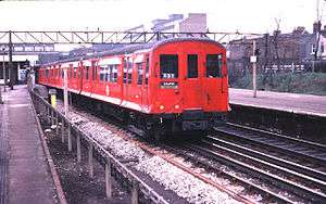
In 1959–60 the Circle line trains were increased to 6 cars, the same length as those operating on the Hammersmith & City line, and the stock of the two lines was integrated and maintenance concentrated at Hammersmith depot, allowing Neasden depot to concentrate on the new A Stock.[22] Aluminium C Stock trains, with public address systems and originally unpainted, replaced these trains from 1970.[23] One person operation of the trains was proposed in 1972, but due to conflict with the Trade Unions was not introduced until 1984.[24] In 2003, the infrastructure of the Circle line was partly privatised in a public–private partnership, managed by the Metronet consortium. Metronet went into administration in 2007 and the local government body Transport for London took over responsibilities.[25]
On 7 July 2005, at about 08:50, bombs exploded on two Circle line trains. One was travelling between Liverpool Street and Aldgate and the other was at Edgware Road. The bombs killed 15 people, including the two suicide bombers.[26][27] Following the attacks, the whole of the Circle line was closed until 8 August.[28] A day before a ban on drinking alcohol on public transport in London came into force, a party was held on 31 May 2008, mainly on the Circle line. Thousands of people attended and 17 were arrested by police due to disorderly behaviour, eventually causing several stations to be closed.[29]
Extension
Prior to 13 December 2009, the Circle line trains travelled in both directions around a simple loop with 27 stations and 12.89 miles (20.75 km) of track. In 2006 there were fourteen trains in service on the line with an interval between trains of 8 1⁄2 minutes during peak hours and 8 minutes off-peak; the minimum running time around the circle off-peak was 51 1⁄2 minutes,[30] but timetabled stops at stations extended this.[lower-alpha 2]
.svg.png)
In December 2009 the Circle line was extended to include the Hammersmith & City route from Edgware Road to Hammersmith. Rather than continuously running around the circle, trains now travel from Hammersmith to Edgware Road, generally going around the circle once before terminating at Edgware Road, and returning via the same route; occasional trains may also continue clockwise through Edgware Road to additional stations. Service operation was changed to improve reliability and increase the service frequency on the Hammersmith branch.[32]
The first S7 Stock train entered passenger service on the Hammersmith & City line on 6 July 2012, running a shuttle service between Hammersmith and Moorgate,[33] and first ran on the Circle line on 2 September 2013.[34][35][36] By June 2014 all services were provided by S7 Stock trains.
Route
Map

Railway line
| Circle line | |||||||||||||||||||||||||||||||||||||||||||||||||||||||||||||||||||||||||||||||||||||||||||||||||||||||||||||||||||||||||||||||||||||||||||||||||||||||||||||||||||||||||||||||||||||||||||||||||||||||||||||||||||||||||||||||||||||||||||||||||||||||||||||||||||||||||||||||||||||||||||||||||||||||||||||||||||||||||||||||||||||||||||||||||||||||||||||||||||||||||||
|---|---|---|---|---|---|---|---|---|---|---|---|---|---|---|---|---|---|---|---|---|---|---|---|---|---|---|---|---|---|---|---|---|---|---|---|---|---|---|---|---|---|---|---|---|---|---|---|---|---|---|---|---|---|---|---|---|---|---|---|---|---|---|---|---|---|---|---|---|---|---|---|---|---|---|---|---|---|---|---|---|---|---|---|---|---|---|---|---|---|---|---|---|---|---|---|---|---|---|---|---|---|---|---|---|---|---|---|---|---|---|---|---|---|---|---|---|---|---|---|---|---|---|---|---|---|---|---|---|---|---|---|---|---|---|---|---|---|---|---|---|---|---|---|---|---|---|---|---|---|---|---|---|---|---|---|---|---|---|---|---|---|---|---|---|---|---|---|---|---|---|---|---|---|---|---|---|---|---|---|---|---|---|---|---|---|---|---|---|---|---|---|---|---|---|---|---|---|---|---|---|---|---|---|---|---|---|---|---|---|---|---|---|---|---|---|---|---|---|---|---|---|---|---|---|---|---|---|---|---|---|---|---|---|---|---|---|---|---|---|---|---|---|---|---|---|---|---|---|---|---|---|---|---|---|---|---|---|---|---|---|---|---|---|---|---|---|---|---|---|---|---|---|---|---|---|---|---|---|---|---|---|---|---|---|---|---|---|---|---|---|---|---|---|---|---|---|---|---|---|---|---|---|---|---|---|---|---|---|---|---|---|---|---|---|---|---|---|---|---|---|---|---|---|---|---|---|---|---|---|---|---|---|---|---|---|---|---|---|---|---|---|---|---|---|---|---|---|---|---|---|---|---|---|---|---|---|---|---|---|---|---|---|---|
Legend | |||||||||||||||||||||||||||||||||||||||||||||||||||||||||||||||||||||||||||||||||||||||||||||||||||||||||||||||||||||||||||||||||||||||||||||||||||||||||||||||||||||||||||||||||||||||||||||||||||||||||||||||||||||||||||||||||||||||||||||||||||||||||||||||||||||||||||||||||||||||||||||||||||||||||||||||||||||||||||||||||||||||||||||||||||||||||||||||||||||||||||
| |||||||||||||||||||||||||||||||||||||||||||||||||||||||||||||||||||||||||||||||||||||||||||||||||||||||||||||||||||||||||||||||||||||||||||||||||||||||||||||||||||||||||||||||||||||||||||||||||||||||||||||||||||||||||||||||||||||||||||||||||||||||||||||||||||||||||||||||||||||||||||||||||||||||||||||||||||||||||||||||||||||||||||||||||||||||||||||||||||||||||||
The Circle line is 17 miles (27 km) long with 35 stations.[37] Much of its track and all of its stations are shared with the other London Underground sub-surface lines: from Hammersmith to just before Aldgate by the Hammersmith & City line, from Baker Street to Aldgate by the Metropolitan line and from Tower Hill station to Edgware Road station by the District line.[38] The line is electrified with a four-rail DC system: a central conductor rail is energised at –210 V and a rail outside the running rail at +420 V, giving a potential difference of 630 V.[39] The running rails are not electrified. Much of the 2-mile-35-chain (3.9 km) double track railway from the Hammersmith terminus to Westbourne Park station is on 20-foot (6.1 m) high brick viaduct.[40]
East of Westbourne Park the line passes beneath the Great Western main line before resurfacing at Royal Oak station and running alongside the tracks of the main line to an island platform just north of the suburban platforms at Paddington station.[38] The line enters a cut and cover tunnel at the end of the platforms and meets the District line and the other end of the Circle line from Bayswater at Praed Street Junction before passing through Edgware Road station in a cutting. After King's Cross St Pancras station the line exits tunnel before passing under the Ray Street Gridiron that carries the City Widened Lines which are currently used by Thameslink services.[38][41] Tunnel is re-entered after Farringdon station; there are bay platforms at Moorgate station.[38]
After passing through Aldgate station the line joins the District line at Tower Hill; this part of the line includes stations on the Victoria Embankment on the north bank of the Thames, until Westminster station is reached.[38] West of Gloucester Road station the line turns off the District main line to join the District line's Edgware Road branch just before High Street Kensington station.[38] In Bayswater the line is in cutting and this is concealed by a façade of two five-storey houses at Nos. 23 and 24 Leinster Gardens.[42] Trains then use different platforms at Paddington station before rejoining the Hammersmith & City line at Praed Street junction and terminating at the four platform Edgware Road station.[38]
Services
As of December 2012 there are six trains per hour, calling at all stations,[43] and requiring 18 trains in service.[37] The journey from Edgware Road around the circle and continuing to Hammersmith takes 72 minutes off-peak.[43] Together with the Hammersmith & City line over 114 million passenger journeys are made each year.[1] Paddington and all stations on the loop are within Zone 1, and those on the Hammersmith line in Zone 2.[44]
There is no regular service to Barking; however there are two trains per day that run from Barking to Edgware Road via Victoria before 6a.m. (as of February 2015)[45]
Rolling stock
S Stock
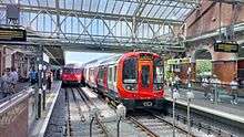
Services are provided by seven-car S Stock, and like the 8-car variants now in use on the Metropolitan line, these trains are part of Bombardier's Movia family, with air-conditioning as the sub-surface tunnels, unlike those on the deep-level tube lines, are able to disperse the exhausted hot air.[46] These trains have regenerative brakes, returning around 20 per cent of their energy to the network.[47] They have a top speed of 62 mph (100 km/h).[46] A 7-car S Stock train has a capacity of 865 passengers compared to 739 for the 6-car C Stock train it replaces.[48][49] With a length of 117 metres (384 ft), the S Stock trains are 24 metres (79 ft) longer than the 93-metre (305 ft) long C stock train, so station platforms have been lengthened.[50] It is planned to increase the traction voltage from the present nominal 630 V to 750 V to give better performance and allow the trains to return more energy to the network through their regenerative brakes.[49]
Depot
The line's depot is at Hammersmith,[lower-alpha 3] close to Hammersmith station, originally built by the Great Western Railway to be operated by the Metropolitan Railway when the joint Hammersmith & City Railway was electrified in the early 20th century.[51] Sidings at Barking, Farringdon and near High Street Kensington (known as Triangle Sidings) stable trains overnight.[37]
Upgrade programme
Together with the introduction of 7-car S Stock trains, the sub-surface track, electrical supply and signalling systems are being upgraded in a programme planned to increase peak-hour capacity on the Circle and Hammersmith & City lines by 65 per cent by the end of 2018.[52][53][54] A single control room for the sub-surface network is to be established in Hammersmith, and an automatic train control (ATC) system will replace signalling equipment installed from the 1940s.[53][55] The cross-London Crossrail line, planned to open in 2018, is expected to reduce crowding on Circle line services between Paddington and Aldgate.[56][57]
List of stations
| Station | Image | Opened[6] | Additional information | Position |
|---|---|---|---|---|
| Hammersmith | _station_building.JPG) | 13 June 1864 | Moved to current position 1 December 1868.[6] | 51°29′39″N 000°13′30″W / 51.49417°N 0.22500°W |
| Goldhawk Road | 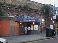 | 1 April 1914 | 51°30′07″N 000°13′37″W / 51.50194°N 0.22694°W | |
| Shepherd's Bush Market | 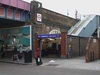 | 13 June 1864 | Moved to current position 1 April 1914.[6] Renamed from "Shepherd's Bush" in 2008.[58] | 51°30′21″N 000°13′35″W / 51.50583°N 0.22639°W |
| Wood Lane | 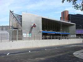 | 1 May 1908 | Open as Wood Lane (Exhibition) 1908–14 and as required from 1920 as Wood Lane (White City). Renamed White City in 1947 and closed in 1959,[6] until re-opened as Wood Lane on 12 October 2008.[59] | 51°30′35″N 000°13′27″W / 51.50972°N 0.22417°W |
| Latimer Road | 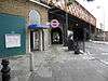 | 16 December 1868 | Closed from 17 January to 1 August 2011 for engineering and refurbishment works.[60] | 51°30′50″N 000°13′02″W / 51.51389°N 0.21722°W |
| Ladbroke Grove | 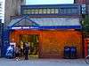 | 13 June 1864 | Opened as Notting Hill, renamed Notting Hill & Ladbroke Grove in 1880, Ladbroke Grove (North Kensington) in 1919, and Ladbroke Grove in 1938.[6] | 51°31′02″N 000°12′38″W / 51.51722°N 0.21056°W |
| Westbourne Park | 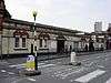 | 1 February 1866 | Moved to current position 1 November 1871,[6] and a Great Western main-line station from 1871 to 1992.[61] | 51°31′16″N 000°12′04″W / 51.52111°N 0.20111°W |
| Royal Oak | 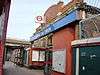 | 30 October 1871 | Also a Great Western main line station after opening.[62]until 1934 | 51°31′09″N 000°11′17″W / 51.51917°N 0.18806°W |
| Paddington | 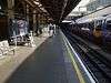 | 10 January 1863 | Opened as Paddington (Bishop's Road), renamed in 1948.[6] Connects with Bakerloo and District lines and Paddington main line station. | 51°31′07″N 000°10′46″W / 51.51861°N 0.17944°W |
| Edgware Road | 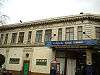 | 10 January 1863 | Connects with District and the anti-clockwise Circle line. | 51°31′12″N 000°10′04″W / 51.52000°N 0.16778°W |
| Baker Street | 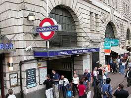 | 10 January 1863 | Connects with Bakerloo, Jubilee and Metropolitan lines. | 51°31′19″N 000°09′25″W / 51.52194°N 0.15694°W |
| Great Portland Street | 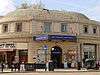 | 10 January 1863 | Opened as Portland Road, renamed Great Portland Street in 1917. Named Great Portland Street & Regent's Park 1923–33.[6] | 51°31′26″N 000°08′38″W / 51.52389°N 0.14389°W |
| Euston Square | 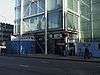 | 10 January 1863 | Opened as Gower Street and renamed in 1909.[6] Street connection with Euston main line station. | 51°31′33″N 000°08′09″W / 51.52583°N 0.13583°W |
| King's Cross St Pancras | 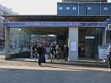 | 10 January 1863 | Opened as King's Cross, renamed King's Cross & St. Pancras in 1925 and King's Cross St. Pancras in 1933. Moved to current position in 1941.[6] Connects with Northern, Piccadilly and Victoria lines and St Pancras and King's Cross main line stations. | 51°31′49″N 000°07′27″W / 51.53028°N 0.12417°W |
| Farringdon | 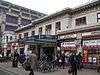 | 10 January 1863 | Opened as Farringdon Street, and moved to current position in 1865. Renamed Farringdon & High Holborn in 1922 and Farringdon in 1936.[6] Connects with Thameslink services. | 51°31′12″N 000°06′19″W / 51.52000°N 0.10528°W |
| Barbican |  | 23 December 1865 | Opened as Aldersgate Street, then Aldersgate in 1910, Aldersgate & Barbican in 1923 and Barbican in 1968.[6] | 51°31′13″N 000°05′52″W / 51.52028°N 0.09778°W |
| Moorgate | 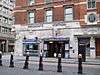 | 23 December 1865 | Opened as Moorgate Street, renamed in 1924.[6] Connects with Northern line and the main line Northern City Line | 51°31′07″N 000°05′19″W / 51.51861°N 0.08861°W |
| Liverpool Street | 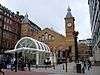 | 11 July 1875 | From February to July 1875 trains used platforms in the mainline station.[63] Connects with Central and Hammersmith & City lines and Liverpool Street mainline station. | 51°31′04″N 000°04′59″W / 51.51778°N 0.08306°W |
| Aldgate | 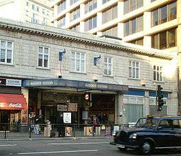 | 18 November 1876 | 51°30′50″N 000°04′34″W / 51.51389°N 0.07611°W | |
| Tower Hill | 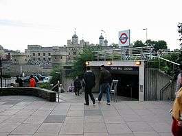 | 25 September 1882 | The Metropolitan Railway opened "Tower of London", however closed this in 1884 as the District Railway had opened "Mark Lane" nearby. This station was renamed "Tower Hill" in 1946 and moved to the site of the "Tower of London" station in 1967.[6][64] Connects with District line. | 51°30′36″N 000°04′34″W / 51.51000°N 0.07611°W |
| Monument | 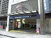 | 6 October 1884 | Opened as Eastcheap, renamed The Monument in 1884.[6] Escalator connection to Bank station giving connections with Central, Northern, Waterloo & City and DLR. | 51°30′47″N 000°05′17″W / 51.51306°N 0.08806°W |
| Cannon Street | 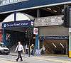 | 6 October 1884 | Connects with Cannon Street main line station. | 51°30′37″N 000°05′27″W / 51.51028°N 0.09083°W |
| Mansion House | 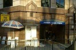 | 3 July 1871 | 51°30′44″N 000°05′39″W / 51.51222°N 0.09417°W | |
| Blackfriars | 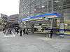 | 30 May 1870 | Connects with Blackfriars main line station and Thameslink services. | 51°30′42″N 000°06′11″W / 51.51167°N 0.10306°W |
| Temple | 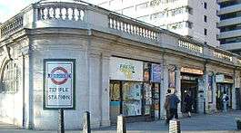 | 30 May 1870 | Opened as The Temple.[6] | 51°30′40″N 000°06′52″W / 51.51111°N 0.11444°W |
| Embankment | 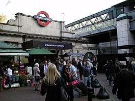 | 30 May 1870 | Opened as Charing Cross, renamed Charing Cross Embankment in 1974 and to the current name from 1976.[6] Connects with Bakerloo and Northern lines and Charing Cross main line station | 51°30′25″N 000°07′19″W / 51.50694°N 0.12194°W |
| Westminster |  | 24 December 1868 | Opened as Westminster Bridge, renamed in 1907.[6] Connects with Jubilee line | 51°30′04″N 000°07′30″W / 51.50111°N 0.12500°W |
| St James's Park | 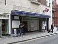 | 24 December 1868 | 51°29′58″N 000°08′04″W / 51.49944°N 0.13444°W | |
| Victoria | 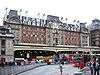 | 24 December 1868 | Connects with Victoria line and Victoria main line station. | 51°29′48″N 000°08′41″W / 51.49667°N 0.14472°W |
| Sloane Square | 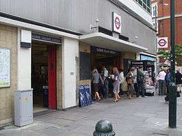 | 24 December 1868 | 51°29′33″N 000°09′24″W / 51.49250°N 0.15667°W | |
| South Kensington | 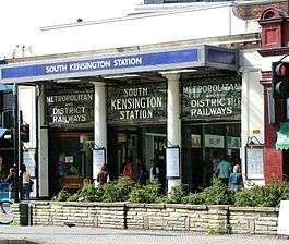 | 24 December 1868 | Connects with Piccadilly line | 51°29′39″N 000°10′26″W / 51.49417°N 0.17389°W |
| Gloucester Road | 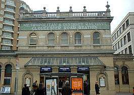 | 1 October 1868 | Opened as Brompton (Gloucester Road), renamed in 1907.[6] Connects with Piccadilly and District lines. | 51°29′41″N 000°10′59″W / 51.49472°N 0.18306°W |
| High Street Kensington | 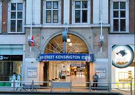 | 1 October 1868 | Opened as Kensington (High Street) and name gradually changed by 1880.[6] Connects with District line Edgware Road branch. | 51°30′03″N 000°11′33″W / 51.50083°N 0.19250°W |
| Notting Hill Gate | 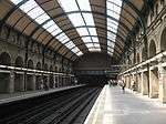 | 1 October 1868 | Connects with Central line. | 51°30′32″N 000°11′49″W / 51.50889°N 0.19694°W |
| Bayswater |  | 1 October 1868 | Opened as Bayswater, renamed Bayswater (Queen's Road) & Westbourne Grove in 1923, Bayswater (Queen's Road) in 1933 and Bayswater (Queensway) in 1946, after which the suffix was gradually dropped.[6] | 51°30′43″N 000°11′17″W / 51.51194°N 0.18806°W |
| Paddington |  | 1 October 1868 | Opened as Paddington (Praed Street), renamed in 1948.[6] Connects with Bakerloo and Hammersmith & City lines and Paddington main line station. |
The line then continues to Edgware Road where trains terminate, then reverse to traverse the loop in an anticlockwise direction to Hammersmith.
See also
Notes and references
Notes
- ↑ combined figures for Circle and Hammersmith & City lines
- ↑ For example the 22:26 outer rail (clockwise) service from Aldgate was booked to arrive back at Aldgate at 23:22 after waiting at Gloucester Road (for 1 1⁄2 minutes), Edgware Road ( 2 1⁄2 minutes) and Baker Street ( 1⁄2 minute).[31]
- ↑ Position: 51°29′52″N 000°13′31″W / 51.49778°N 0.22528°W
References
- 1 2 "Performance: LU Performance Data Almanac". Transport for London. 2012. Archived from the original on 14 February 2013. Retrieved 17 January 2013.
- ↑ Green 1987, pp. 7–9.
- ↑ Green 1987, pp. 10–11.
- ↑ Green 1987, p. 12.
- ↑ Simpson 2003, pp. 23–4.
- 1 2 3 4 5 6 7 8 9 10 11 12 13 14 15 16 17 18 19 20 21 22 23 Rose 2007.
- 1 2 3 Bruce 1983, p. 11.
- ↑ Horne 2003, p. 28.
- ↑ Green 1987, p. 25.
- ↑ Bruce 1983, pp. 33,37.
- ↑ Bruce 1983, p. 40.
- ↑ Bruce 1983, p. 37.
- ↑ Bruce 1983, p. 39.
- ↑ Bruce 1983, p. 71.
- ↑ Bruce 1983, pp. 40–41.
- ↑ Bruce 1983, pp. 76–77.
- ↑ Green 1987, p. 51.
- ↑ Bruce 1983, p. 94.
- ↑ Green 1987, p. 33.
- ↑ Green 1987, p. 54.
- ↑ "1949 tube map". Retrieved 5 March 2012.
- ↑ Bruce 1983, p. 95.
- ↑ Bruce 1983, p. 114.
- ↑ Croome, Desmond F.; Jackson, Alan Arthur (1993). Rails Through the Clay: A History of London's Tube Railways. Capital Transport. p. 468. ISBN 978-1-85414-151-4.
- ↑ "PPP Performance Report" (PDF). Transport for London. 2010. pp. 7–8. Retrieved 7 March 2012.
- ↑ "7 July Bombings: Edgware Road". BBC News. Retrieved 24 November 2012.
- ↑ "7 July Bombings: Aldgate". BBC News. Retrieved 24 November 2012.
- ↑ Day & Reed 2010, p. 217.
- ↑ "Tube drinks party sparks mayhem". BBC News. 1 June 2008. Retrieved 23 August 2012.
- ↑ Working Timetable No. 21, from 11 June 2006. Circle line, Hammersmith & City line. London Underground. 20 April 2006. pp. 2–3.
- ↑ Working Timetable No. 21, from 11 June 2006. Circle line, Hammersmith & City line. London Underground. 20 April 2006. p. 45.
- ↑ "Circle Line extended to the west". BBC News. 5 March 2009. Retrieved 24 November 2011.
- ↑ Bull, John; Moore, George (9 July 2012). "In Pictures: The S7 Stock In Passenger Service". London Reconnections. Retrieved 16 July 2012.
- ↑ "S Stock trains take to Circle line". Global Rail News. 3 September 2013. Retrieved 3 September 2013.
- ↑ Prentice, Paul (18 September 2013). "S Stock trains enter service on the Circle and District lines". Rail (731): 26.
- ↑ Hendy, Peter (December 2013). "Commissioner's Report" (PDF). Transport for London. p. 5. Archived from the original (PDF) on 24 December 2013. Retrieved 21 December 2013.
- 1 2 3 "Circle line facts". Transport for London. Retrieved 5 December 2012.
- 1 2 3 4 5 6 7 "Detailed London Transport Map". carto.metro.free.fr. Retrieved 23 November 2012.
- ↑ Martin, Andrew (26 April 2012). Underground, Overground: A Passenger's History of the Tube. Profile Books. pp. 137–138. ISBN 978-1-84765-807-4. Retrieved 7 December 2012.
- ↑ Jackson 1986, p. 38.
- ↑ Jackson 1986, p. 48.
- ↑ Jackson 1986, pp. 52–53.
- 1 2 "Hammersmith to Edgware Road Circle line timetable". Transport for London. Retrieved 9 December 2012. In the Tube timetable - Tube station box select "Hammersmith (H&C Line)" and press Get Timetable. Select Edgware Road timetable and then view timetable.
- ↑ "Standard Tube Map" (PDF). Transport for London. Retrieved 8 December 2012.
- ↑ http://www.citymetric.com/transport/london-underground-why-are-circle-line-trains-showing-whitechapel-1544
- 1 2 "Metro — London, United Kingdom". Bombardier. Retrieved 27 January 2011.
- ↑ "Transforming the Tube" (PDF). Transport for London. July 2008. Archived from the original (PDF) on 5 June 2011. Retrieved 28 May 2009.
- ↑ "Rolling Stock: C Stock". Transport for London. Retrieved 25 November 2012.
- 1 2 "Rolling Stock: S stock". Transport for London. Retrieved 10 January 2012. Note: The table erroneously says "Length per car", instead of "Length per train".
- ↑ "'S' stock making its mark". Modern Railways. London. December 2010. p. 46.
- ↑ Jackson 1986, p. 185.
- ↑ "Our Upgrade Plan" (PDF). Transport for London. February 2011. Retrieved 7 December 2012.
- 1 2 Abbott, James (January 2013). "Sub-surface renewal". Modern Railways. pp. 38–41.
- ↑ "Hammersmith & City line Upgrade Plan". Transport for London. Retrieved 8 December 2012.
- ↑ Stewart, Rob (January 2013). "Cityflo 650 to control the SSR". Modern Railways. pp. 42–43.
- ↑ "A World-Class new railway for London and the South-East". Crossrail. Retrieved 6 February 2013.
- ↑ "Crossrail business case - Summary Report". Crossrail. July 2010. p. 6. Retrieved 6 February 2013.
- ↑ "Modernisation complete as Shepherd's Bush Tube station re-opens" (Press release). Transport for London. 7 October 2008. Archived from the original on 16 August 2012. Retrieved 6 February 2013.
- ↑ "New Wood Lane Underground station opens" (Press release). Transport for London. 14 October 2008. Retrieved 8 December 2012.
- ↑ "Latimer Road station to close for three months for engineering works" (Press release). Transport for London. 14 January 2011.
- ↑ Butt 1995, p. 244.
- ↑ Butt 1995, p. 200.
- ↑ Jackson 1986, p. 70.
- ↑ Jackson 1986, p. 110.
Bibliography
- Butt, R. V. J. (1995). The Directory of Railway Stations: details every public and private passenger station, halt, platform and stopping place, past and present (1st ed.). Patrick Stephens Ltd. ISBN 1-8526-0508-1.
- Bruce, J Graeme (1983). Steam to Silver. A history of London Transport Surface Rolling Stock. Capital Transport. ISBN 0-904711-45-5.
- Day, John R; Reed, John (2010). The Story of London's Underground. Capital Transport. ISBN 978-1-85414-341-9.
- Green, Oliver (1987). The London Underground: An illustrated history. Ian Allan. ISBN 0-7110-1720-4.
- Horne, Mike (2003). The Metropolitan Line. Capital Transport. ISBN 1-85414-275-5.
- Jackson, Alan (1986). London's Metropolitan Railway. David & Charles. ISBN 0-7153-8839-8.
- Rose, Douglas (December 2007) [1980]. The London Underground: A Diagrammatic History (8th ed.). Capital Transport. ISBN 978-1-85414-315-0.
- Simpson, Bill (2003). A History of the Metropolitan Railway. Volume 1: The Circle and Extended Lines to Rickmansworth. Lamplight Publications. ISBN 1-899246-07-X.
Further reading
- Croome, Desmond F. (1 February 2003). Circle Line. Capital Transport. ISBN 978-1-85414-267-2.
- London Railway Map. Quail Maps. 2001. ISBN 978-1898319-54-2.
- Yonge, John (November 2008) [1994]. Jacobs, Gerald, ed. 5: Southern & TfL. Railway Track Diagrams (3rd ed.). Bradford on Avon: Trackmaps. ISBN 978-0-9549866-4-3.
External links
| Wikimedia Commons has media related to Circle Line. |
- Circle Line Clive's UndergrounD Line Guides
- Circle line on Twitter

| Stations |
| ||||||||||
|---|---|---|---|---|---|---|---|---|---|---|---|
| Rolling stock | |||||||||||
| History |
| ||||||||||
| See also | |||||||||||
| |||||||||||