Chester, Georgia
| Chester, Georgia | |
|---|---|
| Town | |
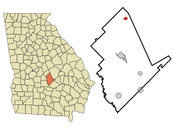 Location in Dodge County and the state of Georgia | |
| Coordinates: 32°23′42″N 83°9′13″W / 32.39500°N 83.15361°WCoordinates: 32°23′42″N 83°9′13″W / 32.39500°N 83.15361°W | |
| Country | United States |
| State | Georgia |
| County | Dodge |
| Incorporated (town) | 1912 |
| Area | |
| • Total | 0.9 sq mi (2.3 km2) |
| • Land | 0.9 sq mi (2.3 km2) |
| • Water | 0 sq mi (0 km2) |
| Elevation | 367 ft (112 m) |
| Population (2010) | |
| • Total | 1,596 |
| • Density | 1,832/sq mi (707.4/km2) |
| Time zone | Eastern (EST) (UTC-5) |
| • Summer (DST) | EDT (UTC-4) |
| ZIP code | 31012 |
| Area code(s) | 478 |
| FIPS code | 13-15900[1] |
| GNIS feature ID | 0331384[2] |
Chester is a town in Dodge County, Georgia, United States. The population was 1,596 at the 2010 census,[3] up from 305 at the 2000 census due to inclusion of Dodge State Prison within the town limits.
Geography
Chester is located in northern Dodge County at 32°23′42″N 83°9′13″W / 32.39500°N 83.15361°W (32.394965, -83.153610).[4] Georgia State Route 126 passes through the town as Main Street, leading west 13 miles (21 km) to Cochran and southeast 8 miles (13 km) to Cadwell. Georgia State Route 257 joins SR 126 on Main Street through the center of Chester, but leads northeast 7 miles (11 km) to Dexter and southwest 9 miles (14 km) to Empire. Eastman, the Dodge County seat, is 15 miles (24 km) to the south via Chester Highway.
According to the United States Census Bureau, Chester has a total area of 0.89 square miles (2.3 km2), all of it land.[3]
Demographics
| Historical population | |||
|---|---|---|---|
| Census | Pop. | %± | |
| 1910 | 278 | — | |
| 1920 | 397 | 42.8% | |
| 1930 | 267 | −32.7% | |
| 1940 | 281 | 5.2% | |
| 1950 | 315 | 12.1% | |
| 1960 | 377 | 19.7% | |
| 1970 | 409 | 8.5% | |
| 1980 | 409 | 0.0% | |
| 1990 | 1,072 | 162.1% | |
| 2000 | 305 | −71.5% | |
| 2010 | 1,596 | 423.3% | |
| Est. 2015 | 1,568 | [5] | −1.8% |
As of the census[1] of 2000, there were 305 people, 133 households, and 82 families residing in the town. The population density was 349.0 people per square mile (135.4/km²). There were 167 housing units at an average density of 191.1 per square mile (74.1/km²). The racial makeup of the town was 54.10% White, 44.59% African American, 0.66% from other races, and 0.66% from two or more races.
There were 133 households out of which 33.1% had children under the age of 18 living with them, 31.6% were married couples living together, 24.1% had a female householder with no husband present, and 38.3% were non-families. 35.3% of all households were made up of individuals and 14.3% had someone living alone who was 65 years of age or older. The average household size was 2.29 and the average family size was 2.93.
In the town the population was spread out with 26.6% under the age of 18, 9.2% from 18 to 24, 26.9% from 25 to 44, 22.0% from 45 to 64, and 15.4% who were 65 years of age or older. The median age was 36 years. For every 100 females there were 83.7 males. For every 100 females age 18 and over, there were 80.6 males.
The median income for a household in the town was $21,875, and the median income for a family was $26,667. Males had a median income of $20,833 versus $20,750 for females. The per capita income for the town was $13,843. About 20.5% of families and 15.8% of the population were below the poverty line, including 13.7% of those under the age of 18 and 17.3% of those 65 or over.
References
- 1 2 "American FactFinder". United States Census Bureau. Archived from the original on 2013-09-11. Retrieved 2008-01-31.
- ↑ "US Board on Geographic Names". United States Geological Survey. 2007-10-25. Retrieved 2008-01-31.
- 1 2 "Geographic Identifiers: 2010 Demographic Profile Data (G001): Chester town, Georgia". U.S. Census Bureau, American Factfinder. Retrieved October 22, 2015.
- ↑ "US Gazetteer files: 2010, 2000, and 1990". United States Census Bureau. 2011-02-12. Retrieved 2011-04-23.
- ↑ "Annual Estimates of the Resident Population for Incorporated Places: April 1, 2010 to July 1, 2015". Retrieved July 2, 2016.
- ↑ "Census of Population and Housing". Census.gov. Archived from the original on May 11, 2015. Retrieved June 4, 2015.
Municipalities and communities of Dodge County, Georgia, United States | ||
|---|---|---|
| City | 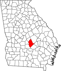 | |
| Towns | ||
| CDP | ||
| Unincorporated community | ||
| Footnotes | ‡This populated place also has portions in an adjacent county or counties | |