Rhine, Georgia
| Rhine, Georgia | |
|---|---|
| Town | |
 Location in Dodge County and the state of Georgia | |
| Coordinates: 31°59′23″N 83°11′56″W / 31.98972°N 83.19889°WCoordinates: 31°59′23″N 83°11′56″W / 31.98972°N 83.19889°W | |
| Country | United States |
| State | Georgia |
| County | Dodge |
| Area | |
| • Total | 3.1 sq mi (8.1 km2) |
| • Land | 3.1 sq mi (8.1 km2) |
| • Water | 0 sq mi (0 km2) |
| Elevation | 243 ft (74 m) |
| Population (2010) | |
| • Total | 394 |
| • Density | 126/sq mi (48.5/km2) |
| Time zone | Eastern (EST) (UTC-5) |
| • Summer (DST) | EDT (UTC-4) |
| ZIP code | 31077 |
| Area code(s) | 229 |
| FIPS code | 13-64932[1] |
| GNIS feature ID | 0321548[2] |
Rhine is a town in Dodge County, Georgia, United States. The population was 394 at the 2010 census.[3]
History
In 1886 the Seaboard Airline Railroad was built through southern Dodge County, and immediately the town of Rhine sprang up. The turpentine and lumber camps of Milan and Rhine began to flourish. They are towns in a rich agricultural section of Georgia.
The first general store that opened in Rhine was by Messrs. G. W. and D. M. Ryals. A turpentine still was established by three brothers named Robitzsch, who came from North Carolina. The town was built on land that was owned for many years by J. M. Swymer. Another pioneer settler was James Reaves, whose family still resides there. Gradually other stores were built and homes erected. The citizens of Rhine are principally engaged in lumber and agriculture.
Geography
Rhine is located in southern Dodge County at 31°59′23″N 83°11′56″W / 31.98972°N 83.19889°W (31.989696, -83.198762).[4] U.S. Route 280 passes through the town, leading west 6 miles (10 km) to Abbeville and east 8 miles (13 km) to Milan. Georgia State Route 117 crosses US 280 in the center of Rhine, leading north 15 miles (24 km) to Eastman, the Dodge County seat, and southeast 19 miles (31 km) to Jacksonville, Georgia. State Route 165 diverges from SR 117 in the north part of town and leads 11 miles (18 km) northeast to Chauncey.
According to the United States Census Bureau, the town of Rhine has a total area of 3.1 square miles (8.1 km2), all of it land.[3]
Demographics
| Historical population | |||
|---|---|---|---|
| Census | Pop. | %± | |
| 1900 | 191 | — | |
| 1910 | 321 | 68.1% | |
| 1920 | 396 | 23.4% | |
| 1930 | 450 | 13.6% | |
| 1940 | 463 | 2.9% | |
| 1950 | 514 | 11.0% | |
| 1960 | 485 | −5.6% | |
| 1970 | 471 | −2.9% | |
| 1980 | 590 | 25.3% | |
| 1990 | 466 | −21.0% | |
| 2000 | 422 | −9.4% | |
| 2010 | 394 | −6.6% | |
| Est. 2015 | 377 | [5] | −4.3% |
As of the census[1] of 2000, there were 422 people, 183 households, and 114 families residing in the town. The population density was 134.4 people per square mile (51.9/km²). There were 243 housing units at an average density of 77.4 per square mile (29.9/km²). The racial makeup of the town was 67.54% White, 32.23% African American, and 0.24% from two or more races. Hispanic or Latino of any race were 0.95% of the population.
There were 183 households out of which 27.3% had children under the age of 18 living with them, 36.6% were married couples living together, 21.3% had a female householder with no husband present, and 37.7% were non-families. 35.0% of all households were made up of individuals and 18.0% had someone living alone who was 65 years of age or older. The average household size was 2.31 and the average family size was 2.95.
In the town the population was spread out with 25.8% under the age of 18, 5.9% from 18 to 24, 23.9% from 25 to 44, 25.4% from 45 to 64, and 19.0% who were 65 years of age or older. The median age was 40 years. For every 100 females there were 70.2 males. For every 100 females age 18 and over, there were 67.4 males.
The median income for a household in the town was $19,107, and the median income for a family was $34,750. Males had a median income of $28,281 versus $21,458 for females. The per capita income for the town was $14,204. About 16.5% of families and 24.1% of the population were below the poverty line, including 19.4% of those under age 18 and 36.0% of those age 65 or over.
References
- 1 2 "American FactFinder". United States Census Bureau. Retrieved 2008-01-31.
- ↑ "US Board on Geographic Names". United States Geological Survey. 2007-10-25. Retrieved 2008-01-31.
- 1 2 "Geographic Identifiers: 2010 Demographic Profile Data (G001): Rhine town, Georgia". U.S. Census Bureau, American Factfinder. Retrieved October 22, 2015.
- ↑ "US Gazetteer files: 2010, 2000, and 1990". United States Census Bureau. 2011-02-12. Retrieved 2011-04-23.
- ↑ "Annual Estimates of the Resident Population for Incorporated Places: April 1, 2010 to July 1, 2015". Retrieved July 2, 2016.
- ↑ "Census of Population and Housing". Census.gov. Retrieved June 4, 2015.
Municipalities and communities of Dodge County, Georgia, United States | ||
|---|---|---|
| City | 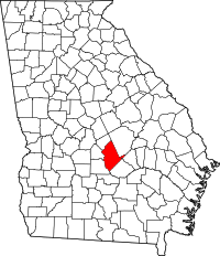 | |
| Towns | ||
| CDP | ||
| Unincorporated community | ||
| Footnotes | ‡This populated place also has portions in an adjacent county or counties | |