Dexter, Georgia
| Dexter, Georgia | |
|---|---|
| Town | |
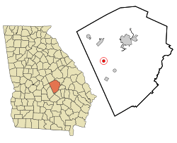 Location in Laurens County and the state of Georgia | |
| Coordinates: 32°26′4″N 83°3′32″W / 32.43444°N 83.05889°WCoordinates: 32°26′4″N 83°3′32″W / 32.43444°N 83.05889°W | |
| Country | United States |
| State | Georgia |
| County | Laurens |
| Area | |
| • Total | 0.8 sq mi (2 km2) |
| • Land | 0.8 sq mi (2 km2) |
| • Water | 0 sq mi (0 km2) |
| Elevation | 312 ft (95 m) |
| Population (2000) | |
| • Total | 509 |
| • Density | 636.3/sq mi (254.5/km2) |
| Time zone | Eastern (EST) (UTC-5) |
| • Summer (DST) | EDT (UTC-4) |
| ZIP code | 31019 |
| Area code(s) | 478 |
| FIPS code | 13-22752[1] |
| GNIS feature ID | 0331543[2] |
Dexter is a town in Laurens County, Georgia, United States. The population was 509 at the 2000 census. It is part of the Dublin Micropolitan Statistical Area.
Geography
Dexter is located at 32°26′4″N 83°3′32″W / 32.43444°N 83.05889°W (32.434580, -83.058904).[3]
According to the United States Census Bureau, the town has a total area of 0.8 square miles (2.1 km2), of which, 0.8 square miles (2.1 km2) of it is land and 0.04 square miles (0.10 km2) of it (2.60%) is water.
Demographics
| Historical population | |||
|---|---|---|---|
| Census | Pop. | %± | |
| 1900 | 199 | — | |
| 1910 | 550 | 176.4% | |
| 1920 | 481 | −12.5% | |
| 1930 | 336 | −30.1% | |
| 1940 | 324 | −3.6% | |
| 1950 | 264 | −18.5% | |
| 1960 | 359 | 36.0% | |
| 1970 | 438 | 22.0% | |
| 1980 | 527 | 20.3% | |
| 1990 | 475 | −9.9% | |
| 2000 | 509 | 7.2% | |
| 2010 | 575 | 13.0% | |
| Est. 2015 | 570 | [4] | −0.9% |
As of the census[1] of 2000, there were 509 people, 207 households, and 143 families residing in the town. The population density was 670.4 people per square mile (258.6/km²). There were 231 housing units at an average density of 304.2 per square mile (117.4/km²). The racial makeup of the town was 77.41% White and 22.59% African American. Hispanic or Latino of any race were 0.20% of the population.
There were 207 households out of which 31.4% had children under the age of 21 living with them, 58.0% were married couples living together, 9.7% had a female householder with no husband present, and 30.9% were non-families. 29.0% of all households were made up of individuals and 21.3% had someone living alone who was 65 years of age or older. The average household size was 2.46 and the average family size was 3.05.
In the town the population was spread out with 26.9% under the age of 21, 7.1% from 21 to 24, 23.0% from 25 to 44, 23.0% from 45 to 64, and 20.0% who were 65 years of age or older. The median age was 40 years. For every 100 females there were 82.4 males. For every 100 females age 21 and over, there were 82.4 males.
The median income for a household in the town was $33,036, and the median income for a family was $44,107. Males had a median income of $30,357 versus $26,375 for females. The per capita income for the town was $22,451. About 10.4% of families and 14.7% of the population were below the poverty line, including 15.7% of those under age 21 and 31.6% of those age 65 or over.
References
- 1 2 "American FactFinder". United States Census Bureau. Retrieved 2008-01-31.
- ↑ "US Board on Geographic Names". United States Geological Survey. 2007-10-25. Retrieved 2008-01-31.
- ↑ "US Gazetteer files: 2010, 2000, and 1990". United States Census Bureau. 2011-02-12. Retrieved 2011-04-23.
- ↑ "Annual Estimates of the Resident Population for Incorporated Places: April 1, 2010 to July 1, 2015". Retrieved July 2, 2016.
- ↑ "Census of Population and Housing". Census.gov. Retrieved June 4, 2015.
Municipalities and communities of Laurens County, Georgia, United States | ||
|---|---|---|
| Cities | 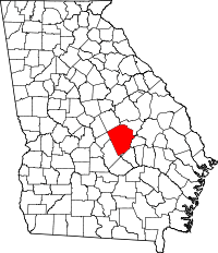 | |
| Towns | ||
| Unincorporated communities | ||
| Footnotes | ‡This populated place also has portions in an adjacent county or counties | |