Cascade Locks, Oregon
| Cascade Locks, Oregon | |
|---|---|
| City | |
|
Former locks on the Columbia River, with the modern Bridge of the Gods in the background | |
 Location in Oregon | |
| Coordinates: 45°40′21″N 121°52′25″W / 45.67250°N 121.87361°WCoordinates: 45°40′21″N 121°52′25″W / 45.67250°N 121.87361°W | |
| Country | United States |
| State | Oregon |
| County | Hood River |
| Incorporated | 1935 |
| Government | |
| • Mayor | Tom Cramblett |
| Area[1] | |
| • Total | 3.04 sq mi (7.87 km2) |
| • Land | 2.08 sq mi (5.39 km2) |
| • Water | 0.96 sq mi (2.49 km2) |
| Elevation | 170 ft (50 m) |
| Population (2010)[2] | |
| • Total | 1,144 |
| • Estimate (2012[3]) | 1,149 |
| • Density | 550.0/sq mi (212.4/km2) |
| Time zone | Pacific (UTC-8) |
| • Summer (DST) | Pacific (UTC-7) |
| ZIP code | 97014 |
| Area code(s) | 541 and 458 |
| FIPS code | 41-11600[2] |
| GNIS feature ID | 1139422[4] |
| Website | www.cascade-locks.or.us www.cascadelocks.net |

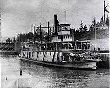
Cascade Locks is a city in Hood River County, Oregon, United States. The city took its name from a set of locks built to improve navigation past the Cascades Rapids of the Columbia River. The U.S. federal government approved the plan for the locks in 1875, construction began in 1878, and the locks were completed on November 5, 1896. The locks were subsequently submerged in 1938, replaced by Bonneville Lock and Dam, although the city lost no land from the expansion of Lake Bonneville behind the dam some 4 miles (6 km) downstream of the city. The city population was 1,144 at the 2010 census. The 2007 estimate is 1,075 residents.[5]

Cascade Locks is just upstream from the Bridge of the Gods, a toll bridge that spans the Columbia River. It is the only bridge across the Columbia between Portland and Hood River. Cascade Locks is also a few miles upstream of Eagle Creek Gorge, a popular scenic area that doubles as an alternate route for the Pacific Crest Trail. Cascade Locks is used frequently by hikers along the Pacific Crest Trail (PCT) to cross the Columbia River. Cascade Locks is the lowest point along the trail, which runs from the Mexico–US border in California to the Canada–US border in Washington.
Since 1999, the Confederated Tribes of Warm Springs have been pursuing an off-reservation casino to be sited in Cascade Locks.[6] Since 2008, city officials have been pursuing an arrangement that would allow them to trade city well water for state-owned spring water and to sell it to Nestlé for bottling. In May, 2016, Hood River County voters voted over 65% in favour of a ballot measure that essentially made Nestlé's plan inoperable from an economic sense. Voters in all precincts except Cascade Locks (Precinct 12) voted in favour of the measure (and against Nestlé); voters within Cascade Locks voted 58% against the measure (and in support of Nestlé's plans). In the wake of the election, Cascade Locks city leaders intend to follow the voters' desires and seek a new deal with Nestlé. Both Hood River County and Cascade Locks are governed by charter documents.[7] [8][9]
Geography
According to the United States Census Bureau, the city has a total area of 3.04 square miles (7.87 km2), of which, 2.08 square miles (5.39 km2) is land and 0.96 square miles (2.49 km2) is water.[1]
Climate
This region experiences warm (but not hot) and dry summers, with no average monthly temperatures above 71.6 °F (22.0 °C). According to the Köppen climate classification system, Cascade Locks has a warm-summer Mediterranean climate, abbreviated "Csb" on climate maps.[10] The city receives an average of 76.27 in (1,937 mm) of precipitation per year.[11]
| Cascade Locks (1894-2014 Averages) | ||||||||||||||||||||||||||||||||||||||||||||||||||||||||||||
|---|---|---|---|---|---|---|---|---|---|---|---|---|---|---|---|---|---|---|---|---|---|---|---|---|---|---|---|---|---|---|---|---|---|---|---|---|---|---|---|---|---|---|---|---|---|---|---|---|---|---|---|---|---|---|---|---|---|---|---|---|
| Climate chart (explanation) | ||||||||||||||||||||||||||||||||||||||||||||||||||||||||||||
| ||||||||||||||||||||||||||||||||||||||||||||||||||||||||||||
| ||||||||||||||||||||||||||||||||||||||||||||||||||||||||||||
Demographics
| Historical population | |||
|---|---|---|---|
| Census | Pop. | %± | |
| 1940 | 703 | — | |
| 1950 | 733 | 4.3% | |
| 1960 | 660 | −10.0% | |
| 1970 | 574 | −13.0% | |
| 1980 | 838 | 46.0% | |
| 1990 | 930 | 11.0% | |
| 2000 | 1,115 | 19.9% | |
| 2010 | 1,144 | 2.6% | |
| Est. 2015 | 1,159 | [12] | 1.3% |
2010 census
As of the census of 2010, there were 1,144 people, 445 households, and 305 families residing in the city. The population density was 550.0 inhabitants per square mile (212.4/km2). There were 502 housing units at an average density of 241.3 per square mile (93.2/km2). The racial makeup of the city was 87.7% White, 0.5% African American, 1.8% Native American, 0.9% Asian, 0.6% Pacific Islander, 2.7% from other races, and 5.8% from two or more races. Hispanic or Latino of any race were 9.1% of the population.[2]
There were 445 households of which 30.3% had children under the age of 18 living with them, 47.2% were married couples living together, 13.7% had a female householder with no husband present, 7.6% had a male householder with no wife present, and 31.5% were non-families. 21.6% of all households were made up of individuals and 7.4% had someone living alone who was 65 years of age or older. The average household size was 2.57 and the average family size was 2.95.[2]
The median age in the city was 40.8 years. 20.8% of residents were under the age of 18; 10.3% were between the ages of 18 and 24; 24.4% were from 25 to 44; 32.9% were from 45 to 64; and 11.5% were 65 years of age or older. The gender makeup of the city was 51.5% male and 48.5% female.[2]
2000 census
As of the census of 2000, there were 1,115 people, 427 households, and 313 families residing in the city. The population density was 517.8 people per square mile (200.2/km²). There were 476 housing units at an average density of 221.0 per square mile (85.5/km²). The racial makeup of the city was 89.15% White, 0.09% African American, 4.22% Native American, 0.72% Asian, 2.60% from other races, and 3.23% from two or more races. Hispanic or Latino of any race were 7.17% of the population.[2]
There were 427 households out of which 37.2% had children under the age of 18 living with them, 57.4% were married couples living together, 11.7% had a female householder with no husband present, and 26.5% were non-families. 21.5% of all households were made up of individuals and 8.2% had someone living alone who was 65 years of age or older. The average household size was 2.61 and the average family size was 2.98.[2]
In the city the population was spread out with 28.7% under the age of 18, 6.7% from 18 to 24, 31.5% from 25 to 44, 21.4% from 45 to 64, and 11.7% who were 65 years of age or older. The median age was 36 years. For every 100 females there were 98.8 males. For every 100 females age 18 and over, there were 97.3 males.[2]
The median income for a household in the city was $35,284, and the median income for a family was $37,422. Males had a median income of $35,469 versus $25,234 for females. The per capita income for the city was $15,359. About 17.0% of families and 19.0% of the population were below the poverty line, including 22.1% of those under age 18 and 9.4% of those age 65 or over.[2]
Economy
.jpg)
In April 2015, the city and the Oregon Department of Fish and Wildlife (ODFW), which uses water for a salmon hatchery, applied with the Oregon Water Resources Department to permanently trade public water rights at Oxbow Springs to Nestlé, a process that does not require a public-interest review. Nestlé had approached city officials with a water proposal in 2008. Since Oregon owns the rights to the spring, the city seeks to trade city well water for spring water and to sell the spring water to Nestlé. The plan has been criticized by legislators and 80,000 citizens.[14] The 250,000-square-foot (23,000 m2), $50 million Nestlé bottling plant in Cascade Locks with an unemployment rate of 18.8 percent would have 50 employees and would increase property-tax collections by 67 percent.[15]
Transportation
US 30 runs through the city, and can be accessed by exit 44 from I-84. The Bridge of the Gods connects Cascade Locks to Washington State Route 14.
See also
- Cascade Locks and Canal, historical site after which the city is named
References
- 1 2 "US Gazetteer files 2010". United States Census Bureau. Archived from the original on 2012-07-14. Retrieved 2012-12-21.
- 1 2 3 4 5 6 7 8 9 "American FactFinder". United States Census Bureau. Retrieved 2012-12-21.
- ↑ "Population Estimates". United States Census Bureau. Archived from the original on 2013-06-17. Retrieved 2013-06-02.
- ↑ "US Board on Geographic Names". United States Geological Survey. 2007-10-25. Retrieved 2008-01-31.
- ↑ PSU:Population Research Center
- ↑ Partlow, Joshua (March 11, 2008). "Gamble in the Gorge?". The Oregonian. Portland, Oregon.
- ↑ http://www.kgw.com/news/local/green/cascade-locks-considers-action-after-nestle-plant-voted-down/201823300
- ↑ http://www.oregonlive.com/environment/index.ssf/2016/05/anti-nestle_ballot_measure_in.html
- ↑ http://koin.com/2016/05/17/hood-river-county-voters-water-bottling-measure-nestle-05172016/
- ↑ Climate Summary for Cascade Locks, Oregon
- 1 2 "Period of Record Monthly Climate Summary for Cascade Locks, Oregon". Western Regional Climate Center. Retrieved 2015-01-30.
- ↑ "Annual Estimates of the Resident Population for Incorporated Places: April 1, 2010 to July 1, 2015". Retrieved July 2, 2016.
- ↑ "Census of Population and Housing". Census.gov. Archived from the original on April 22, 2013. Retrieved June 4, 2015.
- ↑ Tracy Loew (April 23, 2015). "Oregon Legislators Protest Nestlé Water Deal". Statesman Journal. Retrieved August 30, 2015.
- ↑ Alison Vekshin (May 26, 2015). "Nestle Bottled-Water Plan Draws Fight in Drought-Stricken Oregon". Bloomberg. Retrieved August 30, 2015.
External links
| Wikimedia Commons has media related to Cascade Locks, Oregon. |
- Entry for Cascade Locks in the Oregon Blue Book
- Cascade Locks Tourism and Port
- Port of Cascade Locks
- Willingham, William. "Cascade Locks". The Oregon Encyclopedia.
Municipalities and communities of Hood River County, Oregon, United States | ||
|---|---|---|
| Cities | 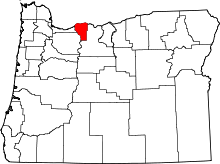 | |
| CDPs | ||
| Other unincorporated communities | ||
| Historic Columbia River Highway | ||
|---|---|---|
| Sheridan State Park MP 44 |
Cascade Locks MP 45-46 |
Herman Creek Bridge MP 47.7 |