Mount Hood, Oregon
Mount Hood is an unincorporated community in Hood River County, Oregon, United States about three miles northeast of Parkdale on Oregon Route 35. Mount Hood is also the terminus of Oregon Route 281, the Hood River Highway.
The community was developed on land owned by a settler named Tieman, and the post office was named for Mount Hood, the most notable object in the landscape.[1] In 1976, the United States Postal Service consolidated the post office with that of Parkdale, which was the larger community. Local residents preferred the name Mount Hood, however, so the post office was named Mount Hood Parkdale.[1]
There were two other localities with post offices named Mount Hood in Oregon, one in Wasco County and one in Yamhill County.[1] The Wasco County post office ran from 1872–1878 and the Yamhill County post office ran from 1854-1862. Both places were probably named for their views of Mount Hood.[1]
Climate
This region experiences warm (but not hot) and dry summers, with no average monthly temperatures above 71.6 °F. According to the Köppen Climate Classification system, Mount Hood has a warm-summer Mediterranean climate, abbreviated "Csb" on climate maps.[2]
References
- 1 2 3 4 McArthur, Lewis A.; Lewis L. McArthur (2003) [1928]. Oregon Geographic Names (Seventh ed.). Portland, Oregon: Oregon Historical Society Press. ISBN 0-87595-277-1.
- ↑ Climate Summary for Mount Hood, Oregon
Coordinates: 45°32′17″N 121°34′02″W / 45.53806°N 121.56722°W
Municipalities and communities of Hood River County, Oregon, United States | ||
|---|---|---|
| Cities | 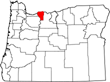 | |
| CDPs | ||
| Other unincorporated communities | ||