Car Nicobar
| Native name: <span class="nickname" ">Pu | |
|---|---|
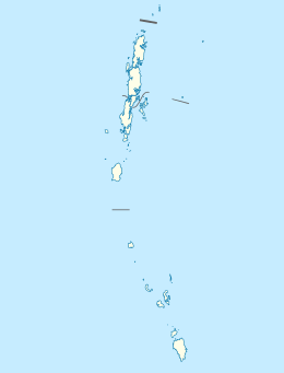 Car Nicobar Location of Car Nicobar Island in India | |
| Geography | |
| Location | Bay of Bengal |
| Coordinates | 9°10′N 92°47′E / 9.17°N 92.78°ECoordinates: 9°10′N 92°47′E / 9.17°N 92.78°E |
| Archipelago | Nicobar Islands |
| Adjacent bodies of water | Indian Ocean |
| Total islands | 1 |
| Major islands |
|
| Area | 126.9 km2 (49.0 sq mi)[1] |
| Length | 15 km (9.3 mi) |
| Width | 12 km (7.5 mi) |
| Coastline | 51 km (31.7 mi) |
| Highest elevation | 10 m (30 ft) |
| Administration | |
| District | Nicobar |
| Island group | Nicobar Islands |
| Subdivisions of India | Car Nicobar Subdivision |
| Taluk | Car Nicobar Taluk |
Largest settlement |
Malacca (population 4200) |
| Demographics | |
| Demonym | Hindi |
| Population | 17841 (2014) |
| Pop. density | 140.5 /km2 (363.9 /sq mi) |
| Ethnic groups | Hindu, Nicobarese |
| Additional information | |
| Time zone | |
| PIN | 744301 |
| Telephone code | 03192 |
| Official website |
www |
| ISO Code | IN-AN-00[2] |
| Literacy | 84.4% |
| Avg. summer temperature | 30.2 °C (86.4 °F) |
| Avg. winter temperature | 23.0 °C (73.4 °F) |
| Sex ratio | 1.2♂/♀ |
| unit_pref | Metric |
| Census Code | 35.638.0001 |
| Official Languages |
Hindi, English, Tamil Car (regional) |
Car Nicobar (Pu in the local language) is the northernmost of the Nicobar Islands. It is also one of three local administrative divisions of the Indian district of Nicobar, part of the Indian union territory of Andaman and Nicobar Islands.[3]
History
The Sea Voyagers of the region referred to the island as the “Northern land of the nake” i.e. Car Nakkavar which is perhaps the direct Predecessor of the current name “Car Nicobar". The island was severely affected by the tsunami that was caused by the 2004 Indian Ocean earthquake, which led to many deaths and damaged infrastructure.
2004 tsunami devastation
Car Nicobar lies 750 km (470 mi) from the epicenter of the 2004 Indian Ocean earthquake, and the ensuing tsunamis struck it with great force. Witnesses reported the waves were as high as 30 ft (9 m). As of December 30, 2004, the number of casualties remained unknown, but were estimated to be high. One survivor told the Associated Press: "There's not a single hut which is standing. Everything is gone. Most of the people have gone away from the shore and Indian govt has made many relief programmes here such as temporary shelters, subsidize their every primary needs etc."
Geography
Car Nicobar falls in between Little Andaman and Nancowry. The area south to the Ten-degree channel comes under Car Nicobar headquarters. Car Nicobar is remarkably flat except for some cliffs in the north and small hilly areas in the interior. It is bordered by a silvery beach and areas of flat ground consisting of coraline diluvium.[4] It is a flat fertile island covered with clusters of coconut palms and enchanting beaches with a roaring sea all around.
Compared to the Middle Andaman and South Andaman, Car Nicobar is a small island, having only 126.9 km2 (49.0 sq mi).
The climate of Car Nicobar Island is tropical, as it is just 9 degree from the equator, with an annual rainfall of 400 mm. The data of past ten years shows that the mean relative humidity in the Island is 79%, the mean maximum temperature is of 30.20 C, and mean minimum temperature is 23.00 C.
The soil analysis revealed a high content of sand & clay hindering the growth of agricultural crops. The area of Car Nicobar is suitable for the plantation crops, and coconut and areca nut are the major products, which are grown in the area.
Administration
Politically, Car Nicobar, along with neighboring Battimalv Island, is a tehsil, roughly equivalent to a county in its range of administrative powers. There are two more Tehsils of Nancowry and Campbell Bay to administer all the other islands of the district. The administrative capital is near the Indian Air Force station Car Nicobar Air Force Base, known as 'Headquarters' which is the largest junction in this small island with some shops, a hospital, a bank, a post office, Office of Superintendent of Police, Office of Deputy Commissioner and some other government offices. The official pin code of Car Nicobar is 744301.[5]
Although the area of Car Nicobar is less than 7% of the area of the Nicobar group, in the census of 2011 its population of[6] 17841 was 48% of the total population of Nicobar.
Flora and fauna
The Car Nicobar islands do not have any evergreen forests, which dominate the central and southern islands of the Nicobars.[7] Most of the island is covered with coconut plantation and natural flora is present only in the interior areas.
Transportation
Car Nicobar the district headquarters is 260 km (162 mi) from Port Blair. Ship service is available between Port Blair and Nicobar district. Normally ship is available twice in a week. One can obtain the ship ticket from the office of the Director, Shipping services (03192-245555) at Port Blair.[8]
Andaman and Nicobar Islands Administration in cooperation with Air India Regional operate charter services between Port Blair's Veer Savarkar International Airport and Car Nicobar Air Force Base (IATA: CBD, ICAO: VOCX).[9] which has temporarily been suspended. There's regular service of PHL helicopter available between Car Nicobar and Port Blair and other islands of Nicobar district.
Demographics
There are 21 villages, the largest of which is named U-rèk-ka (called "Malacca-Perka" for tourists), with a population of 4,200.
The villages are:
- Ha-nyôch (Mus)
- Tö-kuö-nö Sē-ti (Small Lapathy)
- Tö-ki-röng Sē-ti (Big Lapathy)
- Höng-chu (Tapoiming)
- Pum-pai (Chukchucha)
- Sa-rā-ki (Kinyuka)
- Tim-lö (Tamalu)
- Kè-è-rô (Perka, West Malacca)
- U-rèk-ka (Malacca)
- IAF Camp
- Sa-pë-ha (Kakana)
- Ratana
- Öt-ra-höön (Kimius)
- Aukchong
- Foul Point
- Ha-ran (Arong)
- Arong Beach
- Öt-ka-sip (Sawai)
- Rit-töp (Titop)
- Passa
- Töt-chak (Kinmai)
The names in brackets are often used for tourists and other outsiders, as the local names in Nicobarese are difficult for outsiders to pronounce.
Each village has a tuhet meaning elderly heads, the number of which varies. From each of these elders three are elected as 1st, 2nd, and 3rd captain to look after the day-to-day affairs of the village.
According to the 2011 census of India, Car Nicobar Island has 4250 households. The effective literacy rate (i.e. the literacy rate of population excluding children aged 6 and below) is 100%.[10]
| Total | Male | Female | |
|---|---|---|---|
| Population | 17841 | 9735 | 8106 |
| Children aged below 6 years | 1929 | 982 | 947 |
| Scheduled caste | 0 | 0 | 0 |
| Scheduled tribe | 15027 | 7659 | 7368 |
| Literates | 12627 | 7436 | 5191 |
| Workers (all) | 8844 | 5964 | 2880 |
| Main workers (total) | 3664 | 2916 | 748 |
Administration
The island belongs to the township of Car Nicobar of Car Nicobar Taluk.[11] of Nicobar District. District Administration is headed by Deputy Commissioner(Nicobar) while the Sub Division Car Nicobar is headed by an Assistant Commissioner.
Image gallery
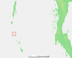 Location of Car Nicobar island
 Map
Map
References
- ↑ "Islandwise Area and Population - 2011 Census" (PDF). Government of Andaman.
- ↑ Registration Plate Numbers added to ISO Code
- ↑ "Village Code Directory: Andaman & Nicobar Islands" (PDF). Census of India. Retrieved January 16, 2011.
- ↑ "Nicobar Geographical Features". 2013-05-26. Archived from the original on 2016-02-07. Retrieved 2013-05-26.
- ↑ "A&N Islands - Pincodes". 2013-05-26. Archived from the original on 2014-03-23. Retrieved 2013-05-26.
- ↑ "Census of India".
- ↑ "A&N Islands - Flora & Fauna". 2013-05-26. Archived from the original on 2016-03-17. Retrieved 2013-05-26.
- ↑ "Nicobar Islands - How to reach". 2013-05-26. Retrieved 2013-05-26.
- ↑
- 1 2 "District Census Handbook - Andaman & Nicobar Islands" (PDF). 2011 Census of India. Directorate of Census Operations, Andaman & Nicobar Islands. Archived from the original (PDF) on 2015-08-01. Retrieved 2015-07-21.
- ↑ Tehsils
| Wikimedia Commons has media related to Car Nicobar. |
- Car Nicobar Air Force Base
 Andaman and Nicobar Islands travel guide from Wikivoyage