Nicobar district
 Nicobar district  Nicobar district Location of Nicobar district in India | |
| Geography | |
|---|---|
| Location | Bay of Bengal |
| Coordinates | 9°09′26″N 92°45′40″E / 9.157343°N 92.761087°ECoordinates: 9°09′26″N 92°45′40″E / 9.157343°N 92.761087°E |
| Archipelago | Nicobar Islands |
| Adjacent bodies of water | Indian Ocean |
| Total islands | 30 |
| Major islands | |
| Area | 1,648.13 km2 (636.35 sq mi)[1] |
| Highest elevation | 642 m (2,106 ft) |
| Administration | |
| District | Nicobar |
| Island group | Nicobar Islands |
Capital City |
Malacca (population 4200) |
| Demographics | |
| Demonym | Hindi |
| Population | 36844 (2014) |
| Pop. density | 22.3 /km2 (57.8 /sq mi) |
| Ethnic groups | Hindu, Nicobarese |
| Additional information | |
| Time zone | |
| PIN | 744301 |
| Telephone code | 03192 |
| Official website |
www |
| ISO Code | IN-AN-00[2] |
| Literacy | 84.4% |
| Avg. summer temperature | 30.2 °C (86.4 °F) |
| Avg. winter temperature | 23.0 °C (73.4 °F) |
| Sex ratio | 1.2♂/♀ |
| unit_pref | Metric |
| Census Code | 35.638.0001 |
| Official Languages |
Hindi, English, Tamil Car (regional) |
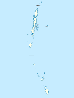
Nicobar district is one of three districts in the Indian Union Territory (UT) of Andaman and Nicobar Islands. The district's administrative territory encompasses all of the Nicobar Islands, which are located in the Indian Ocean (Bay of Bengal, bordering with the Andaman Sea). The headquarters of the district is located on the island of Car Nicobar.
The district administration is headed by a Deputy Commissioner, who in turn reports into the Lt. Governor of the Andaman and Nicobar Islands.
It is the fifth least populous district in the country (out of 640).[3]
Etymology
Falling between the sea route from South India / Sri Lanka to South East Asia and vice-vers, the voyagers referred it as “land of the nake” i.e. Nakkavar which is perhaps the direct Predecessor of the current name “Nicobar’. The medieval Arabic name ‘Lankhabatus’ is a mere mistranscription and misapprehension of “Nankakar or Nakkavar”.
History
The district was created on August 1, 1974, when it was separated off from Andaman district.[4]
Geography
Nicobar district occupies an area of 1,648 square kilometres (636 sq mi),[5] comparatively equivalent to Mauritius.[6]
Demographics
According to the 2011 census Nicobar district has a population of 36844,[3] roughly equal to the nation of Liechtenstein.[7] This gives it a ranking of 636th in India (out of a total of 640).[3] The district has a population density of 20 inhabitants per square kilometre (52/sq mi) .[3] Its population growth rate over the decade 2001-2011 was -12.48%.[3] Nicobars has a sex ratio of 778 females for every 1000 males,[3] and a literacy rate of 77.5%.[3]
The district is designated as an Integrated Tribal District, and is home to significant numbers of indigenous peoples (namely, the Nicobarese and the Shompen, classified as Scheduled Tribes according to the Constitution of India), who form the majority of the district's population. Because of its status as a tribal area, travel to the district is restricted to Indian nationals, and special permit restrictions apply.
The district was severely affected by the tsunami that was caused by the 2004 Indian Ocean earthquake, which led to many deaths and damaged infrastructure.
Administrative divisions
As of 2016, The Nicobar district is divided into 3 sub-divisions and 7 taluks (tehsils).
- Car Nicobar Subdivision
- Car Nicobar taluk - Headquarters
- Nancowry Subdivision
- Great Nicobar Subdivision
References
- ↑ "Islandwise Area and Population - 2011 Census" (PDF). Government of Andaman.
- ↑ Registration Plate Numbers added to ISO Code
- 1 2 3 4 5 6 7 "District Census 2011". Census2011.co.in. 2011. Retrieved 2011-09-30.
- ↑ Law, Gwillim (2011-09-25). "Districts of India". Statoids. Retrieved 2011-10-11.
- ↑ Srivastava, Dayawanti et al. (ed.) (2010). "States and Union Territories: Andaman Islands: Government". India 2010: A Reference Annual (54th ed.). New Delhi, India: Additional Director General, Publications Division, Ministry of Information and Broadcasting (India), Government of India. p. 1208. ISBN 978-81-230-1617-7.
- ↑ "Island Directory Tables: Islands by Land Area". United Nations Environment Program. 1998-02-18. Retrieved 2011-10-11.
Mauritius 1,836km2
- ↑ US Directorate of Intelligence. "Country Comparison:Population". Retrieved 2011-10-01.
212 Liechtenstein 35,236 July 2011 est.
External links
 |
Ten Degree Channel | | ||
| Bay of Bengal | |
Andaman Sea | ||
| ||||
| | ||||
| Indian Ocean |