Tapoiming
| Tapoiming Höng-chu | |
|---|---|
| village | |
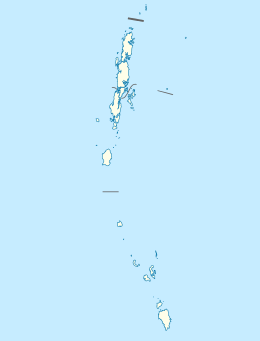 Tapoiming  Tapoiming Location in Andaman and Nicobar Islands, India | |
| Coordinates: 9°13′25″N 92°48′02″E / 9.223660°N 92.800452°ECoordinates: 9°13′25″N 92°48′02″E / 9.223660°N 92.800452°E | |
| Country | India |
| State | Andaman and Nicobar Islands |
| District | Nicobar |
| Tehsil | Car Nicobar |
| Population (2011) | |
| • Total | 941 |
| Time zone | IST (UTC+5:30) |
| Census code | 645024 |
Tapoiming is a village in the Nicobar district of Andaman and Nicobar Islands, India. It is located in the Car Nicobar tehsil.[1]
Demographics
According to the 2011 census of India, Tapoiming has 214 households. The effective literacy rate (i.e. the literacy rate of population excluding children aged 6 and below) is 78.59%.[2]
| Total | Male | Female | |
|---|---|---|---|
| Population | 941 | 505 | 436 |
| Children aged below 6 years | 105 | 62 | 43 |
| Scheduled caste | 0 | 0 | 0 |
| Scheduled tribe | 851 | 416 | 435 |
| Literates | 657 | 382 | 275 |
| Workers (all) | 338 | 281 | 57 |
| Main workers (total) | 53 | 43 | 10 |
| Main workers: Cultivators | 0 | 0 | 0 |
| Main workers: Agricultural labourers | 0 | 0 | 0 |
| Main workers: Household industry workers | 1 | 0 | 1 |
| Main workers: Other | 52 | 43 | 9 |
| Marginal workers (total) | 285 | 238 | 47 |
| Marginal workers: Cultivators | 10 | 8 | 2 |
| Marginal workers: Agricultural labourers | 15 | 7 | 8 |
| Marginal workers: Household industry workers | 13 | 2 | 11 |
| Marginal workers: Others | 247 | 221 | 26 |
| Non-workers | 603 | 224 | 379 |
References
- ↑ "Andaman and Nicobar Islands villages" (PDF). Land Records Information Systems Division, NIC. Retrieved 2015-07-25.
- 1 2 "District Census Handbook - Andaman & Nicobar Islands" (PDF). 2011 Census of India. Directorate of Census Operations, Andaman & Nicobar Islands. Retrieved 2015-07-21.
This article is issued from Wikipedia - version of the 9/9/2016. The text is available under the Creative Commons Attribution/Share Alike but additional terms may apply for the media files.