Burnett, Wisconsin
| Burnett, Wisconsin | |
|---|---|
| Town | |
|
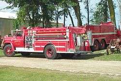
Town of Burnett fire trucks | |
 Location of Burnett, Wisconsin | |
| Coordinates: 43°30′15″N 88°42′38″W / 43.50417°N 88.71056°W | |
| Country | United States |
| State | Wisconsin |
| County | Dodge |
| Area | |
| • Total | 36.5 sq mi (94.4 km2) |
| • Land | 36.2 sq mi (93.7 km2) |
| • Water | 0.3 sq mi (0.7 km2) |
| Elevation[1] | 869 ft (265 m) |
| Population (2000) | |
| • Total | 919 |
| • Density | 25.4/sq mi (9.8/km2) |
| Time zone | Central (CST) (UTC-6) |
| • Summer (DST) | CDT (UTC-5) |
| FIPS code | 55-11275[2] |
| GNIS feature ID | 1582890[1] |
| Website | http://www.townofburnett.com |
Burnett is a town in Dodge County, Wisconsin, United States. The population was 919 at the 2000 census. The census-designated place of Burnett is located in the town, and the unincorporated community of Rolling Prairie is located partially in the town.
History
The town was named for Ellsworth Burnett, a government surveyor who was killed by Indians in 1836.[3]
Geography
According to the United States Census Bureau, the town has a total area of 36.5 square miles (94.4 km²), of which 36.2 square miles (93.7 km²) is land and 0.3 square mile (0.7 km²) (0.74%) is water.
Demographics
As of the census[2] of 2000, there were 919 people, 330 households, and 265 families residing in the town. The population density was 25.4 people per square mile (9.8/km²). There were 353 housing units at an average density of 9.8 per square mile (3.8/km²). The racial makeup of the town was 98.59% White, 0.33% African American, 0.65% from other races, and 0.44% from two or more races. Hispanic or Latino of any race were 0.87% of the population.
There were 330 households out of which 34.2% had children under the age of 18 living with them, 70.9% were married couples living together, 4.5% had a female householder with no husband present, and 19.4% were non-families. 17.0% of all households were made up of individuals and 8.5% had someone living alone who was 65 years of age or older. The average household size was 2.78 and the average family size was 3.14.
In the town the population was spread out with 26.7% under the age of 18, 6.9% from 18 to 24, 28.8% from 25 to 44, 26.1% from 45 to 64, and 11.5% who were 65 years of age or older. The median age was 38 years. For every 100 females there were 107.9 males. For every 100 females age 18 and over, there were 106.1 males.
The median income for a household in the town was $55,000, and the median income for a family was $59,750. Males had a median income of $35,263 versus $24,875 for females. The per capita income for the town was $22,043. About 4.2% of families and 5.8% of the population were below the poverty line, including 7.5% of those under age 18 and 7.0% of those age 65 or over. Coordinates: 43°30′17″N 88°42′25″W / 43.50472°N 88.70694°W
Notable residents
- Lillian Heath (1865-1962), the first female doctor in Wyoming.[4]
- George F. Merrill, Wisconsin State Senator.[5]
- Fred E. Moul, Wisconsin State Assemblyman.[6]
- Elmer C. Nitschke, Wisconsin State Senator.[7]
- Don Peachey, Hall of Fame Musician and Band Leader[8]
- Leander H. Shepard, Wisconsin State Assemblyman.[9]
References
- 1 2 "US Board on Geographic Names". United States Geological Survey. 2007-10-25. Retrieved 2008-01-31.
- 1 2 "American FactFinder". United States Census Bureau. Archived from the original on 2013-09-11. Retrieved 2008-01-31.
- ↑ Chicago and North Western Railway Company (1908). A History of the Origin of the Place Names Connected with the Chicago & North Western and Chicago, St. Paul, Minneapolis & Omaha Railways. p. 49.
- ↑ Dr. Lillian Heath Nelson, National Institutes of Health. Accessed June 8, 2010.
- ↑ Page 486, Wisconsin Blue Book. Accessed July 4, 2013.
- ↑ William J. Anderson & William A. Anderson, eds. (1929). THE WISCONSIN BLUE BOOK. Madison, Wisconsin. p. 546.
- ↑ Nitschke, Elmer 1911, Wisconsin Historical Society. Accessed October 18, 2011.
- ↑ http://www.internationalpolka.com/don-peachey.html
- ↑ THE LEGISLATIVE MANUAL OF THE STATE OF WISCONSIN (16th ed.). Madison, Wis. 1877. p. 459.
Municipalities and communities of Dodge County, Wisconsin, United States | ||
|---|---|---|
| Cities | 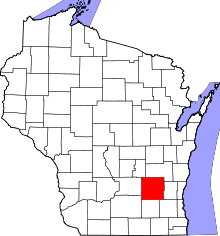 | |
| Villages | ||
| Towns | ||
| CDPs | ||
| Unincorporated communities |
| |
| Ghost towns | ||
| Footnotes | ‡This populated place also has portions in an adjacent county or counties | |