Bucklin, Kansas
| Bucklin, Kansas | |
|---|---|
| City | |
|
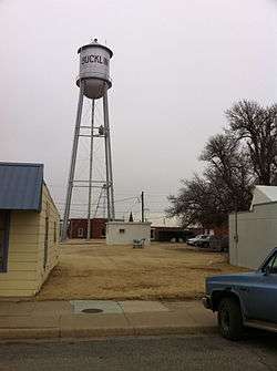
Water tower in Bucklin (2011) | |
 Location within Ford County and Kansas | |
 KDOT map of Ford County (legend) | |
| Coordinates: 37°32′53″N 99°38′6″W / 37.54806°N 99.63500°WCoordinates: 37°32′53″N 99°38′6″W / 37.54806°N 99.63500°W | |
| Country | United States |
| State | Kansas |
| County | Ford |
| Area[1] | |
| • Total | 0.59 sq mi (1.53 km2) |
| • Land | 0.56 sq mi (1.45 km2) |
| • Water | 0.03 sq mi (0.08 km2) |
| Elevation | 2,405 ft (733 m) |
| Population (2010)[2] | |
| • Total | 794 |
| • Estimate (2015)[3] | 794 |
| • Density | 1,300/sq mi (520/km2) |
| Time zone | Central (CST) (UTC-6) |
| • Summer (DST) | CDT (UTC-5) |
| ZIP code | 67834 |
| Area code(s) | 620 |
| FIPS code | 20-09000 [4] |
| GNIS feature ID | 0474249 [5] |
Bucklin is a city in Ford County, Kansas, United States. As of the 2010 census, the city population was 794.[6]
History
Bucklin was originally called Corbitt and under the latter name laid out about 1885. It was renamed Bucklin in 1887, after Bucklin Township.[7]
Bucklin was incorporated in 1909. It was situated at the junction of two railroads.[8]
Geography
Bucklin is located at 37°32′53″N 99°38′6″W / 37.54806°N 99.63500°W (37.547942, -99.635001).[9] According to the United States Census Bureau, the city has a total area of 0.59 square miles (1.53 km2), of which 0.56 square miles (1.45 km2) is land and 0.03 square miles (0.08 km2) is water.[1]
Climate
The climate in this area is characterized by hot, humid summers and generally mild to cool winters. According to the Köppen Climate Classification system, Bucklin has a humid subtropical climate, abbreviated "Cfa" on climate maps.[10]
Demographics
| Historical population | |||
|---|---|---|---|
| Census | Pop. | %± | |
| 1910 | 696 | — | |
| 1920 | 835 | 20.0% | |
| 1930 | 917 | 9.8% | |
| 1940 | 832 | −9.3% | |
| 1950 | 824 | −1.0% | |
| 1960 | 752 | −8.7% | |
| 1970 | 771 | 2.5% | |
| 1980 | 786 | 1.9% | |
| 1990 | 710 | −9.7% | |
| 2000 | 725 | 2.1% | |
| 2010 | 794 | 9.5% | |
| Est. 2015 | 794 | [3] | 0.0% |
| U.S. Decennial Census | |||
2010 census
As of the census[2] of 2010, there were 794 people, 287 households, and 204 families residing in the city. The population density was 1,417.9 inhabitants per square mile (547.5/km2). There were 340 housing units at an average density of 607.1 per square mile (234.4/km2). The racial makeup of the city was 93.3% White, 1.9% African American, 0.9% Native American, 0.3% Asian, 1.0% from other races, and 2.6% from two or more races. Hispanic or Latino of any race were 4.0% of the population.
There were 287 households of which 39.0% had children under the age of 18 living with them, 56.8% were married couples living together, 10.5% had a female householder with no husband present, 3.8% had a male householder with no wife present, and 28.9% were non-families. 25.4% of all households were made up of individuals and 11.8% had someone living alone who was 65 years of age or older. The average household size was 2.64 and the average family size was 3.17.
The median age in the city was 35 years. 30.4% of residents were under the age of 18; 6.4% were between the ages of 18 and 24; 23.4% were from 25 to 44; 22.5% were from 45 to 64; and 17.3% were 65 years of age or older. The gender makeup of the city was 49.1% male and 50.9% female.
2000 census

As of the census[4] of 2000, there were 725 people, 299 households, and 200 families residing in the city. The population density was 1,351.7 people per square mile (518.4/km²). There were 339 housing units at an average density of 632.0 per square mile (242.4/km²). The racial makeup of the city was 95.03% White, 0.41% African American, 0.69% Native American, 0.41% Asian, 1.52% from other races, and 1.93% from two or more races. Hispanic or Latino of any race were 4.00% of the population.
There were 299 households out of which 34.8% had children under the age of 18 living with them, 56.5% were married couples living together, 7.4% had a female householder with no husband present, and 32.8% were non-families. 29.8% of all households were made up of individuals and 16.1% had someone living alone who was 65 years of age or older. The average household size was 2.42 and the average family size was 2.99.
In the city the population was spread out with 28.4% under the age of 18, 7.9% from 18 to 24, 25.1% from 25 to 44, 21.8% from 45 to 64, and 16.8% who were 65 years of age or older. The median age was 38 years. For every 100 females there were 96.5 males. For every 100 females age 18 and over, there were 93.7 males.
The median income for a household in the city was $38,750, and the median income for a family was $44,554. Males had a median income of $31,667 versus $18,235 for females. The per capita income for the city was $17,954. About 6.8% of families and 8.0% of the population were below the poverty line, including 10.3% of those under age 18 and 7.4% of those age 65 or over.
Notable people
- Eddie Sutton, men's college basketball coach
References
- 1 2 "US Gazetteer files 2010". United States Census Bureau. Archived from the original on 2012-07-14. Retrieved 2012-07-06.
- 1 2 "American FactFinder". United States Census Bureau. Retrieved 2012-07-06.
- 1 2 "Annual Estimates of the Resident Population for Incorporated Places: April 1, 2010 to July 1, 2015". Retrieved July 2, 2016.
- 1 2 "American FactFinder". United States Census Bureau. Archived from the original on 2013-09-11. Retrieved 2008-01-31.
- ↑ "US Board on Geographic Names". United States Geological Survey. 2007-10-25. Retrieved 2008-01-31.
- ↑ "2010 City Population and Housing Occupancy Status". U.S. Census Bureau. Archived from the original on July 21, 2011. Retrieved July 20, 2011.
- ↑ Kansas State Historical Society (1916). Biennial Report of the Board of Directors of the Kansas State Historical Society. Kansas State Printing Plant. p. 190.
- ↑ Blackmar, Frank Wilson (1912). Kansas: A Cyclopedia of State History, Embracing Events, Institutions, Industries, Counties, Cities, Towns, Prominent Persons, Etc. Standard Publishing Company. p. 246.
- ↑ "US Gazetteer files: 2010, 2000, and 1990". United States Census Bureau. 2011-02-12. Retrieved 2011-04-23.
- ↑ Climate Summary for Bucklin, Kansas
External links
| Wikimedia Commons has media related to Bucklin, Kansas. |
- City
- Schools
- USD 459, local school district
- Maps
- Bucklin City Map, KDOT
Municipalities and communities of Ford County, Kansas, United States | ||
|---|---|---|
| Cities | 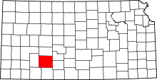 | |
| CDPs | ||
| Other unincorporated communities | ||
| Townships | ||