Fort Dodge, Kansas
| Fort Dodge, Kansas | |
|---|---|
| Census-designated place | |
 Fort Dodge | |
| Coordinates: 37°43′55″N 99°56′07″W / 37.73194°N 99.93528°WCoordinates: 37°43′55″N 99°56′07″W / 37.73194°N 99.93528°W | |
| Country | United States |
| State | Kansas |
| County | Ford |
| Area | |
| • Total | 0.18 sq mi (0.5 km2) |
| • Land | 0.18 sq mi (0.5 km2) |
| • Water | 0.0 sq mi (0 km2) |
| Elevation | 2,464 ft (751 m) |
| Population (2010) | |
| • Total | 165 |
| • Density | 916.7/sq mi (353.9/km2) |
| Time zone | Central (CST) (UTC-6) |
| • Summer (DST) | CDT (UTC-5) |
| ZIP code | 67843 |
| Area code(s) | 620 |
| FIPS code | 20-23890 |
| GNIS feature ID | 473892[1] |
Fort Dodge is an unincorporated community and census-designated place in Grandview Township, Ford County, Kansas, United States.[2] As of the 2010 census it had a population of 165.[3] Fort Dodge is located on U.S. Route 400 5 miles (8 km) southeast of Dodge City. Fort Dodge has a post office with ZIP code 67843.[4]
History
From 1865 to 1882, Fort Dodge was an outpost on the Santa Fe Trail. After the fort closed, the site became the Kansas Soldiers' Home in 1890.[5]
Demographics
As of the 2010 United States Census, there were 165 people, 66 households, and 23 families residing in the CDP. The population density was 916.7 people per square mile (354/km²). There were 98 housing units at an average density of 544.4 per square mile (196/km²). The racial makeup of the CDP was 95.2% White, 1.8% African American, 0.6% American Indian, 0.6% from other races, and 1.8% from two or more races. Hispanics and Latinos of any race were 3.0% of the population.[6]
There were 66 households of which 0.0% had children under the age of 18 living with them, 31.8% were married couples living together, 1.5% had a female householder with no husband present, 1.5% had a male householder with no wife present, and 65.2% were non-families. 46.1% of the population was in group quarters. 65.2% of all households were made up of individuals, and 34.8% had someone living alone who was 65 years of age or older. The average household size was 1.35, and the average family size was 2.00.[6]
The median age in the CDP was 76.6 years. 0.0% of residents were under the age of 18; 0.0% were between the ages of 18 and 24; 3.0% were from 25 to 44; 27.9% were from 45 to 64; and 69.1% were 65 years of age or older. The gender makeup of the CDP was 78.2% male and 21.8% female.[6]
The median income for a household was $23,250, and the median income for a family was $32.045. The per capita income for the CDP was $21,004. About 0.0% of families and 0.0% of the population were below the poverty line, including 0.0% of those under age 18 and 0.0% of those age 65 or over.[6]
Education
Fort Dodge public education is provided by unified school district 443 (Dodge City Public Schools).[7]
Culture
In popular culture and the arts
The episode "County Seat War" (April 8, 1958) of the western television series The Life and Legend of Wyatt Earp, starring Hugh O'Brian as Wyatt Earp, focuses on an underhanded attempt by Fort Dodge to become the county seat of Ford County after it is announced that the U.S. Army is withdrawing from the fort. The actress Carolyn Craig appears in this episode as a young woman in contact with Earp about the election called to determine which location will be the county seat.[8]
Notable people
- James H. "Dog" Kelley, mayor of Dodge City from 1877 to 1881; lived in Fort Dodge in his later years.[9]
- Morris S. Tremaine, businessman and politician. He was New York State Comptroller from 1927 to 1941.
References
- ↑ "US Board on Geographic Names". United States Geological Survey. 2007-10-25. Retrieved 2008-01-31.
- ↑ "Kansas: 2010 - Population and Housing Unit Counts" (PDF). United States Census Bureau. Retrieved 2015-05-21.
- ↑ "Geographic Identifiers: 2010 Census Summary File 1 (G001), Fort Dodge CDP, Kansas". American FactFinder. U.S. Census Bureau. Retrieved May 19, 2016.
- ↑ ZIP Code Lookup
- ↑ "Fort Dodge, Kansas". Santa Fe Trail Research. Retrieved 2011-08-06.
- 1 2 3 4 "Census of Population and Housing". United States Census Bureau. Retrieved 2015-05-21.
- ↑ USD 443 district map
- ↑ ""County Seat War", The Life and Legend of Wyatt Earp, April 8, 1958". Internet Movie Data Base. Retrieved May 11, 2014.
- ↑ Pioneers of Ford County - Page 2; legendsofkansas.com
External links
| Wikimedia Commons has media related to Fort Dodge, Kansas. |
- Ford County Map, KDOT
- Fred Voelker - Fiddling With The Seasons Of Life on YouTube, from Hatteberg's People on KAKE TV news
Municipalities and communities of Ford County, Kansas, United States | ||
|---|---|---|
| Cities | 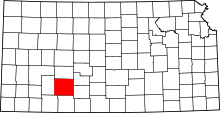 | |
| CDPs | ||
| Other unincorporated communities | ||
| Townships | ||