Brookline, New Hampshire
| Brookline, New Hampshire | ||
|---|---|---|
| Town | ||
|
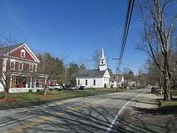
Main Street in Brookline | ||
| ||
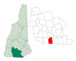 Location in Hillsborough County, New Hampshire | ||
| Coordinates: 42°44′01″N 71°39′49″W / 42.73361°N 71.66361°WCoordinates: 42°44′01″N 71°39′49″W / 42.73361°N 71.66361°W | ||
| Country | United States | |
| State | New Hampshire | |
| County | Hillsborough | |
| Incorporated | 1769 | |
| Government | ||
| • Board of Selectmen |
Darrell Philpot, Chair John Carr Karl Dowling Brendan Denehy Tom Humphreys | |
| • Town Administrator | Tad Putney | |
| Area | ||
| • Total | 20.1 sq mi (52.1 km2) | |
| • Land | 19.8 sq mi (51.2 km2) | |
| • Water | 0.4 sq mi (0.9 km2) 1.79% | |
| Elevation | 256 ft (78 m) | |
| Population (2010) | ||
| • Total | 4,991 | |
| • Density | 250/sq mi (96/km2) | |
| Time zone | Eastern (UTC-5) | |
| • Summer (DST) | Eastern (UTC-4) | |
| ZIP code | 03033 | |
| Area code(s) | 603 | |
| FIPS code | 33-08100 | |
| GNIS feature ID | 0873554 | |
| Website |
brookline | |

Brookline is a town in Hillsborough County, New Hampshire, United States. The population was 4,991 at the 2010 census.[1] Brookline is home to the Talbot-Taylor Wildlife Sanctuary, Potanipo Pond, and the Brookline Covered Bridge.
History

First a part of Dunstable, Massachusetts, then settled as West Hollis, New Hampshire, the town was granted in 1769 as "Raby". New Hampshire Governor John Wentworth named it after his cousin, the 4th Earl of Strafford and Baron of Raby Castle.
The town was renamed in 1798 at the suggestion of a leading citizen in town originally from Brookline, Massachusetts.[2] By 1859, when the population was 718, there were eight sawmills and one gristmill, as well as a sash and blind shop. In the earlier days of the town, Brookline was known throughout southern New Hampshire for producing lumber, charcoal and casks.[3] In 1874, service by the Worcester and Nashua Railroad began in Brookline, and not long after service by the Lyndeborough and Brookline Railroad was planned to operate through the town, primarily to profit off the lumber trade.[4] The Boston and Maine Railroad eventually branched into Brookline in the early 19th century. The train station that served Brookline during the railroad's tenure in the town has since been renovated into a private residential home.[5] A large fraction of the area that was once railroad track is now New Hampshire Route 13.
The town received national attention in 1997, when people participating in the traditional ringing of the Congregational Church bell at midnight on the Fourth of July were arrested. Several prominent members of the community were among those arrested, including Road Agent Clarence Farwell and his wife. The incident led to an investigation of the Brookline police department after questions of excessive force were raised following the arrests.[6]
Geography
According to the United States Census Bureau, the town has a total area of 20.1 square miles (52 km2), of which 19.8 sq mi (51 km2) is land and 0.4 sq mi (1.0 km2) is water, comprising 1.79% of the town. The town's highest point is the western summit of Birch Hill, at 810 feet (250 m) above sea level. Potanipo Hill is a 613-foot-high (187 m) summit southwest of the town center that once was the site of a ski area from 1935 to 1984, and now is home to Andres Institute of Art.
Brookline is drained by the Nissitissit River and Spaulding Brook. The 10-mile-long (16 km) Nissitissit is known for its abundance of trout. The Nissitissit begins at the outlet of Potanipo Pond, 1⁄2 mile (0.8 km) west of the town center. Brookline lies within the Merrimack River watershed.[7]
Brookline is bordered by Mason to the west, Milford to the north, Hollis to the east, and Townsend and Pepperell, Massachusetts to the south. It is about 12 miles (19 km) west of Nashua and approximately 50 miles (80 km) northwest of Boston, Massachusetts.
The town is crossed by New Hampshire Route 13 and New Hampshire Route 130.
Demographics
| Historical population | |||
|---|---|---|---|
| Census | Pop. | %± | |
| 1790 | 338 | — | |
| 1800 | 454 | 34.3% | |
| 1810 | 538 | 18.5% | |
| 1820 | 592 | 10.0% | |
| 1830 | 627 | 5.9% | |
| 1840 | 652 | 4.0% | |
| 1850 | 718 | 10.1% | |
| 1860 | 756 | 5.3% | |
| 1870 | 741 | −2.0% | |
| 1880 | 698 | −5.8% | |
| 1890 | 548 | −21.5% | |
| 1900 | 505 | −7.8% | |
| 1910 | 501 | −0.8% | |
| 1920 | 546 | 9.0% | |
| 1930 | 511 | −6.4% | |
| 1940 | 561 | 9.8% | |
| 1950 | 671 | 19.6% | |
| 1960 | 795 | 18.5% | |
| 1970 | 1,167 | 46.8% | |
| 1980 | 1,766 | 51.3% | |
| 1990 | 2,410 | 36.5% | |
| 2000 | 4,181 | 73.5% | |
| 2010 | 4,991 | 19.4% | |
| Est. 2015 | 5,212 | [8] | 4.4% |
As of the census[10] of 2000, there were 4,181 people, 1,343 households, and 1,146 families residing in the town. The population density was 211.5 people per square mile (81.7/km²). There were 1,384 housing units at an average density of 70.0 per square mile (27.0/km²). The racial makeup of the town was 97.87% White, 0.14% African American, 0.19% Native American, 0.62% Asian, 0.05% Pacific Islander, 0.22% from other races, and 0.91% from two or more races. Hispanic or Latino of any race were 0.91% of the population.
There were 1,343 households out of which 51.9% had children under the age of 18 living with them, 76.7% were married couples living together, 5.7% had a female householder with no husband present, and 14.6% were non-families. 10.6% of all households were made up of individuals and 3.1% had someone living alone who was 65 years of age or older. The average household size was 3.11 and the average family size was 3.36.
In the town the population was spread out with 33.6% under the age of 18, 4.0% from 18 to 24, 35.7% from 25 to 44, 21.6% from 45 to 64, and 5.0% who were 65 years of age or older. The median age was 36 years. For every 100 females there were 102.8 males. For every 100 females age 18 and over, there were 98.6 males.
The median income for a household in the town was $77,075, and the median income for a family was $80,214. Males had a median income of $55,417 versus $32,750 for females. The per capita income for the town was $29,272. About 0.9% of families and 0.8% of the population were below the poverty line, including 0.9% of those under age 18 and none of those age 65 or over.
Education
Brookline is part of a cooperative school district with the neighboring town of Hollis, sharing a middle and high school, Hollis-Brookline Middle School and Hollis-Brookline High School, both of which are located in Hollis. Brookline itself is home to Richard Maghakian Memorial School, an elementary school for grades K-3, and Captain Samuel Douglass Academy, which caters to children in grades 4-6.
Economic development
The Brookline selectboard chartered the town's Economic Development Committee (EDC) to "promote balanced, long-term economic development, which reflects and enhances the character of the community." The EDC publishes a newsletter three or four times a year to promote local businesses.[11]
Community events
Two major community events take place in Brookline: the winter Chowder/Soup/Chili Cook-Off and the early-fall Bridal Show. Hundreds of New England residents have attended these two events.
Town newspaper
The Brookliner has been published biweekly since 1966.[12]
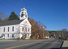
Churches

In 1951 the Church of Christ was formed by the unification of the Congregational (established 1795) and Methodist (est. 1852) churches of Brookline. It was renamed the Brookline Community Church in 2005 and is affiliated with both the UCC and UMC conferences.
Notable people
- Captain Samuel Douglass, Revolutionary War captain who led a militia of 20 men from Townsend Hill to Lexington, Massachusetts, on April 19, 1775, in preparation for the approaching British Army.
Sites of interest
- Andres Institute of Art
- Big Bear/Musket Mountain Ski Area
- Brookline Covered Bridge
- Camp Tevya, a Jewish summer camp
- Potanipo Hill
References
- ↑ United States Census Bureau, American FactFinder, 2010 Census figures. Retrieved March 23, 2011.
- ↑ "Profile for Brookline, New Hampshire, NH". ePodunk. Retrieved July 19, 2012.
- ↑ Coolidge, Austin J.; John B. Mansfield (1859). A History and Description of New England. Boston, Massachusetts: A.J. Coolidge. p. 430. ISBN 1-4369-8768-7.
- ↑ Article in Statistics and Gazetteer of New-Hampshire (1875)
- ↑ "Brookline - NashuaTelegraph.com". www.nashuatelegraph.com. Retrieved 2016-08-01.
- ↑ "Fireworks of Sorts Afflict A New Hampshire Town". The New York Times. 1997-07-08. Retrieved 2007-09-23.
- ↑ Foster, Debra H.; Batorfalvy, Tatianna N.; Medalie, Laura (1995). Water Use in New Hampshire: An Activities Guide for Teachers. U.S. Department of the Interior and U.S. Geological Survey.
- ↑ "Annual Estimates of the Resident Population for Incorporated Places: April 1, 2010 to July 1, 2015". Retrieved July 2, 2016.
- ↑ "Census of Population and Housing". Census.gov. Archived from the original on May 11, 2015. Retrieved June 4, 2016.
- ↑ "American FactFinder". United States Census Bureau. Archived from the original on 2013-09-11. Retrieved 2008-01-31.
- ↑ http://www.brookline.nh.us/economic-development-committee
- ↑ "About The Brookliner. (Brookline, N.H.) 1966-current". Library of Congress. Retrieved July 19, 2012.
External links
- Town of Brookline official website
- Brookline Public Library
- Brookline Economic Development Committee
- New Hampshire Economic and Labor Market Information Bureau Profile
- Brookline Historical Society
- Sawtelle, Ithamar B., History of Brookline, New Hampshire (1885)
- Parker, Edward E., History of Brookline, formerly Raby, Hillsborough County, New Hampshire (1914)
- The Nashua Telegraph - Brookline Town Information
- Brookline Community Church
Municipalities and communities of Hillsborough County, New Hampshire, United States | ||
|---|---|---|
| Cities | 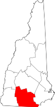 | |
| Towns | ||
| CDPs | ||
| Other villages | ||