Hollis, New Hampshire
| Hollis, New Hampshire | ||
|---|---|---|
| Town | ||
 | ||
| ||
 Location in Hillsborough County, New Hampshire | ||
| Coordinates: 42°44′35″N 71°35′30″W / 42.74306°N 71.59167°WCoordinates: 42°44′35″N 71°35′30″W / 42.74306°N 71.59167°W | ||
| Country | United States | |
| State | New Hampshire | |
| County | Hillsborough | |
| Incorporated | 1746 | |
| Government | ||
| • Board of Selectmen |
Mark Le Doux, Chair David Petry Frank Cadwell Peter Band Vahrij Manoukian | |
| • Town Administrator | Kim Galipeau | |
| Area | ||
| • Total | 32.3 sq mi (83.7 km2) | |
| • Land | 31.8 sq mi (82.2 km2) | |
| • Water | 0.6 sq mi (1.5 km2) 1.76% | |
| Elevation | 404 ft (123 m) | |
| Population (2010) | ||
| • Total | 7,684 | |
| • Density | 240/sq mi (92/km2) | |
| Time zone | Eastern (UTC-5) | |
| • Summer (DST) | Eastern (UTC-4) | |
| ZIP code | 03049 | |
| Area code(s) | 603 | |
| FIPS code | 33-37140 | |
| GNIS feature ID | 0873628 | |
| Website |
www | |

Hollis is a town in Hillsborough County, New Hampshire, United States. The population was 7,684 at the 2010 census.[1] The town center village is listed on the National Register of Historic Places as Hollis Village Historic District.
History
Town name
According to Samuel T. Worcester's history[2] which was commissioned by the town selectmen in 1878, the town was incorporated in the province of New Hampshire on April 3, 1746, "to have continence forever by the name of Holles..."[2]
Worcester argues that, at the time of the charter, Governor Benning Wentworth was indebted to Thomas Pelham-Holles, 1st Duke of Newcastle for his appointment as governor. According to Worcester, it was "very much the custom with Gov. Wentworth" to name towns in honor of his friends and patrons. Thus in the same year, the towns of Pelham and Holles were incorporated, and named after the duke. Worcester cites a Mr. Bancroft who,
- "...in his history, says of him (Newcastle) that he was of so feeble a head, and so treacherous a heart that Sir Robert Walpole called his name 'Perfidy'; that Lord Halifax used to revile him as a knave and fool, and that he was so ignorant of this continent, that it was said of him, that he addressed his letters to the 'Island of New England.'"
Thomas Hollis (1659–1731) was a major benefactor of Harvard College. According to Worcester, about the year 1775, town records started appearing with the town's name spelled as "Hollis", after Thomas Hollis. Both spellings were used until about 1815, after which only the name "Hollis" appears, "...while Holles, the name of the Duke of Newcastle, has passed into merited oblivion."
First settlers

Captain Peter Powers (1707–1757), his wife Anna Keyes (1708–1798), and their two children Peter (1729–1800) and Stephen (b. 1729) were the first settlers of Hollis in 1731. In 1732, the Powers birthed the first child in Hollis, a daughter, also named Anna.[3][4] According to Spaulding's history,[5] Powers "became a noted backwoodsman and colonial land surveyor," and eventually accrued approximately 1,500 acres (610 ha) in the north part of Hollis. Powers was also a militia officer in the French and Indian Wars and was commissioned captain by Governor Wentworth.[6]
The younger Peter was the first college graduate from Hollis, matriculating from Harvard in 1754. He served as pastor of churches throughout New England and died at the age of 71 in Deer Island, Maine.[7]
Notable events
- From its charter in 1746 until about 1763, Hollis was engaged in a running border dispute with Dunstable (now Nashua, New Hampshire) over a small settlement at "One Pine Hill", near Flint Pond. The General Court eventually resolved the dispute in favor of Hollis.[8]
- In 1769, a strip one and a quarter miles wide on the western border of Hollis was incorporated into the new town of Raby. In 1785, the General Court granted a petition of Raby to annex an additional three-quarters of a mile of the western Hollis border. In 1796, the name of Raby was changed to Brookline[9]
- In 1770, by act of the General Court, Hollis annexed a portion of the town of Monson when its charter was repealed by its own request.[10]
- In 1773, Hollis acquired some 500 acres (200 ha) more land from Dunstable in a dispute over the building and upkeep of a bridge over the Nashua River.[11]
- In 1794, the town of Milford was incorporated, subsuming an area of 1,000 to 1,500 acres (400 to 610 ha) from the northwest corner of Hollis, resulting in a total size, by an 1806 survey, of some 30.67 square miles (79.4 km2).
Notable facts
The following is from Worcester's History of Hollis:
- When Hollis was incorporated, the town tax list comprised 54 families.
- By 1760, that number had risen to over 105 families.[12]
- In 1767, two of the 384 slaves in New Hampshire resided in Hollis. In 1775, four of the 656 slaves in New Hampshire resided in Hollis.[13]
- The first trial for murder in Hillsborough County was of Israel Wilkins Jr, of Hollis, for the murder of his father, Israel Wilkins Sr., on November 2, 1772.[14] The elder Wilkins died of "a blow upon the head...of the length three inches and the depth of one inch." Wilkins Jr. was found guilty of man-slaughter, pleaded benefit of clergy, and was subsequently branded upon the thumb with the letter "T", and forced to forfeit all his goods to the King.[15]
- Two-thirds of the grantees of the charter for the town of Plymouth, New Hampshire were from Hollis, causing Worcester to refer to it as "A Hollis Colony".[16]
- Eight Hollis residents were killed at the Battle of Bunker Hill.[17]
- 125 Hollis men were in the army in whole or in part during the year 1776, approximately one tenth of the population.[18]
- 22 Hollis men died while in the army during the Revolutionary War.[19]
- In 1820, Hollis had five grain mills, six saw mills, one clothing mill, two taverns and four stores. By 1878, it had one grain mill, no saw or clothing mills, no taverns, and one store.[20]
Geography
According to the United States Census Bureau, the town has a total area of 32.3 square miles (84 km2), of which 31.8 sq mi (82 km2) is land and 0.6 sq mi (1.6 km2) is water, comprising 1.76% of the town. The highest point in Hollis is the summit of Birch Hill, at 821 feet (250 m) above sea level, located near the town's western border.
The Nashua River flows through the southeast corner of the town out of Pepperell, Massachusetts and into Nashua. The Nissitissit River flows through the western part of the town. Hollis lies fully within the Merrimack River watershed.[21]
Neighboring cities and towns

Climate
Hollis is in USDA plant hardiness zone 5A.[22] The closest NOAA climate station is in Nashua. The nearby table shows applicable temperature and precipitation data by month.
| Climate data for Hollis, NH (Nashua, NH Airport) | |||||||||||||
|---|---|---|---|---|---|---|---|---|---|---|---|---|---|
| Month | Jan | Feb | Mar | Apr | May | Jun | Jul | Aug | Sep | Oct | Nov | Dec | Year |
| Average high °F | 33.4 | 36.5 | 45.4 | 57.0 | 69.1 | 77.5 | 82.5 | 80.6 | 72.4 | 61.4 | 49.8 | 38.1 | 58.6 |
| Daily mean °F | 22.8 | 25.6 | 34.9 | 45.6 | 57.0 | 65.9 | 70.8 | 69.0 | 60.5 | 49.1 | 39.4 | 28.3 | 47.4 |
| Average low °F | 12.1 | 14.6 | 24.4 | 34.1 | 44.9 | 54.2 | 59.1 | 57.3 | 48.6 | 36.8 | 28.9 | 18.4 | 36.1 |
| Average precipitation inches | 3.86 | 3.09 | 4.07 | 3.92 | 3.66 | 3.91 | 3.70 | 3.78 | 3.63 | 3.93 | 4.17 | 3.71 | 45.43 |
| Average snowfall inches | 15.7 | 14.4 | 11.0 | 1.9 | 0 | 0 | 0 | 0 | 0 | 0 | 3.3 | 12.4 | 58.7 |
| Average high °C | 0.8 | 2.5 | 7.4 | 13.9 | 20.6 | 25.3 | 28.1 | 27 | 22.4 | 16.3 | 9.9 | 3.4 | 14.8 |
| Daily mean °C | −5.1 | −3.6 | 1.6 | 7.6 | 13.9 | 18.8 | 21.6 | 20.6 | 15.8 | 9.5 | 4.1 | −2.1 | 8.6 |
| Average low °C | −11.1 | −9.7 | −4.2 | 1.2 | 7.2 | 12.3 | 15.1 | 14.1 | 9.2 | 2.7 | −1.7 | −7.6 | 2.3 |
| Average precipitation mm | 98 | 78.5 | 103.4 | 99.6 | 93 | 99.3 | 94 | 96 | 92.2 | 99.8 | 105.9 | 94.2 | 1,153.9 |
| Average snowfall cm | 39.9 | 36.6 | 27.9 | 4.8 | 0 | 0 | 0 | 0 | 0 | 0 | 8.4 | 31.5 | 149.1 |
| Average precipitation days (≥ 0.01 in.) | 9.8 | 8.8 | 10.7 | 10.4 | 11.3 | 11.2 | 10.0 | 9.4 | 9.3 | 9.4 | 10.7 | 10.1 | 121.1 |
| Source: NOAA Climate Data for Nashua NH [23] | |||||||||||||
Demographics

Hollis population by age
As with many of the towns on the New Hampshire border with Massachusetts, Hollis is rapidly changing from mixed-use farmland (apple orchards, corn, pumpkins, and other vegetables) to a bedroom community for the 54% of working residents who work elsewhere in New Hampshire, and the 30% who work out of state.[24] Significant new development projects continue to be started, to the concern of some of the longer-term residents who have concerns about pressure on the town's school system and impact on open space.
As of the census[25] of 2000, there were 7,015 people, 2,440 households, and 2,025 families residing in the town. The population density was 221.0 people per square mile (85.3/km²). There were 2,491 housing units at an average density of 78.5 per square mile (30.3/km²). The racial makeup of the town was 96.59% White, 0.44% African American, 0.11% Native American, 1.65% Asian, 0.01% Pacific Islander, 0.17% from other races, and 1.01% from two or more races. Hispanic or Latino of any race were 0.93% of the population.
There were 2,440 households out of which 42.0% had children under the age of 18 living with them, 74.9% were married couples living together, 5.8% had a female householder with no husband present, and 17.0% were non-families. 13.4% of all households were made up of individuals and 4.8% had someone living alone who was 65 years of age or older. The average household size was 2.88 and the average family size was 3.16.
In the town the population was spread out with 29.6% under the age of 18, 3.8% from 18 to 24, 28.5% from 25 to 44, 29.8% from 45 to 64, and 8.3% who were 65 years of age or older. The median age was 40 years. For every 100 females there were 99.0 males. For every 100 females age 18 and over, there were 98.0 males.
The median income for a household in the town was $92,847, and the median income for a family was $104,737. Males had a median income of $76,025 versus $46,161 for females. The per capita income for the town was $44,936. About 2.8% of families and 2.6% of the population were below the poverty line, including 1.7% of those under age 18 and 3.6% of those age 65 or over.
Historical population change
| Historical Population of Hollis | ||
|---|---|---|
| Year | Pop. | ±% |
| 1767 | 809 | — |
| 1775 | 1,255 | +55.1% |
| 1783 | 1,392 | +10.9% |
| 1790 | 1,441 | +3.5% |
| 1800 | 1,557 | +8.0% |
| 1810 | 1,529 | −1.8% |
| 1820 | 1,543 | +0.9% |
| 1830 | 1,501 | −2.7% |
| 1840 | 1,333 | −11.2% |
| 1850 | 1,293 | −3.0% |
| 1860 | 1,370 | +6.0% |
| 1870 | 1,079 | −21.2% |
| 1880 | 1,077 | −0.2% |
| 1890 | 1,000 | −7.1% |
| 1900 | 910 | −9.0% |
| 1910 | 935 | +2.7% |
| 1920 | 775 | −17.1% |
| 1930 | 870 | +12.3% |
| 1940 | 996 | +14.5% |
| 1950 | 1,196 | +20.1% |
| 1960 | 1,720 | +43.8% |
| 1970 | 2,616 | +52.1% |
| 1980 | 4,679 | +78.9% |
| 1990 | 5,705 | +21.9% |
| 2000 | 7,017 | +23.0% |
| 2010 | 7,684 | +9.5% |
| 2015 | 7,770 | +1.1% |
| Source: | ||

The table to the right and nearby chart, taken primarily from historical data from the U.S. Census Bureau,[27] shows the population of Hollis from 1767 through 2010.[28] [29] [30] [31] [32] [33] [34] [35] [36] [37] [38] [39] [40] [41] [42] [43] [44] [45]
After nearly doubling in population over the last 33 years of the 18th century, Hollis' population consistently declined (excepting only the decade of the 1850s and the first decade of the 20th century) for 120 years, not returning to the levels of 1800 until sometime during the 1950s. Since 1930, Hollis' population has consistently grown, particularly during the 1950s, '60s, and '70s.
Culture
Hollis has a number of town traditions and celebrations characteristic of old New England towns, including two harvest festivals and the annual celebration "Old Home Days."
Old Home Days
Hollis Old Home Days is "an annual weekend celebration of the days of 'Hollis Past'."[46] "Old Home Days" were originally established in New Hampshire in 1899, by then Governor Frank West Rollins, in an attempt to draw people back to New Hampshire towns. Hollis Old Home Days was reestablished in 1996 in commemoration of the town's 250th anniversary.[47] The 2010 event included "amusement rides, parade, barbecue, silent auction, booths, fireworks, live music, balloon rides, pet parade, heritage craft demonstrations" and various other activities.[48] It is generally held over the second weekend in September at Nichols Field in downtown Hollis.[49]'
Hollis Strawberry Festival
The annual Strawberry Festival each June comprises a concert by the town band accompanied by a variety of strawberry-based treats for sale including strawberry shortcake, pie and ice cream made from locally grown strawberries.[50]
Hollis Apple Festival
The Hollis Apple Festival is held each year in October and includes a concert by the Hollis Town Band.[51][52] The festival previously included the Applefest Half Marathon, first run in 1983.[53] In 2008, it was named "Race of the Year" by New England Runner.[54] The Applefest was co-hosted by the Hollis Women's Club.[51]
Government
As of 2010, Hollis was part of the following state and federal legislative and executive districts:
| Body | District | Extent | |
|---|---|---|---|
| New Hampshire House of Representatives | Hillsborough 5 | Including Mason, Brookline, and Hollis[55] | |
| New Hampshire Senate | 12 | Including Mason, Brookline, Hollis, and part of Nashua[55] | |
| Executive Council of New Hampshire | 5 | Including southwestern New Hampshire from Nashua to Hinsdale and north to Goffstown[56] | |
| U.S. Congress | 2 | Western New Hampshire including Nashua, Concord, Plymouth and Keene and north to the Canada–US border[57] |
Education
There are four schools in Hollis, two of which are part of the Hollis/Brookline Cooperative School District. Hollis Primary School serves kindergarten through third grade, and Hollis Upper Elementary School serves grades four through six. Hollis/Brookline Middle School serves seventh and eighth grade and Hollis/Brookline High School serves grades nine through twelve. For many years, the current primary school was known as Hollis Elementary School and served kindergarten through grade six. The current Middle School (known as Hollis/Brookline Junior High School until 2001) was formerly Hollis/Brookline High School but proved far too small for the number of students attending. A new building was built and became the Hollis/Brookline Junior High School. However, the three buildings were still insufficient, and a new high school was opened in 1998. The former high school became the current middle school, the former middle school became Hollis Upper Elementary, and the former Hollis Elementary became Hollis Primary. Recently, with the finishing of the newly constructed Montessori building, a new method of education has opened with the school.
The historic Farley Building (formerly known as simply the "White Building") is the original Hollis High School built in 1877 and continued to be used as a school building through the 2005-2006 school year. During this last year for the Farley Building, it contained classrooms for English, social studies, art, French, and Spanish. The Town of Hollis acquired the Farley Building from the Hollis School District in August, 2007.
 Hollis Primary School (K-3) |
|
 The Farley Building (Historic) |
 Hollis/Brookline High School (9-12) |

Notable people
- Russell Findlay, first Chief Marketing Officer of Major League Soccer, grew up in Hollis
- Frank Merrill, remembered for his command of Merrill's Marauders, officially the 5307th Composite Unit (provisional), in the Burma Campaign of World War II
- Endicott Peabody, former Massachusetts governor, spent his final years in Hollis after retiring from politics
- Warren Rudman, former US senator from New Hampshire, also lived in Hollis after retirement from politics
- Our Last Night, post-hardcore band
References
- ↑ United States Census Bureau, American FactFinder, 2010 Census figures. Retrieved March 23, 2011.
- 1 2 Worcester, Samuel T. History of the Town of Hollis New Hampshire. From its First Settlement to the Year 1879. University of Michigan: Press of O.C. Moore, Book and Job Printer.
- ↑ Fox, Charles James (1846). History of the Old Township of Dunstable. Google Books: Charles. T. Gill. p. 230.
- ↑ Fox pg. 249
- ↑ Spaulding, Charles S. (1925). An account of some of the early settlers of West Dunstable, Monson and Hollis NH. Harvard College Library: The Telegraph Press, Nashua NH. p. 5.
- ↑ Spaulding, pg 5.
- ↑ Worcester, pg. 287.
- ↑ Worcester, pg 74-80.
- ↑ Worcester, pg 89-92.
- ↑ Worcester, pg 89.
- ↑ Worcester, pg 80-84.
- ↑ Worcester, pg. 100
- ↑ Worcester, pg. 116.
- ↑ Bi-centennial of Old Dunstable: Address by Hon. S.T. Worcester, October 27, 1873. Also Colonel Bancroft's Personal Narrative of the Battle of Bunker Hill, and Some Notices of Persons and Families of the Early Times of Dunstable, Including Welds, Tyngs, Lovewells, Farwells, Fletchers, Bancrofts, Joneses and Cutlers; cited by Google Books
- ↑ Worcester, pg. 125.
- ↑ Worcester, pg. 127
- ↑ Worcester, pg 154.
- ↑ Worcester, pg. 167.
- ↑ Worcester, pg. 202.
- ↑ Worcester, pg. 266.
- ↑ Foster, Debra H.; Batorfalvy, Tatianna N.; Medalie, Laura (1995). Water Use in New Hampshire: An Activities Guide for Teachers. U.S. Department of the Interior and U.S. Geological Survey.
- ↑ "USDA Hardiness Zone Finder". National Gardening Association. Retrieved May 1, 2011.
- ↑ "Cinematography of the United States No. 20 1971-2000, Nashua 2 NNW, NH" (PDF). U.S. Department of Commerce, National Oceanic & Atmospheric Administration, National Environmental Satellite Data, and Information Service. Retrieved May 1, 2011.
- ↑ "Hollis NH". State of New Hampshire. Retrieved 7 May 2011.
- ↑ "American FactFinder". United States Census Bureau. Retrieved 2008-01-31.
- ↑ "Census of Population and Housing". Census.gov. Retrieved June 4, 2016.
- ↑ Historical Census Data. "Census of Population and Housing". U.S. Census Bureau. Retrieved 2 May 2011.
- ↑ See Worcester, pg 269, for data for the years 1767 through 1783, and also for 1810, 1830 and 1840.
- ↑ 1790 New Hampshire Census (1907). First Census of the United States 1790 New Hampshire. Washington: U.S. Department of Commerce and Labor, Bureau of Census, Government Printing Office. p. 9.
- ↑ 1800 U.S. Census (1801). Return of the Whole Number of Persons within the Several Districts of the United States according to 'An act providing for the second Census of Enumeration of the Inhabitants of the United States' (PDF). p. 4.
- ↑ 1820 U.S. Census (1811). Census for 1820. Washington DC: Gales&Seaton. p. 29.
- ↑ 1850 U.S. Census (1853). The Seventh Census of the United States, Volume 5. Robert. p. 21.
- ↑ 1860 U.S. Census (1864). Population of the United States in 1860, compiled from the original returns of the 8th Census. Washington, D.C.: Government Printing Office. p. 308.
- ↑ 1870 U.S. Census (1872). Ninth Census Volume 1, The Statistics of the Population of the United States. Washington, D.C.: Government Printing Office. p. 200.
- ↑ 1880 U.S. Census (1885). Compendium of the 10th Census (June 1, 1880), Part 1 (PDF). Washington, D.C.: Government Printing Office. p. 220.
- ↑ 1900 U.S. Census (1901). Census Reports Volume 1, Twelfth Census of the United States, Taken in the Year 1900, Population, Part 1. Washington, D.C.: U.S. Census Office. p. 266.
- ↑ Data for 1890 taken from 1900 census table
- ↑ 1930 U.S. Census. "Fifteenth Census of the United States - 1930 - Population Volume 1 Number and Distribution of Inhabitants". p. 704. Retrieved 3 May 2011.
- ↑ Data for 1910 and 1920 taken from 1930 Census table
- ↑ 1950 U.S. Census (1952). A Report on the 17th Decennial Census of the United States, Census of Population: 1950, Volume 1, Number of Inhabitants. Washington: U.S. Department of Commerce, Bureau of Census. pp. 29–6.
- ↑ Data for 1940 taken from 1950 Census table
- ↑ 1960 U.S. Census (1963). The 18th Decennial Census of the United States, Census of Population: 1960, Volume 1 Characteristics of Population, Part 31 New Hampshire. Washington, D.C.: U.S. Government Printing Office. pp. 31–9.
- ↑ 1990 U.S. Census. "1990 Census of Population and Housing, Population and Housing Counts, New Hampshire" (PDF). U.S. Department of Commerce, Bureau of Census. p. 10. Retrieved 3 May 2011.
- ↑ Data for 1970 and 1980 taken from 1990 Census table
- ↑ American Fact Finder. ord=&_industry= "Hollis town, Hillsborough County New Hampshire" Check
|url=value (help). U.S. Bureau of Census. Retrieved 3 May 2011. - ↑ "Old Home Days". Retrieved 13 May 2011.
- ↑ Telegraph. "Hollis Old Home Days focus on the best the town has to offer". The Telegraph, Hudson, NH. Retrieved 4 May 2011.
- ↑ Old Home Days. "Hollis Old Home Days". Retrieved 3 May 2011.
- ↑ Old Home Days. "Old Home Days". Retrieved 3 May 2011.
- ↑ "Hollis Town Band Strawberry Festival". Retrieved 13 May 2011.
- 1 2 "Hollis Town Band Apple Festival". Retrieved 13 May 2011.
- ↑ "Applefest Half Marathon". GateCity Striders. Retrieved 13 May 2011.
- ↑ Applefest Half Marathon. "Applefest Half-Marathon - Hollis, New Hampshire". Retrieved 3 May 2011.
- ↑ New England Runner. "Race of the Year - The Applefest Half Marathon". New England Runner. Retrieved 4 May 2011.
- 1 2 "Hollis (Hillsborough County)". State of New Hampshire General Court. Retrieved 27 March 2011.
- ↑ "Councilor David K. Wheeler". State of New Hampshire. Retrieved 27 March 2011.
- ↑ "New Hampshire's 2nd Congressional District & Map". Civic Impulse, LLC. Retrieved 27 March 2011.
External links
- Town of Hollis official website
- Hollis Historical Society
- New Hampshire Economic and Labor Market Information Bureau Profile
- SAU 41, Hollis Brookline Cooperative School District
- Hollis Brookline High School
Municipalities and communities of Hillsborough County, New Hampshire, United States | ||
|---|---|---|
| Cities | 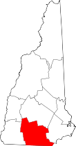 | |
| Towns | ||
| CDPs | ||
| Other villages | ||