Hancock, New Hampshire
| Hancock, New Hampshire | |
|---|---|
| Town | |
|
Town Hall | |
 Location in Hillsborough County, New Hampshire | |
| Coordinates: 42°58′22″N 71°58′47″W / 42.97278°N 71.97972°WCoordinates: 42°58′22″N 71°58′47″W / 42.97278°N 71.97972°W | |
| Country | United States |
| State | New Hampshire |
| County | Hillsborough |
| Incorporated | 1779 |
| Government | |
| • Board of Selectmen |
John Jordan, Chair Thomas C. Shevenell Erik Spitzbarth |
| • Town Administrator | Diane Kendall |
| Area | |
| • Total | 31.2 sq mi (80.9 km2) |
| • Land | 30.0 sq mi (77.6 km2) |
| • Water | 1.2 sq mi (3.2 km2) 4.00% |
| Elevation | 876 ft (267 m) |
| Population (2010) | |
| • Total | 1,654 |
| • Density | 53/sq mi (20/km2) |
| Time zone | Eastern (UTC-5) |
| • Summer (DST) | Eastern (UTC-4) |
| ZIP code | 03449 |
| Area code(s) | 603 |
| FIPS code | 33-33700 |
| GNIS feature ID | 0873618 |
| Website |
www |

Hancock is a town in Hillsborough County, New Hampshire, United States. The population was 1,654 at the 2010 census.[1] Hancock is home to the Welch Family Farm Forest.
The main village of the town, where 204 people resided at the 2010 census,[1] is defined as the Hancock census-designated place (CDP), and is located at the junction of New Hampshire routes 123 and 137.
History

Hancock started as an unidentified settlement on the Contoocook River, in lands known as Society Land or Cumberland, which had been reserved for the proprietors of the lands which became New Hampshire. First settled in 1764, the town was set off from Peterborough and incorporated in 1779, named Hancock in honor of John Hancock. A landowner of 1,875 acres (8 km2) in the community, Hancock was the first governor of the state of Massachusetts, president of the Continental Congress, and signer of the Declaration of Independence.
Almost every building on Main Street in downtown Hancock is listed on the National Register of Historic Places as part of the Hancock Village Historic District. Hancock's Meetinghouse is home to Paul Revere's #236 bell, which chimes on the hour, day and night. The town does not have paved sidewalks, but gravel paths leading from home to home.
 Main Street in 1907
 Historical Society in 1915
 Old Library c. 1905
 Bennington Road with Historical Society, 2013
Geography
According to the United States Census Bureau, the town has a total area of 31.2 square miles (81 km2), of which 30.0 sq mi (78 km2) are land and 1.2 sq mi (3.1 km2) are water, comprising 4.00% of the town. Hancock is drained by the Contoocook River. Powder Mill Pond is in the east, and Nubanusit Lake is on the western border. Skatutakee Mountain, the highest point in Hancock, has an elevation of 2,002 feet (610 m) above sea level. Hancock lies fully within the Merrimack River watershed.[2]
Demographics
| Historical population | |||
|---|---|---|---|
| Census | Pop. | %± | |
| 1790 | 634 | — | |
| 1800 | 1,120 | 76.7% | |
| 1810 | 1,184 | 5.7% | |
| 1820 | 1,178 | −0.5% | |
| 1830 | 1,316 | 11.7% | |
| 1840 | 1,345 | 2.2% | |
| 1850 | 1,012 | −24.8% | |
| 1860 | 844 | −16.6% | |
| 1870 | 692 | −18.0% | |
| 1880 | 689 | −0.4% | |
| 1890 | 637 | −7.5% | |
| 1900 | 642 | 0.8% | |
| 1910 | 642 | 0.0% | |
| 1920 | 531 | −17.3% | |
| 1930 | 561 | 5.6% | |
| 1940 | 631 | 12.5% | |
| 1950 | 612 | −3.0% | |
| 1960 | 722 | 18.0% | |
| 1970 | 909 | 25.9% | |
| 1980 | 1,193 | 31.2% | |
| 1990 | 1,604 | 34.5% | |
| 2000 | 1,739 | 8.4% | |
| 2010 | 1,654 | −4.9% | |
| Est. 2015 | 1,638 | [3] | −1.0% |

As of the census[5] of 2000, there were 1,739 people, 706 households, and 494 families residing in the town. The population density was 58.0 people per square mile (22.4/km²). There were 814 housing units at an average density of 27.2 per square mile (10.5/km²). The racial makeup of the town was 98.39% White, 0.23% African American, 0.29% Native American, 0.40% Asian, 0.06% from other races, and 0.63% from two or more races. Hispanic or Latino of any race were 0.40% of the population.
There were 706 households out of which 31.2% had children under the age of 18 living with them, 62.6% were married couples living together, 5.1% had a female householder with no husband present, and 29.9% were non-families. 25.1% of all households were made up of individuals and 10.3% had someone living alone who was 65 years of age or older. The average household size was 2.46 and the average family size was 2.94.

In the town the population was spread out with 25.0% under the age of 18, 3.9% from 18 to 24, 26.0% from 25 to 44, 28.3% from 45 to 64, and 16.8% who were 65 years of age or older. The median age was 43 years. For every 100 females there were 92.2 males. For every 100 females age 18 and over, there were 90.2 males.
The median income for a household in the town was $55,000, and the median income for a family was $64,423. Males had a median income of $40,000 versus $31,200 for females. The per capita income for the town was $29,445. About 2.7% of families and 3.8% of the population were below the poverty line, including 2.6% of those under age 18 and 4.1% of those age 65 or over.
Sites of interest
- Hancock Historical Society Museum
- Very Long Baseline Array radio telescope
Notable people
- A.A. Ames, corrupt former mayor of Minneapolis and fugitive from justice. Arrested at the house of Rev. C. H. Chapin in Hancock in February 1903.[6][7]
- Oren B. Cheney, abolitionist, Free Baptist preacher, founder of Bates College
- Person C. Cheney, US senator
- Wayne Green, publisher
- Joseph Grew, US ambassador to Japan, Denmark, Turkey, and Switzerland
- Sam Huntington, actor
- Howard Mansfield, author
- Charles E. Merrill Jr., educator, founded the Commonwealth School
- Jay Pierrepont Moffat, US ambassador to Canada
- Jay Pierrepont Moffat, Jr., US ambassador to Chad
- Sy Montgomery, author, adventurer
- Lilla Cabot Perry, artist
- Wallace Tripp, illustrator
- Elizabeth Yates, author and historian
References
- 1 2 United States Census Bureau, American FactFinder, 2010 Census figures. Retrieved March 23, 2011.
- ↑ Foster, Debra H.; Batorfalvy, Tatianna N.; Medalie, Laura (1995). Water Use in New Hampshire: An Activities Guide for Teachers. U.S. Department of the Interior and U.S. Geological Survey.
- ↑ "Annual Estimates of the Resident Population for Incorporated Places: April 1, 2010 to July 1, 2015". Retrieved July 2, 2016.
- ↑ "Census of Population and Housing". Census.gov. Retrieved June 4, 2016.
- ↑ "American FactFinder". United States Census Bureau. Retrieved 2008-01-31.
- ↑ New York Tribune, February 16, 1903.
- ↑ Harold Zink, City Bosses in the United States, Duke University Press, 1930. Page 348.
External links
| Wikimedia Commons has media related to Hancock, New Hampshire. |
- Town of Hancock official website
- Hancock Historical Society
- Various town records 1749-1883 online at Fold3.com
- New Hampshire Economic and Labor Market Information Bureau Profile
Municipalities and communities of Hillsborough County, New Hampshire, United States | ||
|---|---|---|
| Cities | 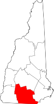 | |
| Towns | ||
| CDPs | ||
| Other villages | ||