Brighton, Kenosha County, Wisconsin
| Brighton, Wisconsin | |
|---|---|
| Town | |
 Location of Brighton, Wisconsin | |
| Coordinates: 42°36′55″N 88°7′21″W / 42.61528°N 88.12250°W | |
| Country | United States |
| State | Wisconsin |
| County | Kenosha |
| Area | |
| • Total | 36.0 sq mi (93.2 km2) |
| • Land | 35.8 sq mi (92.7 km2) |
| • Water | 0.2 sq mi (0.5 km2) |
| Elevation[1] | 784 ft (239 m) |
| Population (2000) | |
| • Total | 1,450 |
| • Density | 40.5/sq mi (15.6/km2) |
| Time zone | Central (CST) (UTC-6) |
| • Summer (DST) | CDT (UTC-5) |
| Area code(s) | 262 |
| FIPS code | 55-09635[2] |
| GNIS feature ID | 1582859[1] |
Brighton is a town in Kenosha County, Wisconsin, United States. The population was 1,450 at the 2000 census. The unincorporated communities of Brighton and Klondike are located within the town.
History
The first settlers in Brighton, a Dr. Johnson and a Mr. Wightman, arrived almost simultaneously in 1838.[3]
Geography
According to the United States Census Bureau, the town has a total area of 36.0 square miles (93.2 km²), of which, 35.8 square miles (92.7 km²) of it is land and 0.2 square miles (0.5 km²) of it (0.50%) is water.
Demographics
As of the census[2] of 2000, there were 1,450 people, 504 households, and 402 families residing in the town. The population density was 40.5 people per square mile (15.6/km²). There were 524 housing units at an average density of 14.6 per square mile (5.7/km²). The racial makeup of the town was 97.24% White, 0.21% African American, 0.21% Native American, 0.55% Asian, 0.07% Pacific Islander, 0.55% from other races, and 1.17% from two or more races. Hispanic or Latino of any race were 2.07% of the population.
There were 504 households out of which 35.5% had children under the age of 18 living with them, 69.6% were married couples living together, 5.2% had a female householder with no husband present, and 20.2% were non-families. 15.5% of all households were made up of individuals and 5.4% had someone living alone who was 65 years of age or older. The average household size was 2.88 and the average family size was 3.20.
In the town the population was age distributed as follows: 26.8% under the age of 18, 6.6% from 18 to 24, 29.9% from 25 to 44, 26.9% from 45 to 64, and 9.7% who were over 64 years. The median age was 39 years. For every 100 females there were 107.4 males. For every 100 females age 18 and over, there were 108.0 males.
The median income for a household in the town was $70,078, and the median income for a family was $74,479. Males had a median income of $42,321 versus $31,827 for females. The per capita income for the town was $26,518. About 1.0% of families and 1.9% of the population were below the poverty line, including 1.1% of those under age 18 and 1.5% of those age 65 or over.
Notable people
- John Dixon, businessman and legislator, was born in the town.[4]
- Dwight L. Burgess, farmer and legislator, was born in and was Chairman of what is now the town.[5]
- Lathrop Burgess, farmer and legislator, lived in the town.[6]
- Mathias J. Scholey, mayor of Kenosha and Wisconsin State Assemblyman, was born in the town.[7]
Points of interest
- Richard Bong State Recreation Area, Wisconsin's largest area of preserved prairie, is located largely in Brighton.
References
- 1 2 "US Board on Geographic Names". United States Geological Survey. 2007-10-25. Retrieved 2008-01-31.
- 1 2 "American FactFinder". United States Census Bureau. Archived from the original on 2013-09-11. Retrieved 2008-01-31.
- ↑ 'Racine Journal,' December 23, 1902, pg.7
- ↑ 'Wisconsin Blue Book 1903,' Biographical Sketch of John Dixon, pg. 1105
- ↑ JOURNAL OF PROCEEDINGS OF THE SIXTH-FOURTH SESSION OF THE Wisconsin Legislature. Madison, Wisconsin: Democrat Printing Company. 1939. pp. 66–67.
- ↑ 'Wisconsin Blue Book 1861,' pg. 36
- ↑ 'M. J. Scholey, Former Kenosha Mayor, Dead,' Racine Journal News, June 11, 1917, pg. 6
External links
Municipalities and communities of Kenosha County, Wisconsin, United States | ||
|---|---|---|
| City | 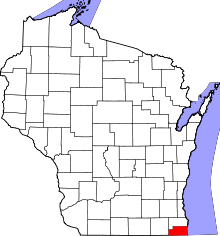 | |
| Villages | ||
| Towns | ||
| CDPs | ||
| Unincorporated communities | ||
| Ghost town | ||
| Footnotes | ‡This populated place also has portions in an adjacent county or counties | |
Coordinates: 42°37′45″N 88°05′59″W / 42.62917°N 88.09972°W