Powers Lake, Wisconsin
| Powers Lake, Wisconsin | |
|---|---|
| CDP | |
 Location of Powers Lake, Wisconsin | |
| Coordinates: 42°32′20″N 88°17′53″W / 42.53889°N 88.29806°WCoordinates: 42°32′20″N 88°17′53″W / 42.53889°N 88.29806°W | |
| Country | United States |
| State | Wisconsin |
| Counties | Kenosha, Walworth |
| Area | |
| • Total | 3.074 sq mi (7.96 km2) |
| • Land | 2.217 sq mi (5.74 km2) |
| • Water | 0.857 sq mi (2.22 km2) |
| Elevation[1] | 869 ft (265 m) |
| Population (2010) | |
| • Total | 1,615 |
| • Density | 530/sq mi (200/km2) |
| Time zone | Central (CST) (UTC-6) |
| • Summer (DST) | CDT (UTC-5) |
| Area code(s) | 262 |
| FIPS code | 55-64825[2] |
| GNIS feature ID | 1571858[1] |
Powers Lake is a census-designated place (CDP) in the town of Wheatland, in Kenosha County in the U.S. state of Wisconsin. As of the 2010 census, the CDP had a total population of 1,615. Part of Powers Lake is located in Walworth County and, in December 20, 2011, became part of the village of Bloomfield.[3]
History
The community was named after James B. Powers, one of its early settlers.[4]
Geography
Powers Lake is located at 42°32'20" North, 88°17'53" West (42.538813, -88.298027).[5]
According to the United States Census Bureau, the CDP has a total area of 3.1 square miles (8.0 km²), of which, 2.2 square miles (5.7 km²) of it is land and 0.9 square miles (2.2 km²) of it is water. The total area is 27.88% water.
Demographics
As of the census[2] of 2000, there were 1,500 people, 544 households, and 405 families residing in the CDP. The population density was 783.6 people per square mile (303.2/km²). There were 855 housing units at an average density of 446.6/sq mi (172.8/km²). The racial makeup of the CDP was 97.53% White, 0.33% African American, 0.13% Native American, 0.27% Asian, 0.00% Pacific Islander, 0.07% from other races, and 1.67% from two or more races. 2.13% of the population were Hispanic or Latino of any race.
There were 544 households out of which 38.2% had children under the age of 18 living with them, 59.6% were married couples living together, 10.8% had a female householder with no husband present, and 25.4% were non-families. 20.0% of all households were made up of individuals and 7.7% had someone living alone who was 65 years of age or older. The average household size was 2.73 and the average family size was 3.15.
In the CDP the population was spread out with 28.5% under the age of 18, 6.6% from 18 to 24, 32.3% from 25 to 44, 21.2% from 45 to 64, and 11.5% who were 65 years of age or older. The median age was 36 years. For every 100 females there were 98.4 males. For every 100 females age 18 and over, there were 92.6 males.
The median income for a household in the CDP was $53,403, and the median income for a family was $53,264. Males had a median income of $42,000 versus $26,736 for females. The per capita income for the CDP was $22,766. 7.4% of the population and 6.6% of families were below the poverty line. 3.0% of those under the age of 18 and 9.7% of those 65 and older were living below the poverty line.
Organizations
Powers Lake has many groups and organizations, including the Powers Lake Yacht Club, which has been sailing on these waters for many years. A more recent organization is the Powers Lake Boat Club, a younger group of boaters, skiers, and partiers. Powers Lake is also home to Team Pup N Suds, a casual inline skating team.
References
- 1 2 "US Board on Geographic Names". United States Geological Survey. 2007-10-25. Retrieved 2008-01-31.
- 1 2 "American FactFinder". United States Census Bureau. Retrieved 2008-01-31.
- ↑ "Boundary Changes". Geographic Changes. Population Division, United States Census Bureau. January 1, 2012. Retrieved February 26, 2013.
- ↑ Kenosha Co. WI Placenames
- ↑ "US Gazetteer files: 2010, 2000, and 1990". United States Census Bureau. 2011-02-12. Retrieved 2011-04-23.
External links
Municipalities and communities of Kenosha County, Wisconsin, United States | ||
|---|---|---|
| City | 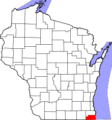 | |
| Villages | ||
| Towns | ||
| CDPs | ||
| Unincorporated communities | ||
| Ghost town | ||
| Footnotes | ‡This populated place also has portions in an adjacent county or counties | |