Twin Lakes, Wisconsin
| Twin Lakes, Wisconsin | |
|---|---|
| Village | |
 Location of Twin Lakes, Wisconsin | |
 Twin Lakes, Wisconsin Location in the United States | |
| Coordinates: 42°31′18″N 88°15′46″W / 42.52167°N 88.26278°WCoordinates: 42°31′18″N 88°15′46″W / 42.52167°N 88.26278°W | |
| Country | United States |
| State | Wisconsin |
| County | Kenosha |
| Area[1] | |
| • Total | 9.75 sq mi (25.25 km2) |
| • Land | 8.18 sq mi (21.19 km2) |
| • Water | 1.57 sq mi (4.07 km2) |
| Elevation[2] | 801 ft (244 m) |
| Population (2010)[3] | |
| • Total | 5,989 |
| • Estimate (2012[4]) | 6,028 |
| • Density | 732.2/sq mi (282.7/km2) |
| Time zone | Central (CST) (UTC-6) |
| • Summer (DST) | CDT (UTC-5) |
| Area code(s) | 262 |
| FIPS code | 55-81250[5] |
| GNIS feature ID | 1575813[2] |
Twin Lakes is a village in Kenosha County, Wisconsin, United States. The population was 5,989 at the 2010 census. The village's name refers to nearby Lake Mary and Lake Elizabeth.
History
A post office called Twin Lakes has been in operation since 1891.[6] The village was named from its location near two nearly identical lakes.[7]
Geography
Twin Lakes is located at 42°31′18″N 88°15′46″W / 42.52167°N 88.26278°W (42.521554, -88.262885).[8]
According to the United States Census Bureau, the village has a total area of 9.75 square miles (25.25 km2), of which, 8.18 square miles (21.19 km2) of it is land and 1.57 square miles (4.07 km2) is water.[1]
Demographics
| Historical population | |||
|---|---|---|---|
| Census | Pop. | %± | |
| 1940 | 409 | — | |
| 1950 | 637 | 55.7% | |
| 1960 | 1,497 | 135.0% | |
| 1970 | 2,276 | 52.0% | |
| 1980 | 3,474 | 52.6% | |
| 1990 | 3,989 | 14.8% | |
| 2000 | 5,124 | 28.5% | |
| 2010 | 5,989 | 16.9% | |
| Est. 2015 | 6,094 | [9] | 1.8% |
2010 census
As of the census[3] of 2010, there were 5,989 people, 2,345 households, and 1,618 families residing in the village. The population density was 732.2 inhabitants per square mile (282.7/km2). There were 3,251 housing units at an average density of 397.4 per square mile (153.4/km2). The racial makeup of the village was 96.2% White, 0.6% African American, 0.2% Native American, 0.4% Asian, 0.1% Pacific Islander, 1.4% from other races, and 1.1% from two or more races. Hispanic or Latino of any race were 4.7% of the population.
There were 2,345 households of which 33.0% had children under the age of 18 living with them, 52.2% were married couples living together, 10.8% had a female householder with no husband present, 6.1% had a male householder with no wife present, and 31.0% were non-families. 24.4% of all households were made up of individuals and 8.6% had someone living alone who was 65 years of age or older. The average household size was 2.55 and the average family size was 3.04.
The median age in the village was 38.9 years. 24.7% of residents were under the age of 18; 7.8% were between the ages of 18 and 24; 27.1% were from 25 to 44; 29.2% were from 45 to 64; and 11.4% were 65 years of age or older. The gender makeup of the village was 50.3% male and 49.7% female.
2000 census
As of the census[5] of 2000, there were 5,124 people, 1,973 households, and 1,390 families residing in the village. The population density was 948.5 people per square mile (366.4/km²). There were 2,742 housing units at an average density of 507.6 per square mile (196.1/km²). The racial makeup of the village was 97.35% White, 0.37% African American, 0.18% Native American, 0.57% Asian, 0.02% Pacific Islander, 0.57% from other races, and 0.96% from two or more races. Hispanic or Latino of any race were 2.48% of the population.
There were 1,973 households out of which 35.1% had children under the age of 18 living with them, 58.0% were married couples living together, 8.3% had a female householder with no husband present, and 29.5% were non-families. 22.8% of all households were made up of individuals and 8.3% had someone living alone who was 65 years of age or older. The average household size was 2.58 and the average family size was 3.05.
In the village the population was spread out with 27.1% under the age of 18, 7.3% from 18 to 24, 30.3% from 25 to 44, 23.1% from 45 to 64, and 12.2% who were 65 years of age or older. The median age was 36 years. For every 100 females there were 98.8 males. For every 100 females age 18 and over, there were 97.8 males.
The median income for a household in the village was $46,601, and the median income for a family was $54,583. Males had a median income of $42,589 versus $27,395 for females. The per capita income for the village was $22,226. About 4.5% of families and 6.6% of the population were below the poverty line, including 7.8% of those under age 18 and 9.2% of those age 65 or over.
References
- 1 2 "US Gazetteer files 2010". United States Census Bureau. Retrieved 2012-11-18.
- 1 2 "US Board on Geographic Names". United States Geological Survey. 2007-10-25. Retrieved 2008-01-31.
- 1 2 "American FactFinder". United States Census Bureau. Retrieved 2012-11-18.
- ↑ "Population Estimates". United States Census Bureau. Retrieved 2013-06-24.
- 1 2 "American FactFinder". United States Census Bureau. Retrieved 2008-01-31.
- ↑ "Kenosha County". Jim Forte Postal History. Retrieved 30 March 2015.
- ↑ Chicago and North Western Railway Company (1908). A History of the Origin of the Place Names Connected with the Chicago & North Western and Chicago, St. Paul, Minneapolis & Omaha Railways. p. 132.
- ↑ "US Gazetteer files: 2010, 2000, and 1990". United States Census Bureau. 2011-02-12. Retrieved 2011-04-23.
- ↑ "Annual Estimates of the Resident Population for Incorporated Places: April 1, 2010 to July 1, 2015". Retrieved July 2, 2016.
- ↑ "Census of Population and Housing". Census.gov. Retrieved June 4, 2015.
External links
- Village of Twin Lake's website
- Twin Lakes Chamber and Business Association's website
- Twin Lakes Wisconsin News
- Lake and Recreation Association of Twin Lakes
- Twin Lakes Community Public Forum
- Wisconsin DNR page on Lake Mary
- Wisconsin DNR page on Elizabeth Lake
Municipalities and communities of Kenosha County, Wisconsin, United States | ||
|---|---|---|
| City | 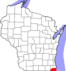 | |
| Villages | ||
| Towns | ||
| CDPs | ||
| Unincorporated communities | ||
| Ghost town | ||
| Footnotes | ‡This populated place also has portions in an adjacent county or counties | |