Blooming Grove Township, Franklin County, Indiana
| Blooming Grove Township | |
|---|---|
| Township | |
|
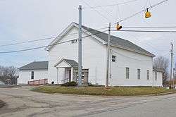
Church in Blooming Grove | |
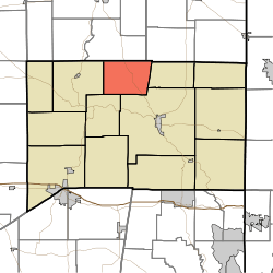 Location of Blooming Grove Township in Franklin County | |
| Coordinates: 39°30′01″N 85°04′46″W / 39.50028°N 85.07944°WCoordinates: 39°30′01″N 85°04′46″W / 39.50028°N 85.07944°W | |
| Country | United States |
| State | Indiana |
| County | Franklin |
| Government | |
| • Type | Indiana township |
| Area | |
| • Total | 21.53 sq mi (55.8 km2) |
| • Land | 21.49 sq mi (55.7 km2) |
| • Water | 0.04 sq mi (0.1 km2) |
| Elevation[1] | 997 ft (304 m) |
| Population (2010) | |
| • Total | 1,154 |
| • Density | 53.7/sq mi (20.7/km2) |
| FIPS code | 18-05824[2] |
| GNIS feature ID | 453114 |
Blooming Grove Township is one of thirteen townships in Franklin County, Indiana. As of the 2010 census, its population was 1,154.[3]
History
Blooming Grove Township was largely settled after the War of 1812.[4]
Geography
According to the 2010 census, the township has a total area of 21.53 square miles (55.8 km2), of which 21.49 square miles (55.7 km2) (or 99.81%) is land and 0.04 square miles (0.10 km2) (or 0.19%) is water.[3] Shady Lake is in this township.
Unincorporated towns
- Blooming Grove
- Pinhook
(This list is based on USGS data and may include former settlements.)
Adjacent townships
- Harmony Township, Union County (northeast)
- Fairfield Township (east)
- Brookville Township (southeast)
- Metamora Township (southwest)
- Laurel Township (west)
- Jackson Township, Fayette County (northwest)
Major highways
Cemeteries
The township contains one cemetery, Ebenezer.
References
- "Blooming Grove Township, Franklin County, Indiana". Geographic Names Information System. United States Geological Survey. Retrieved 2009-09-24.
- United States Census Bureau cartographic boundary files
- ↑ "US Board on Geographic Names". United States Geological Survey. 2007-10-25. Retrieved 2008-01-31.
- ↑ "American FactFinder". United States Census Bureau. Archived from the original on 2013-09-11. Retrieved 2008-01-31.
- 1 2 "Population, Housing Units, Area, and Density: 2010 - County -- County Subdivision and Place -- 2010 Census Summary File 1". United States Census. Retrieved 2013-05-10.
- ↑ Reifel, August Jacob (1915). History of Franklin County, Indiana. Windmill Publications. p. 140.
External links
Municipalities and communities of Franklin County, Indiana, United States | ||
|---|---|---|
| City | ||
| Towns | ||
| Townships | ||
| CDPs | ||
| Other unincorporated communities |
| |
| Footnotes | ‡This populated place also has portions in an adjacent county or counties | |
This article is issued from Wikipedia - version of the 11/4/2016. The text is available under the Creative Commons Attribution/Share Alike but additional terms may apply for the media files.