Franklin County, Indiana
| Franklin County, Indiana | |
|---|---|
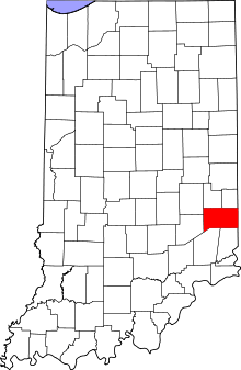 Location in the U.S. state of Indiana | |
 Indiana's location in the U.S. | |
| Founded | 1811 |
| Named for | Benjamin Franklin |
| Seat | Brookville |
| Largest town | Brookville |
| Area | |
| • Total | 391.05 sq mi (1,013 km2) |
| • Land | 384.43 sq mi (996 km2) |
| • Water | 6.62 sq mi (17 km2), 1.69% |
| Population | |
| • (2010) | 23,087 |
| • Density | 60/sq mi (23.09/km²) |
| Congressional district | 6th |
| Time zone | Eastern: UTC-5/-4 |
| Website |
www |
| Footnotes: Indiana county number 24 | |
Franklin County is a county located along the eastern border of the U.S. state of Indiana. It was formed in 1811 and consists of 13 townships. As of 2010, the population was 23,087.[1] The county seat is Brookville.[2] Franklin County is part of the Cincinnati-Middletown, OH-KY-IN Metropolitan Statistical Area.
Geography
According to the 2010 census, the county has a total area of 391.05 square miles (1,012.8 km2), of which 384.43 square miles (995.7 km2) (or 98.31%) is land and 6.62 square miles (17.1 km2) (or 1.69%) is water.[3]
Major highways
 Interstate 74
 U.S. Route 52
 Indiana State Road 1
 Indiana State Road 46
 Indiana State Road 101
 Indiana State Road 121
 Indiana State Road 229
 Indiana State Road 252
Adjacent counties
|
|
History
Franklin County was formed in 1811. It was named for Benjamin Franklin.[4][5]
Some of the early settlers of this county were Primitive Baptists, they came with Elder William Tyner who came from Virginia in 1797. They organized the Little Cedar Grove Baptist Church, the first church in the Whitewater Valley. The members built a log church as early as 1805, about two or three miles southeast of Brookville, Indiana. In 1812 they built a large brick church, with balcony, and rifle por ogle.com/books?id=xU5NF4EAbQMC&pg=PA6&dq=harrison+spring+indiana&as_brr=3&sig=vtmZ2aQQILJjADDIVYbfEFFG4KI#PPA6,M1 Amazing Tales from Indiana, By Fred D., Pg 6–7]</ref>
One further landmark in the county is the Big Cedar Baptist Church and Burying Ground on Big Cedar Creek Road, between the road to Reily and the Oxford Pike. The original church was established in 1817, as an arm of the Little Cedar Baptist church. The plain, simple brick building, but impressive in its simplicity was built in 1838. This church, like all, or nearly all of the pioneer Baptist groups in the county was originally Primitive Baptist or Hardshell. In the 1830s modernism came upon the scene, modernism and human inventions, like Sunday Schools, Missionary Societies, and organs. Organs were particularly anathema to the Primitive Party; an organ was Aaron’s golden calf. The Big Cedar congregation divided into two congregations, but the two groups arrived at an amicable settlement and both congregations continued to use the same building. The Primitives, or Hardshells, had church there on the first and third Sabbath of each month, and the Modernists or Missionary Baptists used the church on the second and fourth Sundays. Each congregation had its own wood shed. The building is now maintained in connection with the Big Cedar Cemetery Association.
Governors James B. Ray, Noah Noble and David Wallace were known as the "Brookville Triumvirate," in that they all had lived in Brookville, Franklin County, Indiana and served consecutive terms in the office of Governor of Indiana. Noble and former governor Ray were political enemies.
James B. Goudie Jr. Speaker of the Indiana House was from Franklin County.
Climate and weather
| Brookville, Indiana | ||||||||||||||||||||||||||||||||||||||||||||||||||||||||||||
|---|---|---|---|---|---|---|---|---|---|---|---|---|---|---|---|---|---|---|---|---|---|---|---|---|---|---|---|---|---|---|---|---|---|---|---|---|---|---|---|---|---|---|---|---|---|---|---|---|---|---|---|---|---|---|---|---|---|---|---|---|
| Climate chart (explanation) | ||||||||||||||||||||||||||||||||||||||||||||||||||||||||||||
| ||||||||||||||||||||||||||||||||||||||||||||||||||||||||||||
| ||||||||||||||||||||||||||||||||||||||||||||||||||||||||||||
In recent years, average temperatures in Brookville have ranged from a low of 17 °F (−8 °C) in January to a high of 87 °F (31 °C) in July, although a record low of −31 °F (−35 °C) was recorded in January 1994 and a record high of 104 °F (40 °C) was recorded in September 1951. Average monthly precipitation ranged from 2.68 inches (68 mm) in September to 4.90 inches (124 mm) in May.[6]
Government
The county government is a constitutional body, and is granted specific powers by the Constitution of Indiana, and by the Indiana Code.
County Council: The county council is the legislative branch of the county government and controls all the spending and revenue collection in the county. Representatives are elected from county districts. The council members serve four-year terms. They are responsible for setting salaries, the annual budget, and special spending. The council also has limited authority to impose local taxes, in the form of an income and property tax that is subject to state level approval, excise taxes, and service taxes.[7][8]
Board of Commissioners: The executive body of the county is made of a board of commissioners. The commissioners are elected county-wide, in staggered terms, and each serves a four-year term. One of the commissioners, typically the most senior, serves as president. The commissioners are charged with executing the acts legislated by the council, collecting revenue, and managing the day-to-day functions of the county government.[7][8]
County Officials: The county has several other elected offices, including sheriff, coroner, auditor, treasurer, recorder, surveyor, and circuit court clerk. Each of these elected officers serves a term of four years and oversees a different part of county government. Members elected to county government positions are required to declare party affiliations and to be residents of the county.[8]
Franklin County is part of Indiana's 6th congressional district; Indiana Senate districts 42 and 43;[9] and Indiana House of Representatives districts 55, 67 and 68.[10]
Townships
- Bath Township
- Blooming Grove Township
- Brookville Township
- Butler Township
- Fairfield Township
- Highland Township
- Laurel Township
- Metamora Township
- Posey Township
- Ray Township
- Salt Creek Township
- Springfield Township
- Whitewater Township
Demographics
| Historical population | |||
|---|---|---|---|
| Census | Pop. | %± | |
| 1820 | 10,763 | — | |
| 1830 | 10,190 | −5.3% | |
| 1840 | 13,349 | 31.0% | |
| 1850 | 17,968 | 34.6% | |
| 1860 | 19,549 | 8.8% | |
| 1870 | 20,223 | 3.4% | |
| 1880 | 20,092 | −0.6% | |
| 1890 | 18,366 | −8.6% | |
| 1900 | 16,388 | −10.8% | |
| 1910 | 15,335 | −6.4% | |
| 1920 | 14,806 | −3.4% | |
| 1930 | 14,498 | −2.1% | |
| 1940 | 14,412 | −0.6% | |
| 1950 | 16,034 | 11.3% | |
| 1960 | 17,015 | 6.1% | |
| 1970 | 16,943 | −0.4% | |
| 1980 | 19,612 | 15.8% | |
| 1990 | 19,580 | −0.2% | |
| 2000 | 22,151 | 13.1% | |
| 2010 | 23,087 | 4.2% | |
| Est. 2015 | 22,872 | [11] | −0.9% |
| U.S. Decennial Census[12] 1790-1960[13] 1900-1990[14] 1990-2000[15] 2010-2013[1] | |||
As of the 2010 United States Census, there were 23,087 people, 8,579 households, and 6,447 families residing in the county.[16] The population density was 60.1 inhabitants per square mile (23.2/km2). There were 9,538 housing units at an average density of 24.8 per square mile (9.6/km2).[3] The racial makeup of the county was 98.3% white, 0.2% black or African American, 0.2% Asian, 0.1% American Indian, 0.3% from other races, and 0.8% from two or more races. Those of Hispanic or Latino origin made up 0.9% of the population.[16] In terms of ancestry, 40.3% were German, 14.7% were American, 13.1% were Irish, and 9.5% were English.[17]
Of the 8,579 households, 35.9% had children under the age of 18 living with them, 61.6% were married couples living together, 8.4% had a female householder with no husband present, 24.9% were non-families, and 20.5% of all households were made up of individuals. The average household size was 2.67 and the average family size was 3.07. The median age was 40.0 years.[16]
The median income for a household in the county was $47,697 and the median income for a family was $60,300. Males had a median income of $43,443 versus $32,612 for females. The per capita income for the county was $23,090. About 8.6% of families and 11.7% of the population were below the poverty line, including 16.8% of those under age 18 and 10.9% of those age 65 or over.[18]
See also
References
- 1 2 "Franklin County QuickFacts". United States Census Bureau. Retrieved 2011-09-17.
- ↑ "Find a County". National Association of Counties. Retrieved 2011-06-07.
- 1 2 "Population, Housing Units, Area, and Density: 2010 - County". United States Census Bureau. Retrieved 2015-07-10.
- ↑ De Witt Clinton Goodrich & Charles Richard Tuttle (1875). An Illustrated History of the State of Indiana. Indiana: R. S. Peale & co. p. 558.
- ↑ Gannett, Henry (1905). The Origin of Certain Place Names in the United States. Govt. Print. Off. p. 131.
- 1 2 "Monthly Averages for Brookville, Indiana". The Weather Channel. Retrieved 2011-01-27.
- 1 2 Indiana Code. "Title 36, Article 2, Section 3". IN.gov. Retrieved 2008-09-16.
- 1 2 3 Indiana Code. "Title 2, Article 10, Section 2" (PDF). IN.gov. Retrieved 2008-09-16.
- ↑ "Indiana Senate Districts". State of Indiana. Retrieved 2011-01-23.
- ↑ "Indiana House Districts". State of Indiana. Retrieved 2011-01-23.
- ↑ "County Totals Dataset: Population, Population Change and Estimated Components of Population Change: April 1, 2010 to July 1, 2015". Retrieved July 2, 2016.
- ↑ "U.S. Decennial Census". United States Census Bureau. Retrieved July 10, 2014.
- ↑ "Historical Census Browser". University of Virginia Library. Retrieved July 10, 2014.
- ↑ "Population of Counties by Decennial Census: 1900 to 1990". United States Census Bureau. Retrieved July 10, 2014.
- ↑ "Census 2000 PHC-T-4. Ranking Tables for Counties: 1990 and 2000" (PDF). United States Census Bureau. Retrieved July 10, 2014.
- 1 2 3 "DP-1 Profile of General Population and Housing Characteristics: 2010 Demographic Profile Data". United States Census Bureau. Retrieved 2015-07-10.
- ↑ "DP02 SELECTED SOCIAL CHARACTERISTICS IN THE UNITED STATES – 2006-2010 American Community Survey 5-Year Estimates". United States Census Bureau. Retrieved 2015-07-10.
- ↑ "DP03 SELECTED ECONOMIC CHARACTERISTICS – 2006-2010 American Community Survey 5-Year Estimates". United States Census Bureau. Retrieved 2015-07-10.
 |
Rush County | Fayette County | Union County | |
| Decatur County | |
Butler County, Ohio | ||
| ||||
| | ||||
| Ripley County | Dearborn County | Hamilton County, Ohio |
Municipalities and communities of Franklin County, Indiana, United States | ||
|---|---|---|
| City | ||
| Towns | ||
| Townships | ||
| CDPs | ||
| Other unincorporated communities |
| |
| Footnotes | ‡This populated place also has portions in an adjacent county or counties | |

Coordinates: 39°25′N 85°04′W / 39.42°N 85.06°W