Bethlehem Township, Clark County, Indiana
| Bethlehem Township | |
|---|---|
| Township | |
|
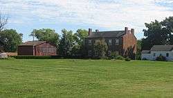
The Abbott-Holloway Farm, a historic site in the township | |
 Location of Bethlehem Township in Clark County | |
| Coordinates: 38°32′49″N 85°27′26″W / 38.54694°N 85.45722°WCoordinates: 38°32′49″N 85°27′26″W / 38.54694°N 85.45722°W | |
| Country | United States |
| State | Indiana |
| County | Clark |
| Government | |
| • Type | Indiana township |
| Area | |
| • Total | 18.59 sq mi (48.1 km2) |
| • Land | 18.27 sq mi (47.3 km2) |
| • Water | 0.31 sq mi (0.8 km2) |
| Elevation[1] | 735 ft (224 m) |
| Population (2010) | |
| • Total | 309 |
| • Density | 16.9/sq mi (6.5/km2) |
| FIPS code | 18-05122[2] |
| GNIS feature ID | 453109 |
Bethlehem Township is one of twelve townships in Clark County, Indiana. As of the 2010 census, its population was 309 and it contained 127 housing units.[3]
History
Bethlehem Township was organized in 1816. It was named after the town of Bethlehem, Indiana.[4]
Geography
According to the 2010 census, the township has a total area of 18.59 square miles (48.1 km2), of which 18.27 square miles (47.3 km2) (or 98.28%) is land and 0.31 square miles (0.80 km2) (or 1.67%) is water.[3]
Unincorporated towns
(This list is based on USGS data and may include former settlements.)
Adjacent townships
- Owen Township (southwest)
- Washington Township (west)
- Saluda Township, Jefferson County (northwest)
Cemeteries
The township contains several cemeteries: Antioch, Bethlehem, Camp Creek, Louden, Mikesell, New Hope, Otto, Palmer, Patterson, Ross, Tiaris, Turner, and Waters (aka Stoner).[5]
References
- "Bethlehem Township, Clark County, Indiana". Geographic Names Information System. United States Geological Survey. Retrieved 2009-09-24.
- United States Census Bureau cartographic boundary files
- ↑ "US Board on Geographic Names". United States Geological Survey. 2007-10-25. Retrieved 2008-01-31.
- ↑ "American FactFinder". United States Census Bureau. Archived from the original on 2013-09-11. Retrieved 2008-01-31.
- 1 2 "Population, Housing Units, Area, and Density: 2010 - County -- County Subdivision and Place -- 2010 Census Summary File 1". United States Census. Retrieved 2013-05-10.
- ↑ Biographical and Historical Souvenir for the Counties of Clark, Crawford, Harrison, Floyd, Jefferson, Jennings, Scott, and Washington, Indiana. Chicago Printing Company. 1889. p. 12.
- ↑ Mauk, Lois. "Clark County, Indiana Cemeteries". usgennet.org. USGenNet. Retrieved 7 September 2014.
External links
Municipalities and communities of Clark County, Indiana, United States | ||
|---|---|---|
| Cities | ||
| Towns | ||
| Townships | ||
| CDPs | ||
| Unincorporated communities |
| |
| Footnotes | ‡This populated place also has portions in an adjacent county or counties | |
This article is issued from Wikipedia - version of the 11/1/2016. The text is available under the Creative Commons Attribution/Share Alike but additional terms may apply for the media files.