Baton Rouge National Cemetery
|
Baton Rouge National Cemetery | |
|
Cemetery entrance, c. 1899 | |
  | |
| Location |
220 North 19th Street Baton Rouge, Louisiana |
|---|---|
| Coordinates | 30°27′0″N 91°10′3″W / 30.45000°N 91.16750°WCoordinates: 30°27′0″N 91°10′3″W / 30.45000°N 91.16750°W |
| Area | 7.7 acres (3.1 ha) |
| Built | 1867 |
| Architectural style | Colonial Revival |
| MPS | Civil War Era National Cemeteries MPS |
| NRHP Reference # | [1] |
| Added to NRHP | July 09, 1997 |
.jpg)
Baton Rouge National Cemetery is a United States National Cemetery located in East Baton Rouge Parish, in the city of Baton Rouge, Louisiana. It encompasses 7.7 acres (3.1 ha), and as of the end of 2005, had 5,459 interments.
History
Burials in the cemetery grounds took place as early as 1830, but the site was predominantly used during the Civil War to bury soldiers who died in Baton Rouge and the surrounding battlefields, including Plaquemine and Camden. It became an official National Cemetery in 1867, and rewards were given to anyone who reported the grave of a Union soldier, so that his remains could be reinterred in the cemetery.
In 1878 two men, Michael and Bernard Jodd, were hired to build a brick wall around the cemetery, but before it was completed, both men contracted yellow fever and died. They were interred in the cemetery and the wall was completed by local laborers.
Notable interments
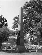
- General Philemon Thomas. His remains were reinterred in the national cemetery in 1886. He was a veteran of both the American Revolutionary War and the War of 1812, and he commanded the forces that captured the fort of Baton Rouge in 1810. He also served as a Congressional Representative from the state of Louisiana in the 22nd and 23rd United States Congresses.
- Lieutenant General Troy Houston Middleton, World War II veteran and president of Louisiana State University.
See also
References
- ↑ National Park Service (2009-03-13). "National Register Information System". National Register of Historic Places. National Park Service.
External links
- National Cemetery Administration
- Baton Rouge National Cemetery
- Civil War Era National Cemeteries
- Historic American Landscapes Survey (HALS) No. LA-5, "Baton Rouge National Cemetery, 220 North 19th Street, Baton Rouge, East Baton Rouge Parish, LA", 35 photos, 4 photo caption pages
- HALS No. LA-5-A, "Baton Rouge National Cemetery, Lodge", 6 data pages
- HALS No. LA-5-B, "Baton Rouge National Cemetery, Rostrum", 4 data pages
| Topics | |
|---|---|
| Lists by states |
|
| Lists by insular areas | |
| Lists by associated states | |
| Other areas | |
| |