Auxvasse, Missouri
| Auxvasse, Missouri | |
|---|---|
| City | |
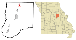 Location of Auxvasse, Missouri | |
| Coordinates: 39°0′59″N 91°53′48″W / 39.01639°N 91.89667°WCoordinates: 39°0′59″N 91°53′48″W / 39.01639°N 91.89667°W | |
| Country | United States |
| State | Missouri |
| County | Callaway |
| Area[1] | |
| • Total | 0.76 sq mi (1.97 km2) |
| • Land | 0.76 sq mi (1.97 km2) |
| • Water | 0 sq mi (0 km2) |
| Elevation | 869 ft (265 m) |
| Population (2010)[2] | |
| • Total | 983 |
| • Estimate (2012[3]) | 981 |
| • Density | 1,293.4/sq mi (499.4/km2) |
| Time zone | Central (CST) (UTC-6) |
| • Summer (DST) | CDT (UTC-5) |
| ZIP code | 65231 |
| Area code(s) | 573 |
| FIPS code | 29-02638[4] |
| GNIS feature ID | 0713496[5] |
Auxvasse is a city in Callaway County, Missouri, United States. It is part of the Jefferson City, Missouri Metropolitan Statistical Area. The population was 983 at the 2010 census.[6]
History
Auxvasse was originally called Clinton City, and under the latter name was platted in 1873.[7] The present name is after nearby Auxvasse Creek.[7] A post office called Auxvasse has been in operation since 1874.[8]
Geography
Auxvasse is located at 39°0′59″N 91°53′48″W / 39.01639°N 91.89667°W (39.016478, -91.896780).[9]
According to the United States Census Bureau, the city has a total area of 0.76 square miles (1.97 km2), all of it land.[1]
Demographics
| Historical population | |||
|---|---|---|---|
| Census | Pop. | %± | |
| 1890 | 348 | — | |
| 1900 | 337 | −3.2% | |
| 1910 | 411 | 22.0% | |
| 1920 | 484 | 17.8% | |
| 1930 | 438 | −9.5% | |
| 1940 | 490 | 11.9% | |
| 1950 | 507 | 3.5% | |
| 1960 | 534 | 5.3% | |
| 1970 | 808 | 51.3% | |
| 1980 | 858 | 6.2% | |
| 1990 | 821 | −4.3% | |
| 2000 | 901 | 9.7% | |
| 2010 | 983 | 9.1% | |
| Est. 2015 | 985 | [10] | 0.2% |
2010 census
As of the census[2] of 2010, there were 983 people, 405 households, and 261 families residing in the city. The population density was 1,293.4 inhabitants per square mile (499.4/km2). There were 472 housing units at an average density of 621.1 per square mile (239.8/km2). The racial makeup of the city was 94.1% White, 3.2% African American, 1.3% Native American, 0.5% Asian, 0.3% from other races, and 0.6% from two or more races. Hispanic or Latino of any race were 1.1% of the population.
There were 405 households of which 37.5% had children under the age of 18 living with them, 45.9% were married couples living together, 12.6% had a female householder with no husband present, 5.9% had a male householder with no wife present, and 35.6% were non-families. 29.9% of all households were made up of individuals and 12.6% had someone living alone who was 65 years of age or older. The average household size was 2.43 and the average family size was 3.03.
The median age in the city was 86.5 years. 28.4% of residents were under the age of 18; 8.7% were between the ages of 18 and 24; 24.9% were from 25 to 44; 24.8% were from 45 to 64; and 13.2% were 65 years of age or older. The gender makeup of the city was 47.4% male and 52.6% female.
2000 census
As of the census[4] of 2000, there were 901 people, 381 households, and 240 families residing in the city. The population density was 1,356.6 people per square mile (527.1/km²). There were 400 housing units at an average density of 602.3 per square mile (234.0/km²). The racial makeup of the city was 95.01% White, 3.22% African American, 0.44% Native American, 0.11% Asian, 0.11% from other races, and 1.11% from two or more races. Hispanic or Latino of any race were 0.44% of the population.
There were 381 households out of which 31.8% had children under the age of 18 living with them, 48.0% were married couples living together, 11.3% had a female householder with no husband present, and 37.0% were non-families. 31.2% of all households were made up of individuals and 18.4% had someone living alone who was 65 years of age or older. The average household size was 2.34 and the average family size was 2.91.
In the city the population was spread out with 26.4% under the age of 18, 7.1% from 18 to 24, 29.4% from 25 to 44, 20.0% from 45 to 64, and 17.1% who were 65 years of age or older. The median age was 37 years. For every 100 females there were 88.1 males. For every 100 females age 18 and over, there were 85.2 males.
The median income for a household in the city was $33,875, and the median income for a family was $42,700. Males had a median income of $28,214 versus $21,250 for females. The per capita income for the city was $15,785. About 6.7% of families and 11.4% of the population were below the poverty line, including 9.6% of those under age 18 and 18.1% of those age 65 or over.
References
- 1 2 "US Gazetteer files 2010". United States Census Bureau. Archived from the original on 2012-01-24. Retrieved 2012-07-08.
- 1 2 "American FactFinder". United States Census Bureau. Retrieved 2012-07-08.
- ↑ "Population Estimates". United States Census Bureau. Archived from the original on 2013-06-17. Retrieved 2013-05-30.
- 1 2 "American FactFinder". United States Census Bureau. Archived from the original on 2013-09-11. Retrieved 2008-01-31.
- ↑ "US Board on Geographic Names". United States Geological Survey. 2007-10-25. Retrieved 2008-01-31.
- ↑ "Race, Hispanic or Latino, Age, and Housing Occupancy: 2010 Census Redistricting Data (Public Law 94-171) Summary File (QT-PL), Auxvasse city, Missouri". U.S. Census Bureau, American FactFinder 2. Archived from the original on September 11, 2013. Retrieved October 28, 2011.
- 1 2 "Callaway County Place Names, 1928–1945 (archived)". The State Historical Society of Missouri. Archived from the original on 24 June 2016. Retrieved 7 September 2016.
- ↑ "Post Offices". Jim Forte Postal History. Archived from the original on 6 March 2016. Retrieved 7 September 2016.
- ↑ "US Gazetteer files: 2010, 2000, and 1990". United States Census Bureau. 2011-02-12. Retrieved 2011-04-23.
- ↑ "Annual Estimates of the Resident Population for Incorporated Places: April 1, 2010 to July 1, 2015". Retrieved July 2, 2016.
- ↑ "Census of Population and Housing". Census.gov. Archived from the original on May 11, 2015. Retrieved June 4, 2015.
External links
- Historic maps of Auxvasse in the Sanborn Maps of Missouri Collection at the University of Missouri
- Callaway County, Missouri tourism site
Municipalities and communities of Callaway County, Missouri, United States | ||
|---|---|---|
| Cities | 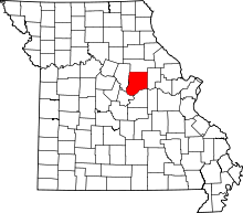 | |
| Villages | ||
| Townships | ||
| Unincorporated communities | ||
| Ghost towns | ||
| Footnotes | ‡This populated place also has portions in an adjacent county or counties | |